Toano Range
The Toano Range is a mountain range located in eastern Elko County, Nevada in the United States. The highest point in the range reaches 7,913 feet (2,412 m).[1] The range is separated from the Goshute Mountains to the south by Morgan Pass.[2]
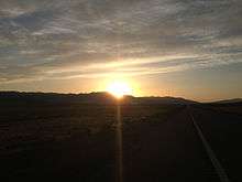
Sunset over the Toano Range
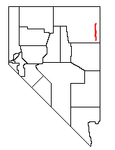
Location of the Toano Mountains within Nevada
Interstate 80 and Union Pacific Railroad's Central Corridor(former Feather River Route), used both by freight trains and Amtrak's California Zephyr, cross the Toano range via Silver Zone Pass. On the eastern approach to the pass the railroad makes a near 360 degree hairpin bend called the Arnold Loop.
Toano is a name derived from the Shoshoni language meaning "pipe camp".[3]
Notes
- "Toano Range Range - Nevada Mountain Peak Information". mountainzone.com. Retrieved 2009-12-09.
- Keith B. Ketner; Warren C. Day; Maya Elrick; Myra K. Vaag; Robert A. Zimmermann; Lawrence W. Snee; Richard W. Saltus; John E. Repetski; Bruce R. Wardlaw; Michael E. Taylor & Anita G. Harris (1998). "U.S. Geological Survey Professional Paper 1593 - An Outline of Tectonic, Igneous, and Metamorphic Events in the Goshute-Toano Range Between Silver Zone Pass and White Horse Pass, Elko County, Nevada: A History of Superposed Contractional and Extensional Deformation" (PDF). United States Geological Survey. Retrieved 2014-11-04.
- Bright, William (2004). Native American Placenames of the United States. University of Oklahoma Press. p. 498. ISBN 978-0-8061-3598-4.
This article is issued from Wikipedia. The text is licensed under Creative Commons - Attribution - Sharealike. Additional terms may apply for the media files.