Te Aroha
Te Aroha (Māori: Te Aroha-a-uta) is a rural town in the Waikato region of New Zealand with a population of 3,906 people in the 2013 census, an increase of 138 people since 2006.[2] It is 53 km (33 mi) northeast of Hamilton and 50 km (31 mi) south of Thames. It sits at the foot of 952 metres (3,123 ft) Mount Te Aroha, the highest point in the Kaimai Range.
Te Aroha | |
|---|---|
 View from a spur of Mount Te Aroha | |
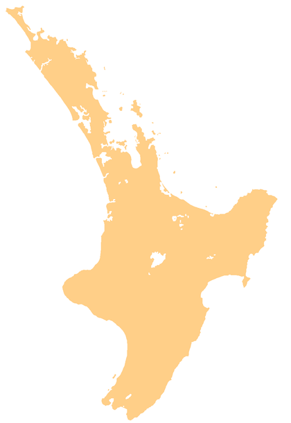 Te Aroha Location of Te Aroha, south of the Coromandel Peninsula  Te Aroha Te Aroha (New Zealand) | |
| Coordinates: 37°32′S 175°43′E | |
| Country | |
| Region | Waikato |
| Territorial authority | Matamata-Piako District |
| Population (June 2019)[1] | |
| • Total | 4,470 |
| Postcode(s) | 3320 |

_Te_Aroha.jpg)
History
The name Te Aroha derives from the Māori name of Mount Te Aroha. In one version, Rāhiri, the eponymous ancestor of Ngāti Rāhiri Tumutumu, climbed the mountain and saw his homeland in the distance and felt a sense of love (aroha) for it. The town is properly named Te Aroha-a-uta; uta meaning 'inland', so the town is named "love flowing inland".[3]
The European settlement was established in the late 1870s. The population grew quickly during the 1880s as a result of a gold rush. A spa was founded in 1883 but popularity had declined by the 1930s.[3]
Te Aroha Borough Council took over from the 1880 Town Board on 2 May 1898.[4] Herriesville became part of Te Aroha Borough Council.[5] The 1938 Council Chambers is now a Category 2 listed building.[6] Matamata-Piako District Council took over under the 1989 local government reforms.
Created in 1888, Te Aroha and Lemon was New Zealand's first local fizzy drink. It was produced up until the 1960s.[7]
On 17 February 1985 Te Aroha experienced a severe flash flood that washed boulders, mud, and trees through the town. Most shops and more than 50 homes were damaged, resulting in the death of three people.[8][9][10]
Bridges
Coulter Bridge, over the Waihou River, on Kenrick St (SH26) was rebuilt in 1910[11] and the present bridge was built alongside it in 1928.[12] The railway bridge was rebuilt in 1912,[13] replacing the 1895 swing bridge.[14] It is now a footbridge, but will not be replaced.[15]
Railway stations
The Thames Branch reached Te Aroha in 1895 and the station opened on 1 March 1886.[16] The station was described in 1902 as, "of wood, and include a ladies' waiting room, a public waiting room, a vestibule, stationmaster's office, ticket office, and parcels office. There is a long asphalted platform."[4]
The area west of the Waihou was named Herriesville from 1914,[17][18] when a private railway siding[19] was opened on 24 January 1914 to serve the A&P ground.[20][21] William Herries had been a local landowner.[22] Seven railway cottages were built in 1924.[23] Both stations closed to passengers on 11 September 1967 and to freight on 11 July 1986, though Herriesville was only open for racecourse traffic.[16]
Geography

The Waihou River runs through Te Aroha. Close by to the east is the base of the Kaimai Range, and the town is overlooked by the 952-metre Mount Te Aroha. To the north of the town is the low-lying, swampy land of the Hauraki Plains. Thermal and mineral springs are both found close to the centre of the town, as is the world's only hot soda water geyser.
Economy
Te Aroha is at the centre of a dairy farming community and much of its economic activity is in serving that community. Tourism is increasing in Te Aroha. The mineral baths are a very popular spot for tourists and locals alike.
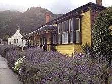
Historically mining played a role in the area, and has left some legacies – not all of them positive, such as toxic residues leaking from the abandoned Tui mine tailings dam.[24] Miners' cottages are in evidence.
Attractions
Te Aroha is the location of the Mokena Hou Geyser, the only natural soda water geyser in the world.[25] The geyser is located in the Te Aroha Domain, the oldest intact Edwardian domain in New Zealand.[26]

The Hauraki Rail Trail has recently (2012) been opened, connecting the town to Paeroa and beyond.
Events
- Waihou and Te Aroha Cobras play an annual rugby match for the Dr Dunn memorial trophy. This is one of the biggest days on the calendar of Te Aroha.
- A Day in the Domain was started in Te Aroha in 1977 by the Arts Council and continues to be a fun, affordable day out. The day attracts artists and performers from far and wide with a variety of stalls and foodies on display. Entertainment is free with competitions and games all day.
- The King and Queen of the Mountain and Bald Spur Derby have been annual events in Te Aroha since the 1950s. Held the weekend before Christmas, the challenge is to be the first man or woman up Mt Te Aroha and back down again. This has been achieved in under one hour. The Bald Spur Derby offers competitors a shorter but still challenging course.
- Te Aroha AP & H Show has been running since the 1890s. Boasting one of the most extensive home industries sections, it has full agricultural and equestrian sections and the usual country fair activities such as the gumboot throwing competition and cattle dogs.
- Te Aroha Cruise (car event) started 2014.
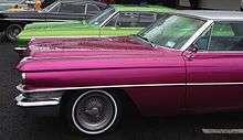 Te Aroha Cruise 2014
Education
Te Aroha College is the town's co-educational state secondary school,[27][28] with a roll of 351 as of March 2020.[29]
There are two co-educational state primary schools in the town: Te Aroha Primary School,[30][31] with a roll of 200;[32] and Stanley Avenue School,[33][34] with a roll of 250.[35]
Elstow-Waihou Combined School, another co-educational state primary school, is located north-west of the town;[36][37] with a roll of 141.[38]
St Joseph's Catholic School is a co-educational state integrated Catholic school,[39] with a roll of 94.[40]
Notable people
- Olympic Gold Medalist Peter Snell
- All Blacks Don Clarke, Kevin 'Herb' Schuler, Carl Hoeft, Keith Robinson and Kevin O'Neill
- Ian S. Ardern of the First Quorum of the Seventy of The Church of Jesus Christ of Latter-day Saints was born in the town
- Robert Coulter, Mayor of Te Aroha and Labour MP
- David Cunliffe, former leader of the New Zealand Labour Party, was born in Te Aroha.
- Stuart Farquhar, Olympic javelin thrower
- Jack Body, New Zealand composer
- Don Beard, New Zealand cricketer and principal of Te Aroha College from 1961 to 1982
- Todd Muller, Member of Parliament for Bay of Plenty, was born in Te Aroha.
References
- "Subnational Population Estimates: At 30 June 2019". Statistics New Zealand. 22 October 2019. Retrieved 11 January 2020.
- 2013 Census QuickStats about a place : Te Aroha
- "Te Aroha". nzhistory.govt.nz. Ministry for Culture and Heritage. Retrieved 8 May 2020.
- "Te Aroha". The Cyclopedia of New Zealand [Auckland Provincial District]. 1902.
- "Waihou River Bridge". New Zealand Herald. 1925. p. 6. Retrieved 25 May 2018.
- "Te Aroha Borough Council Chambers". www.heritage.org.nz. Retrieved 25 May 2018.
- Sharnae Hope (5 January 2020). "New Zealand's first Kiwi fizz wasn't L&P but Te Aroha and Lemon".
- "Case Study: Te Aroha Flood, 1985". Matamata Piako District Council. Retrieved 22 January 2014.
- McSaveney, Eileen (9 July 2013). "Debris from a flash flood". Te Ara – the Encyclopedia of New Zealand.
- "The day disaster arrived". Stuff. Retrieved 24 December 2015.
- "Opening of a new traffic bridge at Te Aroha". www.aucklandcity.govt.nz. 17 March 1910. Retrieved 25 May 2018.
- "An important work at Te Aroha". www.aucklandcity.govt.nz. 13 October 1927. Retrieved 25 May 2018.
- "Te Aroha Heritage Trails". www.mpdc.govt.nz. Retrieved 25 May 2018.
- "Of no further use: the swing span of the Te Aroha railway bridge, which is to be removed". www.aucklandcity.govt.nz. 13 June 1912. Retrieved 25 May 2018.
- "Corporate and Operations Committee" (PDF). Matamata Piako Council. 24 May 2017. Archived from the original (PDF) on 28 January 2018.
- Scoble, Juliet. "Names & Opening & Closing Dates of Railway Stations in New Zealand 1863 to 2010" (PDF). Rail Heritage Trust of New Zealand.
- "Waikato Argus". 9 October 1913. p. 2. Retrieved 25 May 2018.
- "Herriesville". New Zealand Herald. 17 April 1914. p. 9. Retrieved 25 May 2018.
- "Piako County Council". Waikato Times. 23 July 1915. p. 6. Retrieved 25 May 2018.
- "Te Aroha a. P. and H. Show". Thames Star. 1914. p. 4. Retrieved 25 May 2018.
- "New Zealand Railways". Waikato Independent. 1914. p. 5. Retrieved 25 May 2018.
- Taonga, New Zealand Ministry for Culture and Heritage Te Manatu. "Herries, William Herbert". teara.govt.nz. Retrieved 25 May 2018.
- "Railway Cottages". New Zealand Herald. 7 April 1924. p. 8. Retrieved 25 May 2018.
- Cumming, Geoff (6 March 2010). "Miners press to enter the green zone". The New Zealand Herald. Retrieved 26 March 2010.
- "Archived copy". Archived from the original on 9 February 2013. Retrieved 5 January 2012.CS1 maint: archived copy as title (link) Mokena Hou section of the MPDC website
- "Archived copy". Archived from the original on 1 January 2012. Retrieved 5 January 2012.CS1 maint: archived copy as title (link) Te Aroha Domain section of the MPDC website
- "Te Aroha College Official School Website". tearoha-college.school.nz.
- "Te Aroha College Ministry of Education School Profile". educationcounts.govt.nz. Ministry of Education.
- "Te Aroha College Education Review Office Report". ero.govt.nz. Education Review Office.
- "Te Aroha Primary School Official School Website". tearohaprimary.school.nz.
- "Te Aroha Primary School Ministry of Education School Profile". educationcounts.govt.nz. Ministry of Education.
- "Te Aroha Primary School Education Review Office Report". ero.govt.nz. Education Review Office.
- "Stanley Avenue School Official School Website". stanleyave.school.nz.
- "Stanley Avenue School Ministry of Education School Profile". educationcounts.govt.nz. Ministry of Education.
- "Stanley Avenue School Education Review Office Report". ero.govt.nz. Education Review Office.
- "Elstow-Waihou Combined School Official School Website". elstow-waihou.school.nz.
- "Elstow-Waihou Combined School Ministry of Education School Profile". educationcounts.govt.nz. Ministry of Education.
- "Elstow-Waihou Combined School Education Review Office Report". ero.govt.nz. Education Review Office.
- "St Joseph's Catholic School Ministry of Education School Profile". educationcounts.govt.nz. Ministry of Education.
- "St Joseph's Catholic School Education Review Office Report". ero.govt.nz. Education Review Office.
External links
| Wikimedia Commons has media related to Te Aroha. |
- Te Aroha i-SITE Visitor Centre
- Te Aroha Museum Website
- Te Aroha section of the MPDC website
- Te Aroha College
Photos -
- Main street 1909
- Railway station - 1899, 1903, 1905, 1905, 1908 (new station) 1910
- Railway swing bridge 1898
| Authority control |
|
|---|