Takhti-Tepha Natural Monument
Takhti-Tepha Natural Monument (Georgian: ტახტი-თეფას ბუნების ძეგლი) is a landform created by the eruption of mud, slurries, water and gases in proximity of Takhti-Tepha mountain range. This mud volcano is located on plane, south of Dali water reservoir, at 620 m above sea level in Dedoplistsqaro Municipality, Georgia and incorporated in Vashlovani Protected Areas.[1] Mud craters, along with small open vents are constantly active, erupting mud, oil and gas.[2] The length of the pedestrian path across the Takhti-Tepha Natural Monument is 0.5 km. The total area of the natural monument is 9.7 ha. The largest mud cater is 3,5-4 m in diameter. The landscape is built of sandstones and clays.
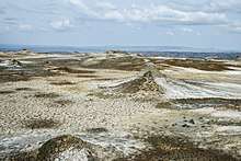
View of bubbling mud craters.
| Takhti-Tepha Natural Monument | |
|---|---|
IUCN category III (natural monument or feature) | |
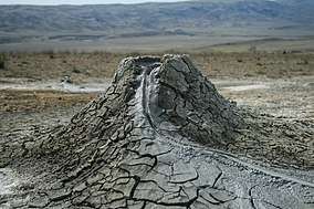 Takhti-Tepha mud volcano. | |
  | |
| Location | |
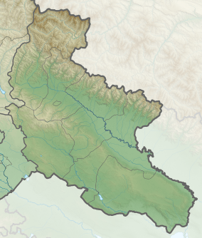
| Nearest city | Dedoplistsqaro |
| Coordinates | 41°14.741′N 45°50.617′E |
| Area | 0.1 km2 (0.039 sq mi) |
| Governing body | Agency of Protected Areas |
| Website | Takhti-Tepha Natural Monument |
See also
References
| Wikimedia Commons has media related to Takhti-Tepha Natural Monument. |
- Takhti-Tefa in Georgia Protected Planet
- Takhti Tepha mud Volcano. Georgian Travel Guide
This article is issued from Wikipedia. The text is licensed under Creative Commons - Attribution - Sharealike. Additional terms may apply for the media files.