Sunflower River
The Sunflower River (also known as the Big Sunflower River) is one of the main tributaries of the Yazoo River in the U.S. state of Mississippi. It is navigable by barge for 50 miles. It rises in De Soto County, Mississippi near the Tennessee border and flows south for 100 miles to the Yazoo River. At Clarksdale on its banks, the annual Sunflower River Blues & Gospel Festival is held.
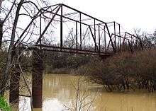
The United States Army Corps of Engineers maintains a navigation channel, thirty miles in length. Built in 1976, the channel is used by barges and pleasure craft.
According to the USGS, variant names include Hushpuckaman Creek.[1] The Hushpuckena River drains the northwestern part of the Sunflower River Basin, Quiver River drains the northeastern portion, and Bogue Phalia drains the west central portion of the watershed, all of which lies in the Mississippi River alluvium soil of the Yazoo Delta.[2] At Sunflower, MS, the river measures approximately 1,099 cubic feet per second.[3]
Water Quality
Like the Yazoo, this river is heavily silt laden. The river gets its mud from the bayous and small streams that feed it. The river has a distinct "Clear-Mud Line" where it meets the Yazoo, showing that the Big Sunflower is muddier than the Yazoo at their convergence.
Archaeology
Early investigators of native American culture identified many mound sites on the river with Clarence B. Moore's interest in the earth-works on the river near Holly Bluff about a half a mile from the entrance to Lake George being the most notable.[4]
Wildlife Refuges
Land use along the river and in the watershed is confined to agriculture with the exception of three forested areas which serve as wildlife refuges, the Holt Collier National Wildlife Refuge, the Dahomey National Wildlife Refuge, and the Panther Swamp National Wildlife Refuge, which are managed by the U.S. Fish and Wildlife Service.[5]
See also
- List of Mississippi rivers
References
- U.S. Geological Survey Geographic Names Information System: Big Sunflower River
- Speers, Paul et al. (1964). Low-Flow Characteristics of Streams in the Miss Embayment in Miss. and Ala.: Water Resources of the Mississippi Embayment. Geological Survey Professional Paper 448-1. Washington: GPO. p. I-29
- https://waterdata.usgs.gov/ms/nwis/annual/?format=sites_selection_links&search_site_no=07288500&agency_cd=USGS&referred_module=sw
- Brown, Calvin S. (1926). Archeology of Mississippi. 1992 ed. Jackson: University Press of Mississippi. p. 73. ISBN 0-87805-603-3
- Barlow, J.R.B.; Coupe, R.H. (2014). "Occurrence and transport of nitrogen in the Big Sunflower River, northwestern Mississippi, October 2009–June 2011". U.S. Geological Survey Scientific Investigations Report. Scientific Investigations Report. 5107: 3–4. doi:10.3133/sir20145107.
| Wikimedia Commons has media related to Sunflower River. |