South Carolina Highway 303
South Carolina Highway 303 (SC 303) is a 13.5-mile-long (21.7 km) state highway in the U.S. state of South Carolina. Known as the Green Pond Highway, it connects Green Pond and Walterboro.
| ||||
|---|---|---|---|---|
| ||||
| Route information | ||||
| Maintained by SCDOT | ||||
| Length | 13.51 mi[1] (21.74 km) | |||
| Existed | 1930–present | |||
| Major junctions | ||||
| South end | ||||
| North end | ||||
| Location | ||||
| Counties | Colleton | |||
| Highway system | ||||
| ||||

Route description
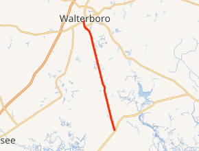
SC 303 begins at an intersection with U.S. Route 17 (US 17; ACE Basin Parkway) south-southeast of Green Pond, Colleton County, where the roadway continues as Donnelley Drive. This intersection in on the northwestern corner of the Donnelley Wildlife Management Area. It travels to the north-northwest and enters Green Pond, where it crosses railroad tracks. It then crosses Ashepoo River and travels through Ritter. Farther to the north-northwest, it enters Walterboro, where it meets its northern terminus, an intersection with US 17 Alternate/SC 63 (Jefferies Boulevard).[2]
History
Major intersections
The entire route is in Colleton County.
| Location | mi[1] | km | Destinations | Notes | |
|---|---|---|---|---|---|
| | 0.00 | 0.00 | |||
| Walterboro | 13.51 | 21.74 | |||
| 1.000 mi = 1.609 km; 1.000 km = 0.621 mi | |||||
See also


References
- "Statewide Highways (shapefile)" (zip). South Carolina Department of Transportation. September 29, 2017. Retrieved December 8, 2017.
- Google (May 13, 2016). "South Carolina Highway 303" (Map). Google Maps. Google. Retrieved May 13, 2016.
External links

- Mapmikey's South Carolina Highways Page: SC 300-309