Sonora Peak
Sonora Peak is a mountain in the Central Sierra Nevada of California north of Sonora Pass. Located on the boundary between Alpine and Mono counties, it is the highest point in Alpine County.[1] Due to the high elevation, most of the precipitation this mountain receives consists of snow.[4]
| Sonora Peak | |
|---|---|
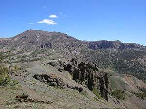 Sonora Peak from Sonora Pass | |
| Highest point | |
| Elevation | 11,464 ft (3,494 m) NAVD 88[1] |
| Prominence | 1,816 ft (554 m) [1] |
| Listing | California county high points 10th |
| Coordinates | 38°21′14″N 119°38′07″W [2] |
| Geography | |
| Location | Alpine and Mono counties, California, U.S. |
| Parent range | Central Sierra Nevada |
| Topo map | USGS Sonora Pass |
| Climbing | |
| Easiest route | Hike, class 1-2[3] |
One of the most direct routes of ascent starts at Sonora Pass, 2 miles (3 km) south as the crow flies. Starting at the trailhead of the PCT on Sonora Pass, it is about a 2.5-mile (4.0 km) hike with 1,000 feet (300 m) elevation gain to the top of a pass. From there, the easiest and most direct way is to turn northwest and follow the ridge that will lead to the summit. About halfway from the pass to the peak a small trail appears that heads directly to the peak.[3]
References
- "Sonora Peak, California". Peakbagger.com. Retrieved 2009-02-26.
- "Sonora Peak". Geographic Names Information System. United States Geological Survey. Retrieved 2009-02-26.
- "Sonora Peak". Northern Sierra Peaks Guide. Archived from the original on 2014-02-01. Retrieved 2016-03-20.
- "Subsection M261Ek - Glaciated Batholith and Volcanic Flows". US Forest Service. Archived from the original on 2005-03-11. Retrieved 2009-02-26.