Sept Îles Lake (Saint-Raymond)
The Lac Sept Îles (sometimes spelled Lac aux Sept-Isles[1]) (English: Seven Islands Lake) is a waterbody located in the township of Gosford, in the municipality of Saint-Raymond, in the Portneuf Regional County Municipality, in the administrative region of Capitale-Nationale, in Quebec, in Canada.
| Sept Îles Lake | |
|---|---|
 | |
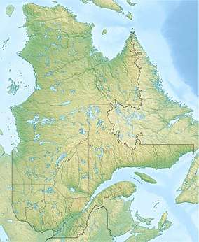 Sept Îles Lake Location in Quebec | |
| Location | Saint-Raymond (municipality), Portneuf Regional County Municipality, Capitale-Nationale, Quebec, Canada |
| Coordinates | 46.9338°N 71.7466°W |
| Lake type | Naturel |
| Primary inflows | (Clockwise from the mouth) Gosford River, discharge of Lac au Chien and discharge of Lac au Cèdre |
| Primary outflows | Portneuf River |
| Basin countries | Canada |
| Max. length | 4.2 km (2.6 mi) |
| Max. width | 2.2 km (1.4 mi) |
| Max. depth | 37 m (121 ft) |
| Surface elevation | 209 m (686 ft) |
Thanks to its forest and mountain environment, its islands and bays, its proximity to the Quebec (city) and the Duchesnay tourist resort, the resort is very developed around the lake. A road completely surrounds the lake to serve residents and vacationers. Vacationing at Sept Îles Lake dates back to 1857-58, compared to 1896 at Sergent Lake.
Geography
The Lake Sept Îles is located 6 km northeast of the village center of Saint-Raymond, in Portneuf Regional County Municipality; 2.3 km from Sergent Lake (located to the south) and 2.2 km from Saint-Joseph Lake (La Jacques-Cartier) (located to the south-east). Lake Sespt-Îles is mainly supplied by three tributaries:
- north-west: the Gosford River flowing mountains 5.7 km south-west (parallel to the Sainte-Anne River, to flow to the bottom a narrow bay which ends at the mouth of Lac des Aulnaies which is separated from Lac Sept Îles by a bridge;
- northeast: the Lac au Chien pass (0.9 km long) which links Lac au Chien (altitude of 209 m) and lake Sept Îles. Lac au Chien itself is fed by Lac à la Perche (217 m), Lac du Ventre Rouge (227 m), Lac des Roches, Lac Maher (241 m) and Lac aux Deux Truites (230 m);
- south-east: the outlet (about 680 m long) from Lac au Cèdre (altitude 224 m).
Lake Sept-Îles is surrounded by mountain peaks that reach:
- north: between 397 m and 533 m,
- south-east: between 267 m and 381 m,
- south: between 349 m and 372 m,
- west: 254 m and 335 m.
The lake has several bays including Vachon Bay (to the southeast). The mouth of the lake is located southwest of the lake. The outlet of the lake is the Portneuf River which flows southwest to the town of Portneuf where its waters flow into the St. Lawrence River.
Toponymy
The lake is aptly named because it has exactly seven islands, three islands and four islets. Colonization around the lake began around 1857-1858; eleven families were listed there in 1861, while the population of Saint-Raymond was then 2,902 inhabitants. During the XXth, the perimeter of the lake was fitted out with numerous houses and chalets. The island of Genois, the largest and not accessible by road, has around twenty homes. The other islands contain some hambitations.[2]
The toponym “Lac Sept Îles” was formalized on December 5, 1968 at the Bank of Place Names of the Commission de toponymie du Québec.[3]
Notes and references
- Spelling used in the report of the surveyor Jean-Pierre Proulx in 1829
- Source: Names and places of Quebec, work of the Commission of toponymy of Quebec, published in 1994 and 1996 in the form of a printed illustrated dictionary, and in that of a CD made by the company Micro-Intel, in 1997, from this dictionary.
- Commission de toponymie du Québec - Bank of Place Names - Toponym: Lac Sept Îles