Sandviksfjellet
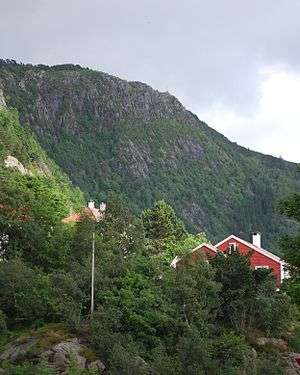
Sandviksfjellet is a mountain in the city of Bergen in Vestland county, Norway. It is one of the traditional seven mountains that surround the city centre of Bergen.[2] The mountain lies on the east side of the city neighborhood of Sandviken, just north of the mountain Fløyen. The European route E39 highway runs through the mountain as part of the Fløyfjell Tunnel.
| Sandviksfjellet | |
|---|---|
 | |
| Highest point | |
| Elevation | 392 m (1,286 ft) |
| Coordinates | 60.4094°N 5.3402°E[1] |
| Geography | |
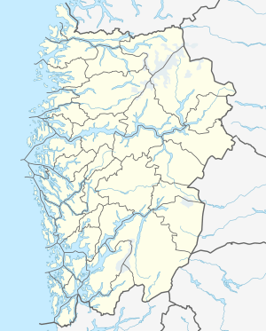 Sandviksfjellet Location of the mountain  Sandviksfjellet Sandviksfjellet (Norway) | |
| Location | Vestland, Norway |
| Climbing | |
| Easiest route | Hiking |
The mountain is 392 metres (1,286 ft) high.[2] The hiking route called Stoltzekleiven the path used for a yearly mountain run,[3] where Jon Tvedt holds the record.[4]
See also
- List of mountains of Norway
References
- "Sandviksfjellet, Bergen (Vestland)" (in Norwegian). yr.no. Retrieved 2020-03-01.
- Hartvedt, Gunnar Hagen (1994). "Sandviksfjellet". Bergen Byleksikon (in Norwegian). Oslo: Kunnskapsforlaget. p. 400. ISBN 82-573-0485-9.
- Hartvedt, Gunnar Hagen (1994). "Stoltzekleiven". Bergen Byleksikon (in Norwegian). Oslo: Kunnskapsforlaget. p. 437. ISBN 82-573-0485-9.
- "Han var helt rå". Nettavisen.no. 12 January 2009. Retrieved 2009-11-14.
This article is issued from Wikipedia. The text is licensed under Creative Commons - Attribution - Sharealike. Additional terms may apply for the media files.