Saltoro Mountains
The Saltoro Mountains are a subrange of the Karakoram Range.[1] They are located in the heart of the Karakoram, on the southwest side of the Siachen Glacier, one of the two longest glaciers outside the polar regions. The name given to this range is shared with the Saltoro Valley which is located to the west of this range, downslope on the gilgit baltistan side of the Actual Ground Position Line.
| Saltoro Mountains | |
|---|---|
| Saltoro Muztagh | |
 | |
| Highest point | |
| Peak | Saltoro Kangri |
| Elevation | 7,742 m (25,400 ft) |
| Coordinates | 35°24′01″N 76°50′55″E |
| Geography | |
| Country | India and Pakistan |
| State or Region | Ladakh and Gilgit–Baltistan |
| Parent range | Karakoram |
| Borders on | Masherbrum Mountains |
The Saltoro Mountains are Lesser Karakorams on the southern and western side of the large Karakoram-glaciers (Siachen, Baltoro, Biafo and Hispar Glacier from east to west) while the main ridge of the Karakorams lies north resp. east of these glaciers. The subranges of the main ridges are called Muztagh whereas the mountain groups of the Lesser Karakorams are denominated as Mountains, Ranges or Groups.[2]
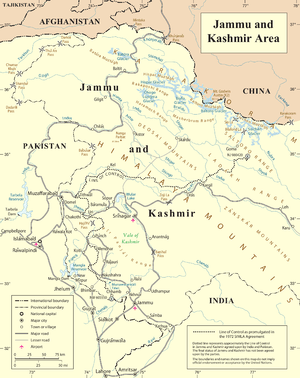
They are claimed as part of Ladakh by India and as part of Gilgit–Baltistan by Pakistan. Between 1984 and 1987, India assumed military control of the main peaks and passes of the range, with Pakistani forces holding the glacial valleys just to the west. Hence, despite high peaks and dramatic climbing opportunities, they are little visited except by military forces due to the ongoing Siachen Conflict.
On the southwest side, the Saltoro Mountains drop steeply to the valleys of the Kondus and Dansam Rivers, which join to form the Saltoro River, a tributary of the Shyok River. This in turn flows into the Indus River. To the northwest, the Kondus Glacier separates the range from the neighboring Masherbrum Mountains, while on the southeast, the Gyong River, Glacier, and Pass (Gyong La) separate the northern Saltoro Mountains from the southern Saltoro Mountains or "Kailas Mountains" (not to be confused with Tibet's sacred Mount Kailash).
Selected peaks
The following is a table of the peaks in the Saltoro Mountains which are over 7,200 metres (23,622 ft) in elevation and have over 500 metres (1,640 ft) of topographic prominence. (This is a common criterion for peaks of this stature to be independent.)
| Mountain | Height (m) | Height (ft) | Coordinates | Prominence (m) | Parent mountain | First ascent | Ascents (attempts) |
|---|---|---|---|---|---|---|---|
| Saltoro Kangri | 7,742 | 25,400 | 35°23′57″N 76°50′51″E | 2,160 | Gasherbrum I | 1962 | 2 (1) |
| K12 | 7,428 | 24,370 | 35°17′42″N 77°01′18″E | 1,978 | Saltoro Kangri | 1974 | 4 (2) |
| Ghent Kangri (Mount Ghent) | 7,401 | 24,281 | 35°31′03″N 76°48′01″E | 1,493 | Saltoro Kangri | 1961 | 4 (0) |
| Sherpi Kangri | 7,380 | 24,213 | 35°27′58″N 76°46′53″E | 900 | Ghent Kangri | 1976 | 1 (1) |
See also
- Saltoro Kangri
- Sia Kangri
- Indira Col
- Chumik Glacier
- Baltoro Glacier
- Actual Ground Position Line
- List of highest mountains
References
- "Tryst With Deceit?". outlookindia.com/.
- Mason, Kenneth (1938). "Karakoram Nomenclature". Himalayan Journal 10. Retrieved 10 February 2014.
Sources
- Jerzy Wala, Geographical Sketch Map of the Karakoram, Swiss Foundation for Alpine Research, Zurich, 1990.