Saint-Lambert-du-Lattay
Saint-Lambert-du-Lattay is a former commune in the Maine-et-Loire department in western France. On 31 December 2015, it was merged into the new commune Val-du-Layon.[2]
Saint-Lambert-du-Lattay | |
|---|---|
Part of Val-du-Layon | |
 Coat of arms | |
Location of Saint-Lambert-du-Lattay 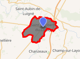
| |
 Saint-Lambert-du-Lattay 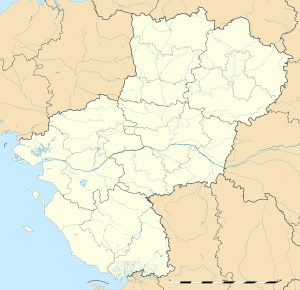 Saint-Lambert-du-Lattay | |
| Coordinates: 47°18′11″N 0°37′52″W | |
| Country | France |
| Region | Pays de la Loire |
| Department | Maine-et-Loire |
| Arrondissement | Angers |
| Canton | Chemillé-Melay |
| Commune | Val-du-Layon |
| Area 1 | 14.44 km2 (5.58 sq mi) |
| Population (2017)[1] | 2,150 |
| • Density | 150/km2 (390/sq mi) |
| Time zone | UTC+01:00 (CET) |
| • Summer (DST) | UTC+02:00 (CEST) |
| Postal code | 49750 |
| Elevation | 16–96 m (52–315 ft) (avg. 66 m or 217 ft) |
| 1 French Land Register data, which excludes lakes, ponds, glaciers > 1 km2 (0.386 sq mi or 247 acres) and river estuaries. | |
Geography

The Layon Valley
The commune is situated 28 km south-by-west of Angers on the way towards Cholet. Saint-Lambert-du-Lattay is on the south bank of the river Layon and the river Hyrôme flows through the eastern part of the village. The banks of the rivers host vineyards which are notably producing Coteaux du layon and other Anjou wines.
History
War in the Vendée (1793–1796) and especially the battle of Pont-Barré took place in Saint-Lambert-du-Lattay during the French Revolution.
Miscellaneous
- Patrick Dewaere (actor) is buried in the cemetery of Saint-Lambert-du-Lattay
References
- Téléchargement du fichier d'ensemble des populations légales en 2017, INSEE
- Arrêté préfectoral, 25 November 2015 (in French)
- "Le comité de Jumelage" (in French). saintlambertdulattay.fr. Retrieved November 12, 2011.
- "Jumelage" (in French). linkebeek.info. Retrieved November 12, 2011.
External links
| Wikimedia Commons has media related to Saint-Lambert-du-Lattay. |
- (in French) Official website of the commune
| Authority control |
|---|
This article is issued from Wikipedia. The text is licensed under Creative Commons - Attribution - Sharealike. Additional terms may apply for the media files.