Ryder Glacier (Greenland)
Ryder Glacier (Danish: Ryder Gletscher), is one of the major glaciers in northern Greenland.[1]
| Ryder Glacier | |
|---|---|
| Ryder Gletscher | |
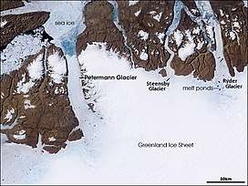 The Ryder Glacier with its melt ponds in a NASA picture | |
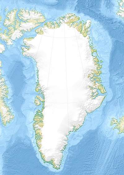 Location within Greenland | |
| Type | Tidal outlet glacier |
| Location | Greenland |
| Coordinates | 81°38′N 49°10′W |
| Length | 80 km (50 mi) |
| Width | 19 km (12 mi) |
| Terminus | Sherard Osborn Fjord; Lincoln Sea |
This glacier was first mapped by Lauge Koch in 1917 during Knud Rasmussen's 1916-1918 Second Thule Expedition to north Greenland and was named after Danish Arctic explorer Carl Ryder.
Geography
The Ryder Glacier originates in the Greenland Ice Cap. It is roughly north-south oriented and has its terminus at the head of the Sherard Osborn Fjord between Permin Land and Warming Land. It is 30 km long and is a floating tongue within the fjord.[2][3]
 Map of part of Ellesmere Island and far Northern Greenland. |
See also
References
External links
This article is issued from Wikipedia. The text is licensed under Creative Commons - Attribution - Sharealike. Additional terms may apply for the media files.