Rosemary Bank
Rosemary Bank is a seamount approximately 120 kilometres west of Scotland, located in the Rockall Trough, in the northeast Atlantic. It was discovered in 1930 by the survey vessel HMS Rosemary, from which it takes its name. It is one of only three seamounts known in Scottish waters.[2]
| Rosemary Bank MPA | |
|---|---|
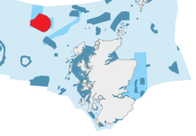 The location and extent of the Rosemary Bank MPA, shown in red | |
| Location | North Atlantic, Scotland |
| Area | 6,927 km2 (2,675 sq mi)[1] |
| Designation | Scottish Government |
| Established | 2014 |
| Operator | Marine Scotland |
Rosemary Bank hosts a range of important habitats including deep sea sponge aggregations and cold water coral. Many species of fish, including orange roughy, blue ling, leafscale gulper shark and Portuguese dogfish are also found here.[2] In 2014 the bank was declared a Nature Conservation Marine Protected Area (NCMPA). The designation covers 692,700 hectares (6,927 km2), and is in place to protect the sponge aggregations, and the cenozoic marine geomorphology of the seabed.[1]
The feature originated about 70 million years ago, as a result of volcanic activity. Rosemary Bank rises to approximately 1000 metres above the sea floor, its highest point being 400 metres below sea-level. Around its base lies a thin "moat", where the sea-bottom is up 300 m lower than the surrounding terrain. The lowest parts of the MPA are approximately 2300 metres below sea-level.[3]
References
- "Rosemary Bank MPA(NC)". Scottish Natural Heritage. Retrieved 31 August 2019.
- "Underwater 'Ben Nevis' an important sponges habitat". BBC News. 5 December 2019. Retrieved 5 December 2019.
- "Rosemary Bank Seamount MPA". Joint Nature Conservation Committee. Retrieved 5 December 2019.
External link
- "Rosemary Bank Seamount Site Summary Document" (PDF). Joint Nature Conservation Committee. Retrieved 26 November 2019.