River Cladagh
The Cladagh River (from Irish an Chlaideach, meaning 'washing river'[1]) is a small river in County Fermanagh which rises from Marble Arch Caves, below Cuilcagh Mountain, before flowing through Cladagh Glen Nature Reserve and eventually draining into the Arney River.
| Cladagh River | |
|---|---|
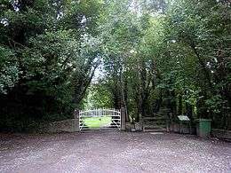
 Cladagh River flowing through Cladagh Glen | |
| Native name | an Chlaideach |
| Location | |
| Country | United Kingdom |
| State | Northern Ireland |
| Region | Ulster |
| County | Co. Fermanagh |
| Physical characteristics | |
| Source | |
| • location | Marble Arch Caves, Co. Fermanagh |
| • coordinates | 54°15′36.464″N 7°48′48.744″W |
| • elevation | 145 m (476 ft) |
| Mouth | Arney River |
• coordinates | 54°17′10.73″N 7°47′29.19″W |
• elevation | 50 m (160 ft) |
| Length | 4 km (2.5 mi) |
Below ground
The river is sourced by three tributaries, the Sruh Croppa, the Aghinrawn and the Owenbrean, all of which sink into limestone on the Marlbank (a plateau on northern Cuilcagh Mountain) and join underground in the extensive Marble Arch cave system.[2] The Sruh Croppa and Aghinrawn flow together for a short distance from Cradle Hole into Marble Arch Cave, before joining up with the Owenbrean at The Junction. In normal water levels, Marble Arch Caves tour begins by boat, underground on the initial stretch of the Cladagh, and passes The Junction before continuing upstream along the Owenbrean.[2]
Above ground
The main resurgence from the cave system pours from beneath a cliff face into the chaotic limestone collapse fields immediately above the Marble Arch, a natural limestone bridge which lends its name to the cave system. The Cladagh then cascades under the arch and turns abruptly north into the head of Cladagh River gorge, or Cladagh Glen.[3]
Halfway along Cladagh Glen, another large resurgence joins the Cladagh at Cascades Rising. This is the discharge for the Prod's Pot–Cascades Rising cave system, which takes water from a large catchment including Gortmaconnell (2 km), Brookfield (2.5 km) and more surprisingly Badger Pot and other East Cuilcagh sinks, 5.5 km away, as well as a portion of the Owenbrean River from small sinks upstream of its main sink at Pollasumera (Gunn, J.).[4]
See also
- List of rivers of Northern Ireland
Notes
- "Illustrations of Townlands in Maps". Ulster Placenames – Celebrating Ulster's Townlands. Retrieved 5 May 2009.
- Jones, Burns, Fogg & Kelly (1997), p. 79
- "Cladagh River, Marble Arch". Habitas Online. Retrieved 28 February 2009.
- Jones, Burns, Fogg & Kelly (1997), p. 61
References
- Jones, Gareth Ll.; Burns, Gaby; Fogg, Tim; Kelly, John (1997). The Caves of Fermanagh and Cavan (2nd Ed.). Lough Nilly Press. ISBN 0-9531602-0-3.