RNAS Merryfield
Royal Naval Air Station Merryfield (ICAO: EGDI) is an air station of the Royal Navy's Fleet Air Arm located 2.7 miles (4.3 km) northwest of Ilminster, Somerset and 8.1 miles (13.0 km) southeast of Taunton, Somerset, England.
| RNAS Merryfield | |||||||||||
|---|---|---|---|---|---|---|---|---|---|---|---|
| Part of RNAS Yeovilton (HMS Heron) | |||||||||||
| Ilton, Somerset | |||||||||||
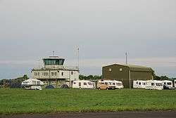 The control tower in 2007 | |||||||||||
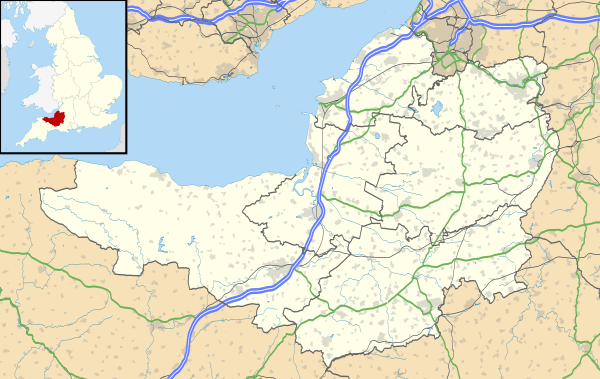 RNAS Merryfield Location in Somerset | |||||||||||
| Coordinates | 50°58′12″N 002°56′24″W | ||||||||||
| Type | Royal Naval Air Station | ||||||||||
| Site information | |||||||||||
| Owner | Ministry of Defence | ||||||||||
| Controlled by | |||||||||||
| Site history | |||||||||||
| Built | 1971 | ||||||||||
| In use | 1971-present | ||||||||||
| Battles/wars | Cold War | ||||||||||
| Airfield information | |||||||||||
| Identifiers | IATA: N/a, ICAO: EGDI[1], WMO: 03334 | ||||||||||
| Elevation | 45 metres (148 ft) AMSL | ||||||||||
| |||||||||||
History
The following squadrons were posted here at some point:[2]
Current use
The site is mainly used for helicopter exercises and there are a large number of lettered helicopter landing spots spread across the site on the taxiways.
See also
References
- "Merryfield-Airport". SkyVector. Retrieved 2 October 2014.
- "Merryfield (Isle Abbotts)". Airfields of Britain Conservation Trust. Retrieved 28 January 2014.
This article is issued from Wikipedia. The text is licensed under Creative Commons - Attribution - Sharealike. Additional terms may apply for the media files.