Punta Santiago, Humacao, Puerto Rico
Punta Santiago is a barrio in the municipality of Humacao, Puerto Rico. Its population in 2010 was 4,723.[3][4][5] It is one of the most vulnerable barrios to flooding and complete destruction when hurricanes enter Puerto Rico through Humacao.
Punta Santiago | |
|---|---|
Barrio | |
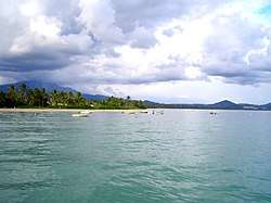 View of ocean and beach from a boardwalk in Punta Santiago | |
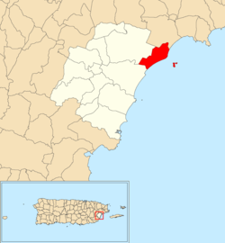 Location of Punta Santiago within the municipality of Humacao shown in red | |
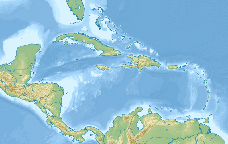 Punta Santiago Location of Puerto Rico | |
| Coordinates: 18°09′52″N 65°45′02″W[1] | |
| Commonwealth | |
| Municipality | |
| Area | |
| • Total | 3.17 sq mi (8.2 km2) |
| • Land | 2.20 sq mi (5.7 km2) |
| • Water | 0.97 sq mi (2.5 km2) |
| Elevation | 3 ft (0.9 m) |
| Population (2010) | |
| • Total | 4,723 |
| Source: 2010 Census | |
| Time zone | UTC−4 (AST) |
History
The United States took control of Puerto Rico from Spain in the aftermath of the Spanish-American War under the terms of the Treaty of Paris of 1898. In 1899, the United States conducted its first census of Puerto Rico finding that the population of Punta Santiago and San Francisco barrios was 1,754.[6]
Flood zone
In 2019, updated flood zone maps show that because of its location- where most cyclones enter the island, Humacao is one of the most vulnerable areas of Puerto Rico.[7] Humacao was working on flood mitigation plans and shared that its barrios located on the coast; Antón Ruíz, Punta Santiago, Río Abajo, Buena Vista and Candelero Abajo barrios, are prone to flooding and in danger of being completed destroyed by a hurricane.[8]
Hurricane Maria
According to Father José Colón, the town's local Catholic priest, Hurricane Maria caused total flooding of Punta Santiago.[9]
"The town was flooded from all directions, from the ocean, rain and nearby rivers..."
Gallery
.jpg) PR National Guard clearing debris at Punta Santiago after Hurricane Maria in 2017
PR National Guard clearing debris at Punta Santiago after Hurricane Maria in 2017.jpg) PR National Guard clearing debris at Punta Santiago after Hurricane Maria in 2017
PR National Guard clearing debris at Punta Santiago after Hurricane Maria in 2017
See also
References
- "US Gazetteer 2019". US Census. US Government.
- U.S. Geological Survey Geographic Names Information System: Punta Santiago barrio
- Picó, Rafael; Buitrago de Santiago, Zayda; Berrios, Hector H. Nueva geografía de Puerto Rico: física, económica, y social, por Rafael Picó. Con la colaboración de Zayda Buitrago de Santiago y Héctor H. Berrios. San Juan Editorial Universitaria, Universidad de Puerto Rico,1969.
- Gwillim Law (20 May 2015). Administrative Subdivisions of Countries: A Comprehensive World Reference, 1900 through 1998. McFarland. p. 300. ISBN 978-1-4766-0447-3. Retrieved 25 December 2018.
- Puerto Rico:2010:population and housing unit counts.pdf (PDF). U.S. Dept. of Commerce, Economics and Statistics Administration, U.S. Census Bureau. 2010.
- Joseph Prentiss Sanger; Henry Gannett; Walter Francis Willcox (1900). Informe sobre el censo de Puerto Rico, 1899, United States. War Dept. Porto Rico Census Office (in Spanish). Imprenta del gobierno. p. 163.
- Alvarado León, Gerardo E. "Sobre 250,000 estructuras están en zonas inundables [More than 250,000 structures in flood zones]" (PDF). Junta de Planificación - Gobierno de Puerto Rico (in Spanish). El Nuevo Día. Retrieved 3 July 2019.
- Solano Quintana, Bárbara. "Piden participación ciudadana para revisión del plan de mitigación de Humacao" (PDF). El Nuevo Día (in Spanish). Retrieved 3 July 2019 – via Junta de Planificación Gobierno de Puerto Rico.
- "What the hurricanes revealed about Puerto Rico". America Magazine. December 27, 2017.