Puerto Rico Highway 190
Puerto Rico Highway 190 (PR-190) is a road located in Carolina, Puerto Rico.[3] This highway begins at its intersection with PR-26 in Cangrejo Arriba and ends at its junction with PR-3 and PR-8887 between Sabana Abajo and San Antón barrios.[4]
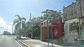
Avenida Monserrate at the Intersection with PR-190 in Carolina
| ||||
|---|---|---|---|---|
| Route information | ||||
| Maintained by Puerto Rico DTPW | ||||
| Length | 4.1 km[1][2] (2.5 mi) | |||
| Major junctions | ||||
| South end | ||||
| North end | ||||
| Location | ||||
| Municipalities | Carolina | |||
| Highway system | ||||
| ||||

Major intersections
The entire route is located in Carolina.
| Location | km[1][2] | mi | Destinations | Notes | |
|---|---|---|---|---|---|
| San Antón | 4.1 | 2.5 | Southern terminus of PR-190 | ||
| Sabana Abajo | 2.7– 2.6[lower-alpha 1] | 1.7– 1.6 | Western terminus of PR-190 through Avenida Paseo de los Gigantes; eastbound exit and entrance | ||
| PR-26 exits 13, 13A and 13B; partial cloverleaf interchange | |||||
| Avenida Paseo de los Gigantes – Carolina | Eastern terminus of PR-190 through Avenida Paseo de los Gigantes; westbound exit and entrance | ||||
| 1.5– 1.4 | 0.93– 0.87 | PR-26 exits 12, 12A and 12B | |||
| Cangrejo Arriba | 0.0 | 0.0 | Northern terminus of PR-190; incomplete diamond interchange; PR-26 eastbound exit and westbound entrance | ||
| 1.000 mi = 1.609 km; 1.000 km = 0.621 mi | |||||
- PR-190 kilometer markers are interrupted on Avenida Paseo de los Gigantes.
See also
References
- Google (2 March 2020). "PR-190 north" (Map). Google Maps. Google. Retrieved 2 March 2020.
- Google (2 March 2020). "PR-190 south" (Map). Google Maps. Google. Retrieved 2 March 2020.
- National Geographic Maps (2011). Puerto Rico (Map). 1:125,000. Adventure Map. Evergreen, CO: National Geographic Maps. ISBN 978-1566955188. OCLC 756511572.
- "Tránsito Promedio Diario (AADT)". Puerto Rico Department of Transportation and Public Works (in Spanish). p. 100-101. Retrieved 5 June 2019.
This article is issued from Wikipedia. The text is licensed under Creative Commons - Attribution - Sharealike. Additional terms may apply for the media files.