Puerto Rico Highway 116
Puerto Rico Highway 116 (PR-116) is a main highway in the southwest part of Puerto Rico, beginning in Guánica, Puerto Rico at Puerto Rico Highway 2 to Lajas, Puerto Rico[4] at Puerto Rico Highway 101. It is the main route to Guánica and Lajas, and grants access to places such as the Dry Forest of Puerto Rico (Bosque Seco), common for its cacti and dry, desert-like climate, and also to beaches like Parguera in Lajas and Playa Santa in Guánica. It is divided, two lane-per-direction in the first 4 kilometers before turning one lane-per direction in the rest of its length. The width of its lanes allows for speed limits above the normal rural roads.[5]
| ||||
|---|---|---|---|---|
| Avenida Manuel "Pito" Pagán Ramírez[1] | ||||
| Route information | ||||
| Maintained by Puerto Rico DTPW | ||||
| Length | 26.6 km[2] (16.5 mi) | |||
| Existed | 1953[3]–present | |||
| Major junctions | ||||
| West end | ||||
| ||||
| East end | ||||
| Location | ||||
| Municipalities | Lajas, Guánica | |||
| Highway system | ||||
| ||||

Major intersections
| Municipality | Location | km[2] | mi | Destinations | Notes |
|---|---|---|---|---|---|
| Lajas | Lajas | 0.0 | 0.0 | Western terminus of PR-116 | |
| 1.0 | 0.62 | ||||
| Lajas–Sabana Yeguas line | 1.5– 1.6 | 0.93– 0.99 | |||
| Sabana Yeguas | 2.9 | 1.8 | |||
| Sabana Yeguas–Parguera line | 5.5 | 3.4 | |||
| Parguera–Costa– Sabana Yeguas tripoint | 6.6 | 4.1 | |||
| Costa | 12.7 | 7.9 | |||
| Guánica | Montalva | 17.9 | 11.1 | ||
| Ensenada | 20.9 | 13.0 | Incomplete trumpet interchange; no eastbound exit | ||
| 21.2 | 13.2 | ||||
| Guánica barrio-pueblo | 21.6 | 13.4 | |||
| Ciénaga | 22.1– 22.2 | 13.7– 13.8 | |||
| 22.5– 22.6 | 14.0– 14.0 | ||||
| Ciénaga–Caño– Carenero tripoint | 23.0 | 14.3 | |||
| Carenero | 24.1 | 15.0 | |||
| Susúa Baja | 25.6 | 15.9 | |||
| 26.6 | 16.5 | Eastern terminus of PR-116; PR-2 exit 194; trumpet interchange | |||
| 1.000 mi = 1.609 km; 1.000 km = 0.621 mi | |||||
Gallery for PR-116
 A rural stretch of Highway 116 in Lajas
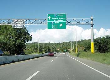 Eastern end of Highway 116 in Guanica where it meets Highway 2
Related routes
Currently, PR-116 has three branches in its old segments in Guánica and Yauco. Originally they were identified as PR-116R.[5]
Puerto Rico Highway 1116
| |
|---|---|
| Location | Guánica – Yauco |
| Length | 4.4 km[6] (2.7 mi) |
Puerto Rico Highway 1116 (PR-1116) was the old section of PR-116 between Guánica and Yauco.[5] It extended from PR-116 between Caño and Carenero barrios to PR-121 in Susúa Baja.[7] In 2015, this highway was designated as Avenida Agustín "Quino" López Oliveras[8] and renumbered to PR-326.[9]
| Municipality | Location | km[6] | mi | Destinations | Notes |
|---|---|---|---|---|---|
| Guánica | Carenero | 0.0 | 0.0 | Southern terminus of PR-1116 | |
| Susúa Baja | 1.6 | 0.99 | |||
| 2.3 | 1.4 | ||||
| 2.9– 3.0 | 1.8– 1.9 | ||||
| Yauco | Susúa Baja | 4.4 | 2.7 | Northern terminus of PR-1116 | |
| 1.000 mi = 1.609 km; 1.000 km = 0.621 mi | |||||
Puerto Rico Highway 3116
| |
|---|---|
| Location | Guánica |
| Length | 3.4 km[10] (2.1 mi) |
Puerto Rico Highway 3116 (PR-3116) is an old segment of PR-116 that provides access to Ensenada.[5] The entire route is located in Guánica.
| Location | km[10] | mi | Destinations | Notes | |
|---|---|---|---|---|---|
| Montalva | 0.0 | 0.0 | Western terminus of PR-3116 | ||
| Montalva–Ensenada line | 1.1 | 0.68 | |||
| Ensenada | 1.9 | 1.2 | |||
| 3.4 | 2.1 | Eastern terminus of PR-3116; incomplete trumpet interchange; no exit ramp from PR-116 eastbound | |||
| 1.000 mi = 1.609 km; 1.000 km = 0.621 mi | |||||
Puerto Rico Highway 4116
| |
|---|---|
| Location | Guánica |
| Length | 1.5 km[11] (0.93 mi) |
Puerto Rico Highway 4116 (PR-4116) is the original route of PR-116 through downtown Guánica. This road can be seen as Puerto Rico 116 Business.[5] The entire route is located in Guánica.
| Location | km[11] | mi | Destinations | Notes | |
|---|---|---|---|---|---|
| Guánica barrio-pueblo | 0.0 | 0.0 | Western terminus of PR-4116 | ||
| Guánica barrio-pueblo–Carenero– Ciénaga tripoint | 1.0– 1.1 | 0.62– 0.68 | |||
| Carenero | 1.5 | 0.93 | Eastern terminus of PR-4116; Guánica State Forest | ||
| 1.000 mi = 1.609 km; 1.000 km = 0.621 mi | |||||
See also
References
- "Para designar con el nombre de Avenida Manuel (Pito) Pagán Ramírez, a la Carretera PR – 116, que comprende desde Lajas hasta Guánica". LexJuris (Leyes y Jurisprudencia) de Puerto Rico (in Spanish). 2010. Retrieved 1 June 2019.
- Google (6 March 2020). "PR-116" (Map). Google Maps. Google. Retrieved 6 March 2020.
- "Guánica, Memoria Núm. 44" (PDF). Puerto Rico Planning Board (in Spanish). 1955. Retrieved 4 August 2020.
- "Tránsito Promedio Diario (AADT)". Transit Data (Datos de Transito) (in Spanish). DTOP PR. pp. 66–67.
- National Geographic Maps (2011). Puerto Rico (Map). 1:125,000. Adventure Map. Evergreen, CO: National Geographic Maps. ISBN 978-1566955188. OCLC 756511572.
- Google (1 March 2020). "PR-1116" (Map). Google Maps. Google. Retrieved 1 March 2020.
- "Carretera 326, Susúa Baja". Cartogiraffe. Retrieved 15 August 2020.
- "Para denominar la carretera estatal PR-1116 de Yauco a Guánica, con el nombre de Agustín (Quino) López Oliveras". LexJuris (Leyes y Jurisprudencia) de Puerto Rico (in Spanish). 2015. Retrieved 1 June 2019.
- "Abriendo puertas". El Nuevo Día (in Spanish). 2020. Retrieved 16 August 2020.
- Google (1 March 2020). "PR-3116" (Map). Google Maps. Google. Retrieved 1 March 2020.
- Google (1 March 2020). "PR-4116" (Map). Google Maps. Google. Retrieved 1 March 2020.
External links
| Wikimedia Commons has media related to |