Polenz (river)
The Polenz is the right-hand, smaller headstream of the Lachsbach in the German state of Saxony. Its lower course flows through the western Elbe Sandstone Mountains in a canyon-like valley.
| Polenz | |
|---|---|
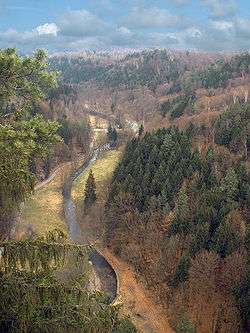 The Polenz valley immediately above the Lusatian Fault | |
| Location | |
| Country | Germany |
| State | Saxony |
| Physical characteristics | |
| Source | |
| • location | in Saxony |
| • elevation | ca. 380 m above sea level (NN) |
| Mouth | |
• location | confluence with the Sebnitz at Lachsbach near Porschdorf |
• coordinates | 50°56′35″N 14°08′06″E |
• elevation | ca. 150 m above sea level (NN) |
| Length | 31.3 km (19.4 mi)[1] |
| Basin size | 104 km2 (40 sq mi)[1] |
| Discharge | |
| • location | [2] |
| • average | 1.1 m³/s |
| Basin features | |
| Progression | Lachsbach→ Elbe→ North Sea |
| Landmarks |
|
| Navigable | no |
Geography
The Polenz rises from nine springs on the German-Czech border between the villages of Langburkersdorf and Nová Víska (Neudörfel). The springs are located southwest of the 461 m high Roubený (Raupenberg) mainly on German territory and unite at a height of 363 m above sea level. The upper reaches of the Polenz form the natural boundary between the forest land Hohwald and the Saxon Switzerland.
Tributaries
The most important tributaries of the Polenz are the:
- Laubbach, Langburkersdorf
- Schluckenbach, Neustadt in Sachsen
- Lohbach, Neustadt in Sachsen
- Flemigbach, Polenz
- Rückersdorfer Bach, below Polenz
- Cunnersdorfer Bach, by the Bock Mill
- Goldflüßchen, at the Heeselicht Mill
- Bärenhohlflüßchen, above the Rußig Mill
- Schindergraben, at Hockstein
- Tiefergrundbach, at the Frinzthal Mill
See also
References
| Wikimedia Commons has media related to Polenz. |
- Topographische Karte 1:25,000
- The regional drainage of the catchment areas of the Polenz and Sebnitz at the Porschdorf am Lachsbach gauge is 11.3 l/s km². That gives an average for the Polenz, with its catchment area of 104 km², of about 1.1 m³/s
This article is issued from Wikipedia. The text is licensed under Creative Commons - Attribution - Sharealike. Additional terms may apply for the media files.