Oregon Route 212
Oregon Route 212 is an Oregon state highway that serves the eastern Portland metro area. It is an east–west route, running between Boring and Clackamas.
| ||||
|---|---|---|---|---|
 | ||||
| Route information | ||||
| Maintained by ODOT | ||||
| Existed | 1935–present | |||
| Major junctions | ||||
| West end | ||||
| East end | ||||
| Highway system | ||||
| ||||

Route description
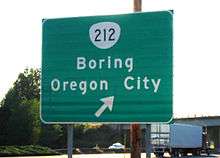

OR 212 begins east of Boring and northwest of Sandy at an interchange with U.S. Route 26. OR 212 heads west, through the small town of Boring, and through the small city of Damascus. On the route between these two towns are numerous intersections with backroads that lead to Gresham, Portland's biggest eastern suburb. The sides of this route are covered in farms and berry fields. This section of OR 212 is the Clackamas-Boring Highway No. 174 (see Oregon highways and routes).
After Damascus, the highway intersects with OR 224, just east of Clackamas. It quickly becomes four lanes (two in each direction) as it speeds past warehouses in the Portland suburb, marked as both OR 212 and OR 224. After several miles, which are heavily traveled by trucks, the highway comes to its western terminus, at an intersection with Interstate 205 and OR 213. This section of OR 212 is part of the Clackamas Highway No. 171.
History
A previous alignment through Boring ran due west onto Fireman Way, curving south onto 272nd.
Two junctions with 257th Ave give away an old alignment. OR 212 traveled due west on the eastern junction with 257th, curving south to meet the western junction.
Armstrong Circle at 172nd is a previous alignment.
Before the construction of I-205, OR 212 continued west on a shared alignment with OR 213 to Oregon City. There, it crossed the Willamette River into West Linn and continued west to Tualatin where it eventually terminated at an intersection with OR 99W. This section replaced the original Oregon Route 244, but was eventually decommissioned after I-205 was completed; however the entire route can still be driven (other than a now-closed bridge across the Clackamas River which used to connect Oregon City with Gladstone, Oregon).
Before US 26 was rerouted, it used to run on Orient Drive. OR 212 traveled this brief segment of Compton Road before the US 26 realignment shortened it.
Major intersections
Milepoints are as reported by ODOT and do not necessarily reflect current mileage. Z indicates overlapping mileage due to construction longer than established route, and – indicates negative mileage behind established beginning point.[1] Segments that are locally maintained may be omitted. For routes traversing multiple named state highways, each milepoint is preceded by the corresponding state highway number. The entire route is in Clackamas County.
| Location | Milepoint[2] | Destinations | Notes | ||
|---|---|---|---|---|---|
| Clackamas | 171 Z4.93 | I-205 exit 12 northbound/12A southbound. | |||
| Happy Valley | 171 6.56 | Western end of OR 224 overlap | |||
| Damascus | 171 8.19 174 0.03 | Eastern end of OR 224 overlap | |||
| | 174 8.87 | Interchange | |||
1.000 mi = 1.609 km; 1.000 km = 0.621 mi
| |||||
References
- Road Inventory and Classification Services (July 2017). "Straightline Chart Legend" (PDF). Oregon Department of Transportation. Retrieved April 7, 2018.
- Road Inventory and Classification Services. "Straightline Charts". Oregon Department of Transportation. Retrieved April 6, 2018.
- Clackamas Highway No. 171 (October 2016)
- Clackamas-Boring Highway No. 174 (January 2017)