Onondaga Creek
Onondaga Creek is a major tributary of Onondaga Lake which is located in Onondaga County, New York. The headwaters of the creek originate 27 miles (43 km) south of the city of Syracuse near the hamlet of Vesper, in the town of Tully, New York. The creek flows north through the Tully Valley and through the city of Syracuse where it empties into Onondaga Lake.[3]
| Onondaga Creek | |
|---|---|
 Onondaga Creek about 1900 | |
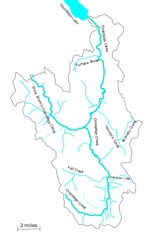 Onondaga Creek watershed | |
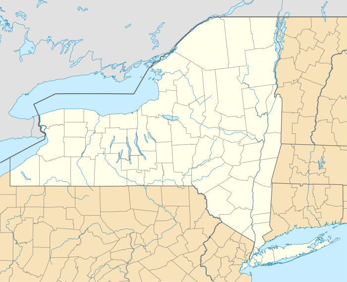 Location of the mouth in New York | |
| Location | |
| Country | United States |
| State | New York |
| County | Onondaga County, New York |
| Physical characteristics | |
| Source | |
| • location | Vesper, New York, Onondaga County, New York |
| Mouth | |
• location | Onondaga Lake, Syracuse, Onondaga County, New York |
• coordinates | 43°4′4″N 76°10′41″W |
| Length | 27.2 mi (43.8 km)[1] |
| Basin size | 111 sq mi (290 km2)[1] |
| Discharge | |
| • location | Syracuse[2] |
| • average | 183 cu ft/s (5.2 m3/s)[2] |
| • minimum | 23 cu ft/s (0.65 m3/s) |
| • maximum | 2,040 cu ft/s (58 m3/s) |
The major tributaries of Onondaga Creek are the West Branch of Onondaga Creek, Hemlock Creek and Rattlesnake Gulf.[3][4]
History
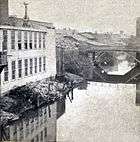
The settlement that became Syracuse arose in a forested swampy area at the creek outlet in the early 1800s as a result of the state of NY constructing the Erie Canal and developing salt production on the shores of Onondaga Lake. From this time forward, the natural meandering flood plain of the creek was periodically channelized and straightened to facilitate uncontrolled development of the creek-side and flood plain upstream towards the Onondaga Nation Reservation. A "progress"-based economic cycle involved land developers purchasing farmland and building in the adjacent rural towns, followed by flooding, sewage, water supply, and school crises. The city of Syracuse would then respond to petitions by the new homeowners and businesses to formally ask the state legislature to annex these lands. By the turn of the twentieth century, this cycle accelerated due to the city acquiring water rights to Skaneatles lake, and the development of street car lines.
After a series of major floods, the city engineer was authorized by the state to study the whole watershed. The 1927 report concluded that the region had experienced much heavier rainfalls in the preceding decades than had Onondaga Creek, so the in the future floods could be significantly larger. In addition, the anticipated uncontrolled sprawl up to the Onondaga Nation reservation would in effect block the remaining overflows to the farmland flood plain further increasing peak flood flows. the City Engineer recommend the construction of two flood control dam within Onondaga reservation, just inside the northern and the southern boundaries. There were no city, state or federal funds available for such a project.
The Onondaga nation and the Iroquois Confederation strongly opposed this taking. In 1936 Congress passed the Federal Flood Control Act. It provided funding for construction. States had to acquire land rights, and were responsible for operation and maintenance. By 1940 a flood control project for Onondaga creek was authorized, subject to agreement by the Nation.
References
- "Onondaga Creek Fact Sheet" (PDF). Onondaga Nation. Retrieved 2014-11-04.
- "USGS Gage #04240010 on Onondaga Creek at Spencer Street, Syracuse, NY" (PDF). National Water Information System. U.S. Geological Survey. 1970–2013. Retrieved 2014-11-04.
- "System Description: Onondaga Creek". OurLake, 2009. Retrieved November 6, 2011.
- Currie, S., Firstenberg, M., Geartz, G., Jeffords, B., Kreider, T. & Nodine, D. "Onondaga Creek Restoration Project Report: Trolley Lot Restoration Conceptual Design" (PDF). Onondaga Environmental Institute, 10 December 2009. Retrieved 12 May 2016.CS1 maint: multiple names: authors list (link)
External links
