Oksenøya
Oksenøya or Uksenøya is an island in the Sunnmøre region of Møre og Romsdal county, Norway. The island is divided between Ålesund Municipality and Skodje Municipality on the north side of the Storfjorden. Oksenøya has an area of 108 square kilometres (42 sq mi) and it has a population of 27,334 (in 2015). The Ålesund portion of the island (58 square kilometres or 22 square miles) is home to about 26,000 people, the Skodje side about 1,200. This is the largest island in Ålesund Municipality.[1][2]
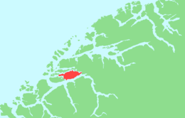 | |
 Oksenøya Location of the island  Oksenøya Oksenøya (Norway) | |
| Geography | |
|---|---|
| Location | Møre og Romsdal, Norway |
| Coordinates | 62.4632°N 6.5042°E |
| Area | 108 km2 (42 sq mi) |
| Length | 20 km (12 mi) |
| Width | 8 km (5 mi) |
| Highest elevation | 576 m (1,890 ft) |
| Highest point | Meraftafjellet |
| Administration | |
Norway | |
| County | Møre og Romsdal |
| Municipalities | Ålesund Municipality and Skodje Municipality |
| Demographics | |
| Population | 27334 (2015) |
The island was originally part of the old Borgund Municipality, but is now split between Ålesund and Skodje. It is home to the villages of Spjelkavik, Myrland, and Løvika (in Ålesund) and the village of Valle (in Skodje).[3]
The European route E39 and European route E136 highways run across the island. The island is dominated by the large lake Brusdalsvatnet which covers 7.5 square kilometres (2.9 sq mi) on the northern part of the island and is used as a drinking water reservoir for the municipality (and city) of Ålesund.
See also
References
- "Geografi" (in Norwegian). Ålesund kommune. Retrieved 2010-10-02.
- Thorsnæs, Geir, ed. (2019-03-13). "Uksenøya". Store norske leksikon (in Norwegian). Kunnskapsforlaget. Retrieved 2019-08-10.
- "Uksenøya" (in Norwegian). yr.no. Retrieved 2010-10-02.