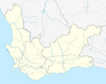
Northern Suburbs, Cape Town
The Northern Suburbs is a group of suburbs and exurbs in the City of Cape Town Metropolitan Municipality. It comprises the sub-districts of Tygerberg and Oostenberg (it includes majority of Oostenberg except Eersterivier). The region's main and largest town is Bellville.
Northern Suburbs | |
|---|---|
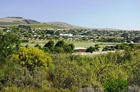
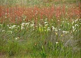
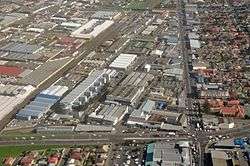
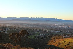 A view of some parts of the Northern Suburbs | |
 Northern Suburbs 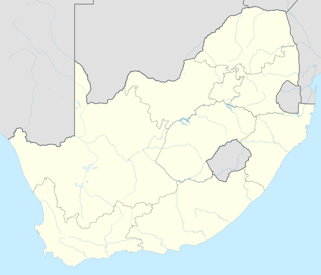 Northern Suburbs | |
| Coordinates: 33°49′0″S 18°38′00″E | |
| Country | South Africa |
| Province | Western Cape |
| Municipality | City of Cape Town |
| Time zone | UTC+2 (SAST) |
| Postal code (street) | 7303- 7599 |
Overview
The Northern Suburbs lies behind of the imaginary line, 'the Boerewors Curtain' which basically distincts between the predominantly English-speaking Southern Suburbs and the predominantly Afrikaans-speaking Northern Suburbs.[1]
Geography
The Northern Suburbs stretches from Maitland, Edgemead and Bothasig in the west, to Kraaifontein, Brackenfell, Blue Downs, and Kuils River in the east, to Philadelphia in the north, and to Cape Town International Airport, Heideveld, Mfuleni in the south.[2]
Suburbs such as Maitland, Edgemead, Bothasig and Goodwood are located more towards the city centre, whilst Durbanville is located on the northern outskirts and Brackenfell, Blue Downs, Kraaifontein and Kuils River are on the eastern outskirts. Suburbs such as Durbanville, Brackenfell, Kraaifontein and Kuils River are transitioning from rural to urban towns.[3][4]
Towns such as Klipheuwel, Visserhok and Philadelphia are rural towns and exurbs of Cape Town. Fisantekraal is a township near Durbanville and is also an exurb of Cape Town.
Commerce

Its main town and economic hub is Bellville which is centrally located in the region. Bellville is home to the Northern Suburbs' largest shopping centre, Tyger Valley Shopping Centre, home to many corporate headquarters namely Sanlam, Metropolitan and Pioneer Foods and regional offices, three universities and a few colleges and 6 hospitals.[5][6]
Parow is also another but smaller economic centre which includes the head offices for The Foschini Group, MWEB, Pepkor and PetroSA and South Africa's second largest hospital, Tygerberg Hospital[7][8][9][10]
Brackenfell, located on the outskirts is also another but smaller and developing economic centre, home to Cape Gate Shopping Centre, which also one of the largest shopping centres in the Western Cape. Brackenfell is also known to home to local retailers' headquarters such as Shoprite-Checkers and Food Lover's Market.[11][12][13]
Industrialisation
The Northern Suburbs's main industrial areas are in Bellville, Parow, Goodwood, Brackenfell, Maitland and Kraaifontein. Industrial areas include Stikland, Bellville South and Sacks Circle in Bellville; Parow Industrial in Parow; Brackengate, Okavango Park and Brackenfell Industrial in Brackenfell, Kraaifontein Industrial in Kraaifontein, Epping in Goodwood and the industrial area along Voortrekker Road in Maitland.
Rural Activity
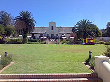
Majority of the rural economy or activity is based around Durbanville, Fisantekraal, Philadelphia, Klipheuwel, Kraaifontein, Brackenfell and Kuils River. Durbanville is known for the Durbanville Wine Valley which lies amongst the Tygerberg Valley Hills, whilst Kraaifontein has surrounding poultry, equestrian and guest farms. Brackenfell includes the Hazendal Wine Estate and Kuils River includes the Zevenwacht Wine Estate which are both at the start of the Stellenbosch Wine Route and the Cape Winelands. Philadelphia and Klipheuwel have various farms surrounding them such as dairy, wheat and bird farms. Philadelphia also has a wine farm near the town, Capaia Wines.[14][15][16]
County Fair has a poultry farm and abattoir near Fisantekraal.[17]
Transport
Air
.JPG)
The Cape Town International Airport is located on the southernmost border of the Northern Suburbs and is situated in Matroosfontein. It offers domestic and international flights to Africa, Asia, Europe and North America.[18]
Rail
There are numerous commuter train stations in the Northern Suburbs offered by Metrorail Western Cape serving the City of Cape Town and surrounding towns. Train stations in the Northern Suburbs stretch from Goodwood in the west to Kraaifontein in the east to Mikpunt in the north and Belhar in the south. Durbanville is the only suburb in the region with no rail access.[19]
Road Links

The Northern Suburbs's main road is the N1 freeway which links to Cape Town city centre, Paarl, Worcester and Bloemfontein, Johannesburg and Pretoria to a further extent. The N1 bypasses Maitland and then cuts through Goodwood, Parow, Bellville, Brackenfell and Kraaifontein.[20]
The R300 is another major freeway in the Northern Suburbs linking to Mitchells Plain and Phillipi in the Cape Flats region. This road begins in the Stellenberg Interchange between Brackenfell and Bellville and passes the suburbs of Brackenfell, Bellville, Kuils River, Blue Downs and Delft before meeting with the N2, south of Delft.[21]
Durbanville is the only suburb that has no link to a freeway however it does have an indirect link to the N7 to Malmesbury via the M13 and to the N1 via the R302, M124 and M100.[22]
Regional routes in the Northern Suburbs the R300, R102 to Cape Town and Somerset West, R302 to Malmesbury and R101 to Paarl and Worcester.
Recreation
Entertainment
- Bugz Playpark, Kraaifontein
- Cool Runnings Tobaggan Park, Bellville
- GrandWest Casino & Entertainment World, Goodwood
Gardens
- Cape Garden Centre, Joostenberg Vlakte, Kraaifontein
- Durbanville Rose Garden, Durbanville
Major Parks
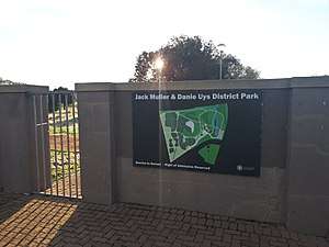
- Jack Muller & Danie Uys Park, Bellville
- Majik Forest, Bellville
Museums
- Motor Museum, Kraaifontein
- Rust-en-vrede, Durbanville
Nature Reserves
Scate Parks
- Edgemead Scate Park, Edgemead
Sports facilities
- Bellville Golf Club, Bellville
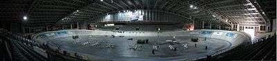
- Bellville Velodrome, Bellville
- Brackenfell Action Arena, Brackenfell
- Durbanville Golf Club, Durbanville
- Durbanville Sports Club, Durbanville
- Kuils River Golf Club, Kuils River
- Parow Golf Club, Parow
- Tyger Valley Golf Academy, Bellville
- Wagner's Golf Academy, Brackenfell
Theatres
- Barnyard Theatre, Bellville
Suburbs & Exurbs
Suburbs


- Belhar
- Bellville
- Blue Downs
- Brackenfell
- Bothasig
- Durbanville
- Edgemead
- Elsies River
- Goodwood
- Kraaifontein
- Kuilsriver
- Maitland
- Monte Vista
- Parow
Although the suburbs of Bothasig, Edgemead and Monte Vista geographically fall under the Northern Suburbs, they administratively fall under Milnerton which is mainly part of the Blaauwberg region of the City of Cape Town.

References
- "NORTHERN SUBURBS, Cape Town". www.sa-venues.com. Retrieved 23 June 2020.
- "Maps: Find your way around Cape Town". mapmyway. 8 January 2015. Retrieved 10 July 2020.
- "NORTHERN SUBURBS, Cape Town". www.sa-venues.com. Retrieved 23 June 2020.
- "Cape Town Map | South Africa Google Satellite Maps". www.maplandia.com. Retrieved 23 June 2020.
- Scholtz, Christoff. "The future success of our cities must begin today | Global Africa Network". Retrieved 23 June 2020.
- "hospitals in bellville – Google Search". www.google.com. Retrieved 23 June 2020.
- "Tygerberg Hospital". 23 June 2020.
- "THE FOSCHINI GROUP – HEAD OFFICE". www.jewellery.org.za. Retrieved 23 June 2020.
- "Find us – MWEB". www.mweb.co.za. Retrieved 23 June 2020.
- "PEPKOR – Contact us". home.intekom.com. Retrieved 23 June 2020.
- "Cape Gate Shopping Centre". capegatecentre.co.za. Retrieved 23 June 2020.
- "Shoprite Holdings | Contact Shoprite Holdings". www.shopriteholdings.co.za. Retrieved 23 June 2020.
- "Contact". Food Lovers Market. Retrieved 23 June 2020.
- "Hazendal Wine Estate". Hazendal Wine Estate. Retrieved 10 July 2020.
- "Zevenwacht Wine Estate in Kuils River, Cape Town". www.sa-venues.com. Retrieved 10 July 2020.
- "Capaia Wines » Winery". Retrieved 10 July 2020.
- "County Fair - Hocraft Poultry Farm - Fisantekraal Cape Town Phone number WWW | Yoys". Yoys connected business. Retrieved 1 July 2020.
- "Cape Town International Airport". 23 June 2020.
- "Metrorail Western Cape" (PDF). 23 June 2020.
- "Best Of Cape Town's Northern Suburbs for Property Buyers – Property24". www.property24.com. Retrieved 23 June 2020.
- "Brackenfell Map | South Africa Google Satellite Maps". www.maplandia.com. Retrieved 23 June 2020.
- "Durbanville Map | South Africa Google Satellite Maps". www.maplandia.com. Retrieved 23 June 2020.