New Brunswick Route 115
Route 115 is a highway in New Brunswick, Canada; running from a junction with Route 134 in the Lewisville neighbourhood of Moncton to Route 134 in Saint-François-de-Kent (near Bouctouche, a distance of 44 kilometres.
| ||||
|---|---|---|---|---|
| Route information | ||||
| Maintained by New Brunswick Department of Transportation | ||||
| Length | 44.0 km[1] (27.3 mi) | |||
| Existed | 1965–present | |||
| Major junctions | ||||
| South end | ||||
| North end | ||||
| Location | ||||
| Major cities | Irishtown, Notre-Dame, Saint-Antoine | |||
| Highway system | ||||
| Provincial highways in New Brunswick Former routes
| ||||

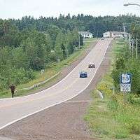
In Moncton, Route 115 follows Elmwood Drive, a suburban arterial running due north from the city through the neighbourhood of Sunny Brae. The route continues north to the community of Irishtown, then northeast to Notre-Dame. From Notre-Dame, Route 115 turns north to the village of Saint-Antoine, New Brunswick, becoming known as rue Principale and chemin McKees Mills, then follows the south bank of the Little Bouctouche River to through McKees Mills as it ends in Saint-Francois-de-Kent.
History
Route 115 came into existence in 1965 as a renumbering of Route 31, during a mass redesignation of provincial highways. Until the late 1970s, Route 115 was routed from Notre-Dame eastward along present-day Route 535 to its former northern terminus in Cocagne.
References
- New Brunswick Department of Transportation: Designated Provincial Highways, 2003