National Register of Historic Places listings in Tulare County, California
This is a list of the National Register of Historic Places listings in Tulare County, California.
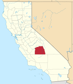
Location of Tulare County in California
This is intended to be a complete list of the properties and districts on the National Register of Historic Places in Tulare County, California, United States. Latitude and longitude coordinates are provided for many National Register properties and districts; these locations may be seen together in an online map.[1]
There are 36 properties and districts listed on the National Register in the county, including 1 National Historic Landmark.
- This National Park Service list is complete through NPS recent listings posted August 14, 2020.[2]
Current listings
| [3] | Name on the Register[4] | Image | Date listed[5] | Location | City or town | Description |
|---|---|---|---|---|---|---|
| 1 | Allensworth Historic District |  Allensworth Historic District |
February 23, 1972 (#72000263) |
Town of Allensworth and its environs along CA 43 35°51′45″N 119°23′12″W |
Allensworth | |
| 2 | Ash Mountain Entrance Sign | 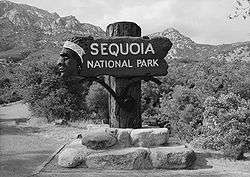 Ash Mountain Entrance Sign |
April 27, 1978 (#78000367) |
N of Three Rivers in Sequoia National Park 36°29′15″N 118°50′09″W |
Three Rivers | |
| 3 | Bank of Italy Building | 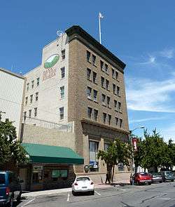 Bank of Italy Building |
April 1, 1982 (#82002280) |
128 E. Main St. 36°19′49″N 119°17′16″W |
Visalia | |
| 4 | Barton-Lackey Cabin | 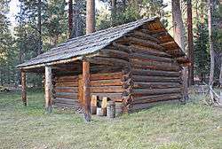 Barton-Lackey Cabin |
March 30, 1978 (#78000290) |
N of Mineral King in Kings Canyon National Park 36°42′46″N 118°34′59″W |
Mineral King | |
| 5 | Bearpaw High Sierra Camp |  Bearpaw High Sierra Camp |
April 21, 2016 (#16000192) |
Along High Sierra Trail, 11 mi. East of Crescent Meadow, Sequoia National Park 36°33′54″N 118°37′17″W |
Three Rivers | |
| 6 | Cabin Creek Ranger Residence and Dormitory | 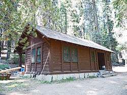 Cabin Creek Ranger Residence and Dormitory |
April 27, 1978 (#78000368) |
SE of Wilsonia on Generals Highway in Sequoia National Park 36°38′56″N 118°48′49″W |
Wilsonia | |
| 7 | Cattle Cabin | 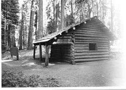 Cattle Cabin |
September 15, 1977 (#77000150) |
NE of Three Rivers on Sequoia National Park 36°34′18″N 118°45′11″W |
Three Rivers | |
| 8 | C. A. Elster Building | C. A. Elster Building |
March 25, 1982 (#82002279) |
CA 190 and Tule River Dr. 36°07′50″N 118°48′59″W |
Springville | |
| 9 | Exeter Public Library |  Exeter Public Library |
December 10, 1990 (#90001811) |
309 S. E St. 36°17′36″N 119°08′17″W |
Exeter | |
| 10 | First Congregational Church |  First Congregational Church |
January 5, 1999 (#98001553) |
165 E. Mill St. 36°04′07″N 119°00′43″W |
Porterville | |
| 11 | Generals' Highway Stone Bridges | .jpg) Generals' Highway Stone Bridges |
September 13, 1978 (#78000284) |
N of Mineral King in Sequoia National Park 36°36′27″N 118°44′46″W |
Mineral King | |
| 12 | Giant Forest Lodge Historic District | 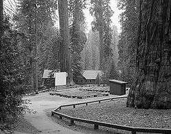 Giant Forest Lodge Historic District |
May 5, 1978 (#78000287) |
NE of Three Rivers in Sequoia National Park 36°33′56″N 118°45′58″W |
Three Rivers | |
| 13 | Giant Forest Village-Camp Kaweah Historic District | 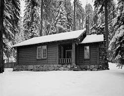 Giant Forest Village-Camp Kaweah Historic District |
May 22, 1978 (#78000311) |
N of Three Rivers in Sequoia National Park 36°33′52″N 118°46′24″W |
Three Rivers | |
| 14 | Groenfeldt Site | March 30, 1978 (#78000288) |
Address Restricted |
Three Rivers | ||
| 15 | Hockett Meadow Ranger Station | 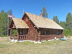 Hockett Meadow Ranger Station |
April 27, 1978 (#78000369) |
S of Silver City in Sequoia National Park 36°22′37″N 118°39′19″W |
Silver City | |
| 16 | Hospital Rock | 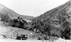 Hospital Rock |
August 29, 1977 (#77000122) |
Address Restricted |
Three Rivers | |
| 17 | Hyde House | 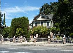 Hyde House |
April 26, 1979 (#79000565) |
500 S. Court St. 36°19′33″N 119°17′28″W |
Visalia | |
| 18 | Mineral King Road Cultural Landscape | 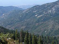 Mineral King Road Cultural Landscape |
October 24, 2003 (#03001063) |
Mineral King Rd, Sequoia National Park 36°26′49″N 118°40′50″W |
Mineral King | |
| 19 | Moro Rock Stairway | 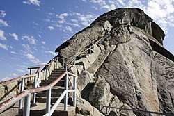 Moro Rock Stairway |
December 29, 1978 (#78000283) |
N of Three Rivers in Sequoia National Park 36°32′39″N 118°45′51″W |
Three Rivers | |
| 20 | Orosi Branch Library | 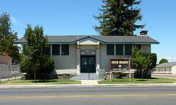 Orosi Branch Library |
August 25, 1983 (#83001247) |
12662 Ave. 416 36°32′42″N 119°17′22″W |
Orosi | |
| 21 | Pear Lake Ski Hut | 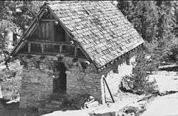 Pear Lake Ski Hut |
May 5, 1978 (#78000285) |
N of Mineral King on Sequoia National Park 36°36′29″N 118°40′15″W |
Mineral King | |
| 22 | Pogue Hotel | August 5, 1991 (#91000927) |
32792 Sierra Dr. (CA 198) 36°22′58″N 119°01′25″W |
Lemon Cove | ||
| 23 | Quinn Ranger Station | 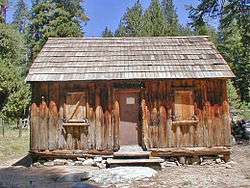 Quinn Ranger Station |
April 13, 1977 (#77000118) |
S on Mineral King on Sequoia National Park 36°19′29″N 118°34′33″W |
Mineral King | |
| 24 | Redwood Meadow Ranger Station | 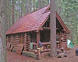 Redwood Meadow Ranger Station |
April 13, 1978 (#78000289) |
NE of Three Rivers in Sequoia National Park 36°31′46″N 118°38′07″W |
Three Rivers | |
| 25 | Sequoia Field- Visalia-Dinuba School of Aeronautics | 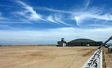 Sequoia Field- Visalia-Dinuba School of Aeronautics |
June 9, 2000 (#99001591) |
Near jct. of Ave. 368 and Road 112, 9 mi (14 km). N of Visalia 36°26′51″N 119°19′15″W |
Visalia | |
| 26 | Shorty Lovelace Historic District | 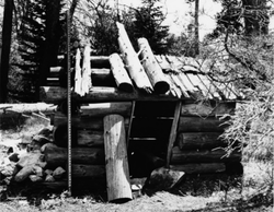 Shorty Lovelace Historic District |
January 31, 1978 (#78000293) |
E of Pinehurst on Kings Canyon National Park 36°44′26″N 118°31′03″W |
Pinehurst | |
| 27 | Smithsonian Institution Shelter |  Smithsonian Institution Shelter |
March 8, 1977 (#77000119) |
W of Lone Pine in Sequoia National Park 36°34′49″N 118°17′32″W |
Lone Pine | |
| 28 | Squatter's Cabin | 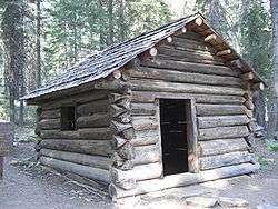 Squatter's Cabin |
March 8, 1977 (#77000116) |
NE of Three Rivers 36°33′31″N 118°45′09″W |
Three Rivers | |
| 29 | Tenalu | September 4, 1986 (#86002194) |
Address Restricted |
Porterville | ||
| 30 | Tharp's Log |  Tharp's Log |
March 8, 1977 (#77000117) |
NE of Three Rivers 36°33′40″N 118°44′29″W |
Three Rivers | |
| 31 | The Pioneer | May 5, 1977 (#77000358) |
27000 S. Mooney Blvd. 36°16′50″N 119°18′43″W |
Visalia | ||
| 32 | Tulare Union High School Auditorium and Administration Building | 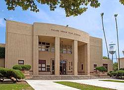 Tulare Union High School Auditorium and Administration Building |
December 17, 1999 (#99001566) |
755 E. Tulare Ave. 36°12′32″N 119°20′17″W |
Tulare | |
| 33 | US Post Office-Porterville Main |  US Post Office-Porterville Main |
January 11, 1985 (#85000141) |
65 W. Mill Ave. 36°04′07″N 119°01′01″W |
Porterville | |
| 34 | US Post Office-Visalia Town Center Station | 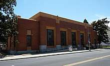 US Post Office-Visalia Town Center Station |
January 11, 1985 (#85000142) |
11 W. Acequia St. 36°19′41″N 119°17′27″W |
Visalia | |
| 35 | Wilsonia Historic District | March 14, 1996 (#95001151) |
Roughly bounded by Pine Ln., Fern Ln., Hillcrest Rd., Sierra Ln., Kaweah Ln., Goddard Ln. and Park Rd. 36°44′05″N 118°57′22″W |
Wilsonia | ||
| 36 | Zalud House |  Zalud House |
March 31, 1987 (#86003681) |
393 N. Hockett St. 36°04′21″N 119°00′56″W |
Porterville |
See also
| Wikimedia Commons has media related to National Register of Historic Places in Tulare County, California. |
References
- The latitude and longitude information provided in this table was derived originally from the National Register Information System, which has been found to be fairly accurate for about 99% of listings. Some locations in this table may have been corrected to current GPS standards.
- "National Register of Historic Places: Weekly List Actions". National Park Service, United States Department of the Interior. Retrieved on August 14, 2020.
- Numbers represent an ordering by significant words. Various colorings, defined here, differentiate National Historic Landmarks and historic districts from other NRHP buildings, structures, sites or objects.
- "National Register Information System". National Register of Historic Places. National Park Service. July 9, 2010.
- The eight-digit number below each date is the number assigned to each location in the National Register Information System database, which can be viewed by clicking the number.
| Topics | |
|---|---|
| Lists by state |
|
| Lists by insular areas | |
| Lists by associated state | |
| Other areas | |
| Related | |
| |
Municipalities and communities of Tulare County, California, United States | ||
|---|---|---|
| Cities | Tulare County map | |
| CDPs |
| |
| Unincorporated communities | ||
| Ghost towns |
| |
| Indian reservation | ||
This article is issued from Wikipedia. The text is licensed under Creative Commons - Attribution - Sharealike. Additional terms may apply for the media files.