National Register of Historic Places listings in Terrebonne Parish, Louisiana
This is a list of the National Register of Historic Places listings in Terrebonne Parish, Louisiana.
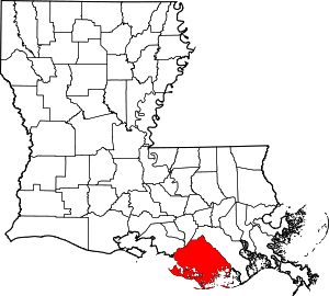
Location of Terrebonne Parish in Louisiana
This is intended to be a complete list of the properties and districts on the National Register of Historic Places in Terrebonne Parish, Louisiana, United States. The locations of National Register properties and districts for which the latitude and longitude coordinates are included below, may be seen in a map.[1]
There are 19 properties and districts listed on the National Register in the parish. Another property was once listed but has been removed.
- This National Park Service list is complete through NPS recent listings posted August 14, 2020.[2]
Current listings
| [3] | Name on the Register[4] | Image | Date listed[5] | Location | City or town | Description |
|---|---|---|---|---|---|---|
| 1 | Ardoyne Plantation House | 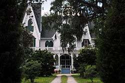 Ardoyne Plantation House |
November 1, 1982 (#82000469) |
Northwest of Houma on Louisiana Highway 311 29°38′57″N 90°49′10″W |
Houma | |
| 2 | Argyle | 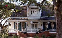 Argyle |
July 1, 1994 (#94000657) |
3313 Bayou Black Dr. 29°34′22″N 90°45′04″W |
Houma | |
| 3 | Armitage | 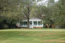 Armitage |
April 12, 1984 (#84001366) |
Louisiana Highway 20 and Colonial Dr. 29°45′51″N 90°48′59″W |
Schriever | |
| 4 | Herman Albert Cook House | 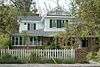 Herman Albert Cook House |
February 24, 1995 (#95000107) |
515 W. Main St. 29°35′49″N 90°43′44″W |
Houma | |
| 5 | Ducros Plantation | 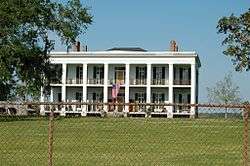 Ducros Plantation |
November 7, 1985 (#85002759) |
Louisiana Highway 20 29°45′13″N 90°49′05″W |
Schriever | |
| 6 | Fifth District High School | 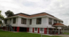 Fifth District High School |
June 18, 2018 (#100002590) |
918 Roussell St. 29°35′30″N 90°43′18″W |
Houma | |
| 7 | Gibson Methodist Episcopal Church | 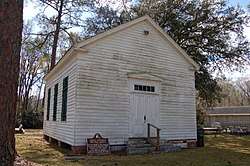 Gibson Methodist Episcopal Church |
May 8, 1986 (#86001032) |
S. Bayou Black Dr. 29°41′06″N 90°59′16″W |
Gibson | |
| 8 | Houma Elementary School | 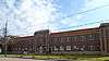 Houma Elementary School |
June 15, 2015 (#15000347) |
711 Grinage St. 29°35′33″N 90°43′26″W |
Houma | |
| 9 | Houma Historic District |  Houma Historic District |
December 8, 1983 (#83003640) |
Roughly bounded by E. Park Ave. and Main, Canal, Lafayette, Academy, High, Roussell, and Barrow Sts.; also 7717, 7719, 7725, 7801-09, 7815-17, 7819 W. Main, 407, 425, 507 Rousell, 7910, 7932, 7936, 7942 W. Park Ave. 30°29′49″N 90°42′06″W |
Houma | Second set of addresses represents a boundary adjustment, listed 2015-10-06. |
| 10 | Magnolia | August 4, 1983 (#83000548) |
Louisiana Highway 311 29°42′53″N 90°49′08″W |
Schriever | ||
| 11 | Montegut School | 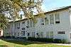 Montegut School |
October 7, 1993 (#93001036) |
1137 Louisiana Highway 55 29°28′39″N 90°33′20″W |
Montegut | |
| 12 | Orange Grove Plantation House | 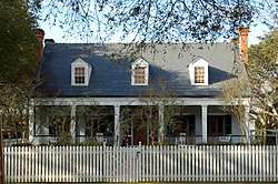 Orange Grove Plantation House |
March 26, 1980 (#80001764) |
West of Houma on U.S. Route 90 29°35′19″N 90°49′23″W |
Houma | Circa-1840 Greek Revival briquette-entre-poteaux architecture; operates as an inn today. See Orange Grove Plantation House. |
| 13 | Polmer Store | 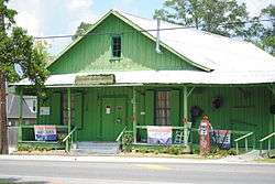 Polmer Store |
May 30, 1996 (#96000607) |
1849 Louisiana Highway 311 29°38′32″N 90°48′50″W |
Schriever | |
| 14 | S.S. R.M. Parker Jr. (shipwreck and remains) | December 7, 2018 (#100002561) |
Address Restricted |
Cocodrie vicinity | ||
| 15 | Residence Plantation House | 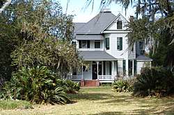 Residence Plantation House |
September 8, 2001 (#01000943) |
8951 Park Ave. 29°35′53″N 90°41′21″W |
Houma | |
| 16 | St. George Plantation House |  St. George Plantation House |
October 5, 1982 (#82000470) |
Louisiana Highway 24 29°44′20″N 90°48′28″W |
Schriever | |
| 17 | Clifford Percival Smith House | 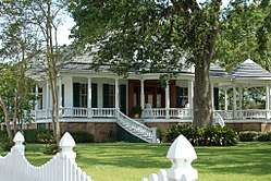 Clifford Percival Smith House |
April 20, 1989 (#89000327) |
501 E. Park Ave. 29°35′59″N 90°43′08″W |
Houma | |
| 18 | Southdown Plantation |  Southdown Plantation |
January 18, 1974 (#74002188) |
1 mile southwest of Houma on Louisiana Highway 311 29°35′17″N 90°43′52″W |
Houma | |
| 19 | Wesley House | 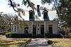 Wesley House |
August 11, 1982 (#82002799) |
1210 E. Main St. 29°35′53″N 90°42′34″W |
Houma |
Former listing
| [3] | Name on the Register | Image | Date listed | Date removed | Location | City or town | Summary |
|---|---|---|---|---|---|---|---|
| 1 | St. Matthew's Episcopal Church | 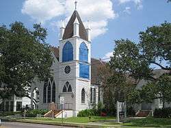 St. Matthew's Episcopal Church |
May 1, 1989 (#89000331) | March 31, 2015 | 243 Barrow St. 29°35′48″N 90°43′07″W |
Houma | St. Matthew's Church was destroyed by fire on November 11, 2010[6] |
See also
| Wikimedia Commons has media related to National Register of Historic Places in Terrebonne Parish, Louisiana. |
References
- The latitude and longitude information provided in this table was derived originally from the National Register Information System, which has been found to be fairly accurate for about 99% of listings. Some locations in this table may have been corrected to current GPS standards.
- "National Register of Historic Places: Weekly List Actions". National Park Service, United States Department of the Interior. Retrieved on August 14, 2020.
- Numbers represent an ordering by significant words. Various colorings, defined here, differentiate National Historic Landmarks and historic districts from other NRHP buildings, structures, sites or objects.
- "National Register Information System". National Register of Historic Places. National Park Service. March 13, 2009.
- The eight-digit number below each date is the number assigned to each location in the National Register Information System database, which can be viewed by clicking the number.
- http://www.houmatoday.com/article/20101111/ARTICLES/101119753
| Topics | |
|---|---|
| Lists by state |
|
| Lists by insular areas | |
| Lists by associated state | |
| Other areas | |
| Related | |
| |
Municipalities and communities of Terrebonne Parish, Louisiana, United States | ||
|---|---|---|
Parish seat: Houma | ||
| Cities | | |
| CDPs | ||
| Other unincorporated communities | ||
| Footnotes | ‡This populated place also has portions in an adjacent parish or parishes | |
This article is issued from Wikipedia. The text is licensed under Creative Commons - Attribution - Sharealike. Additional terms may apply for the media files.