Nangamangalam
Nangamangalam is a village in the Chittoor district of Andhra Pradesh in India.
Nangamangalam | |
|---|---|
village | |
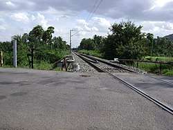 Intersection of NH4 and the railway line | |
.svg.png) Nangamangalam Location in Andhra Pradesh, India  Nangamangalam Nangamangalam (India) | |
| Coordinates: 13.3°N 79.10°E | |
| Country | |
| State | Andhra Pradesh |
| District | Chittoor |
| Elevation | 300 m (1,000 ft) |
| Population (2001) | |
| • Total | 2,661 |
| Languages | |
| • Official | Telugu |
| Time zone | UTC+5:30 (IST) |
| PIN | 517132 |
| Telephone code | 08572 |
| Vehicle registration | AP |
History
The village supposedly came up around 500 years back when a few people belonging to Reddy community from Guntur and Nellore came and settled here, which was then an area under the rule of Bomminayaka, who ruled Vellore.
Administration
The village comes under the Gudipala Mandal of Chittoor District and falls under the Chittoor assembly constituency and Chittoor parliamentary constituency.
Demographics
Telugu is official language of this village.
The table below shows the demographic details of Nangamangalam.[1]
| Description | Count |
|---|---|
| Households | 737 |
| Total Population | 2,661 |
| Male population | 1,275 |
| Female Population | 1,386 |
| Population under 6 years | 315 |
| Boys Under 6 Years | 158 |
| Girls Under 6 Years | 157 |
| Total Literates | 1,710 |
| Total Illiterates | 951 |
References
- "Population data for Nangamangalam". OurVillageIndia.org. 2007. Retrieved 19 February 2009.
External links
| Wikimedia Commons has media related to Nangamangalam. |
This article is issued from Wikipedia. The text is licensed under Creative Commons - Attribution - Sharealike. Additional terms may apply for the media files.