Naman, New South Wales
Naman, New South Wales is a bounded rural locality of Coonamble Shire and a civil parish of Gowen County, New South Wales.[1][2]
| Naman, New South Wales New South Wales | |
|---|---|
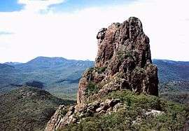 Crater Bluff, Naman Parish | |
Naman, New South Wales | |
| Coordinates | 31°26′20″S 148°54′40″E |
| Postcode(s) | 2817 |
| Location | |
| LGA(s) | Cooonamble Shire |
| State electorate(s) | Barwon |
| Federal Division(s) | Parkes |
The Parish is on the Tunderbrine Creek a tributary of the Castlereagh River and the nearest settlement of the parish is Tooraweenah, New South Wales to the south.[3]
The parish is on the traditional lands of the Weilwan Aboriginal people.
References
- Robert McLean, The New atlas of Australia : the complete work containing over one hundred maps and full descriptive geography of New South Wales, Victoria, Queensland, South Australia and Western Australia, together with numerous illustrations and copious indices (Sydney :J. Sands, [1886) Map 1.
- Map of Gowan County, New South Wales.
- Robert McLean, The New atlas of Australia : the complete work containing over one hundred maps and full descriptive geography of New South Wales, Victoria, Queensland, South Australia and Western Australia, together with numerous illustrations and copious indices (Sydney :J. Sands, [1886) Map 14.
This article is issued from Wikipedia. The text is licensed under Creative Commons - Attribution - Sharealike. Additional terms may apply for the media files.