Mount Murphy
Mount Murphy is a massive, snow-covered and highly eroded shield volcano with steep, rocky slopes. It is directly south of Bear Peninsula, Marie Byrd Land, Antarctica. The mountain is bounded by the Smith, Pope and Haynes Glaciers.
| Mount Murphy | |
|---|---|
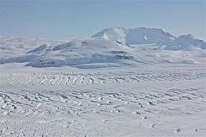 Aerial view of Mt. Murphy | |
| Highest point | |
| Elevation | 2,705 m (8,875 ft) [1] |
| Prominence | 2,055 m (6,742 ft) [1] |
| Listing | Ultra |
| Coordinates | 75°20′S 110°44′W [1] |
| Geography | |
 Mount Murphy Antarctica | |
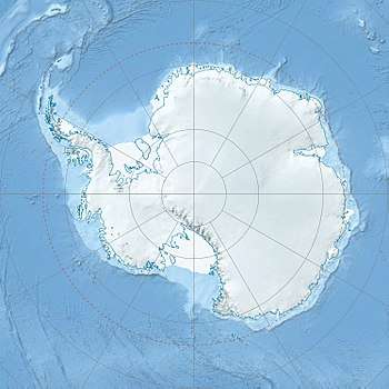
| Location | Marie Byrd Land, Antarctica |
| Geology | |
| Age of rock | Unknown |
| Mountain type | Shield volcano |
| Volcanic field | Marie Byrd Land Volcanic Province |
| Last eruption | Pleistocene[2] |
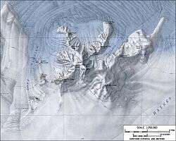
Delineated from aerial photographs taken by US Navy Operation Highjump in January 1947. Named by US-ACAN for Robert Cushman Murphy of the American Museum of Natural History, noted authority on Antarctic and sub-Antarctic bird life. While serving on the whaler, he charted the Bay of Isles region of South Georgia.
Features
Bucher Peak (75°20′S 110°52′W) at 2,445 metres (8,020 ft), is one of the highest peaks in the west-central summit area of the Mount Murphy massif. Buettner Peak is a sharp peak rising midway along the north wall of Roos Glacier in the northwest part of the Mount Murphy massif
References
- "Antarctica Ultra-Prominences" Peaklist.org. Retrieved 2012-09-07.
- "Murphy". Global Volcanism Program. Smithsonian Institution. Retrieved 2016-04-27.
Sources
- LeMasurier, W. E.; Thomson, J. W., eds. (1990). Volcanoes of the Antarctic Plate and Southern Oceans. American Geophysical Union. ISBN 0-87590-172-7.
- "Skiing the Pacific Ring of Fire and Beyond". Amar Andalkar's Ski Mountaineering and Climbing Site. 2007 [1997]. Retrieved 2005-01-14.