Mount Moriah (Nevada)
Mount Moriah is a 12,072-foot (3,680 m) mountain in the northern Snake Range of eastern White Pine County, Nevada, United States. It is the fifth-highest mountain in the state,[3] and also ranks as the ninth-most topographically prominent peak in the state.[5] It is located in the Mount Moriah Wilderness administered by the Humboldt-Toiyabe National Forest.
| Mount Moriah | |
|---|---|
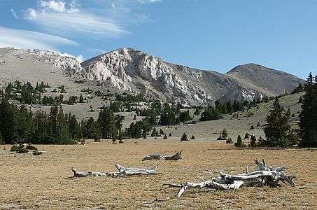 Mount Moriah, looking southwest from 'The Table,' in the Snake Range. | |
| Highest point | |
| Elevation | 12,072 ft (3,680 m) NAVD 88[1] |
| Prominence | 4,907 ft (1,496 m) [2] |
| Listing | |
| Coordinates | 39°16′23″N 114°11′56″W [1] |
| Geography | |
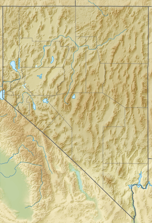 Mount Moriah Location in Nevada | |
| Location | White Pine County, Nevada, U.S. |
| Parent range | Snake Range |
| Topo map | USGS Mount Moriah |
Geography
Mount Moriah rises over 6,000 feet (1,800 m) vertical feet above the Snake Valley on its east flank, and the Spring Valley to its west.[6] The summit is the highest point in the Humboldt-Toiyabe National Forest.[2]
Immediately to the north is a large flat sub-alpine area called The Table,[7] which supports an ancient stand of Great Basin Bristlecone Pine (Pinus longaeva).[6]
The mountain is about 37 miles (60 km) east of Ely, the nearest town. U.S. Route 6 and U.S. Route 50 traverse the Sacramento Pass nearby, which divides the northern and southern sections of the Snake Range. To the south of the pass are Great Basin National Park and Wheeler Peak.
References
- "Mt Moriah". NGS data sheet. U.S. National Geodetic Survey. Retrieved 2011-05-19.
- "Mount Moriah, Nevada". Peakbagger.com. Retrieved 2011-05-19.
- "Nevada 11,000-foot Peaks". Peakbagger.com. Retrieved 2011-05-19.
- "Western States Climbers List". Climber.org. Retrieved 2016-04-07.
- "Nevada Peaks with 2000 feet of Prominence". Peakbagger.com. Retrieved 2014-10-23.
- "Ely-Wilderness-Mount Moriah". United States Forest Service. Retrieved 2014-01-28.
- "The Table" (map). Gmap4. Retrieved 2011-05-19.
External links
- "Mount Moriah (NV)". SummitPost.org. Retrieved 2008-04-04.
