Mount Kerinci
Mount Kerinci (also spelled Kerintji, among several other ways, and referred to as Gunung Kerinci, Gadang, Berapi Kurinci, Kerinchi, Korinci/Korintji, or Peak of Indrapura/Indrapoera) is a volcano in Sumatra island of Indonesia. It is surrounded by the lush forest of Kerinci Seblat National Park, home to the endangered species of Sumatran tiger and Sumatran rhinoceros.
| Mount Kerinci | |
|---|---|
| Gunung Kerinci ڬونوڠ كرينچي | |
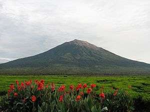 Kerinci as seen from Kayu Aro | |
| Highest point | |
| Elevation | 3,805 m (12,484 ft) |
| Prominence | 3,805 m (12,484 ft) Ranked 33rd |
| Isolation | 1,905 km (1,184 mi) |
| Listing | Island high point Ultra Ribu |
| Coordinates | 1°41′48″S 101°15′56″E |
| Geography | |
| Parent range | Barisan Mountains |
| Geology | |
| Mountain type | Stratovolcano |
| Volcanic arc/belt | Pacific Ring of Fire |
| Last eruption | 2020 |
| Climbing | |
| First ascent | December 1877 by Arend Ludolf van Hasselt and Daniël David Veth |
Geography
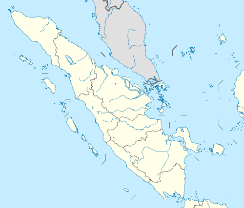
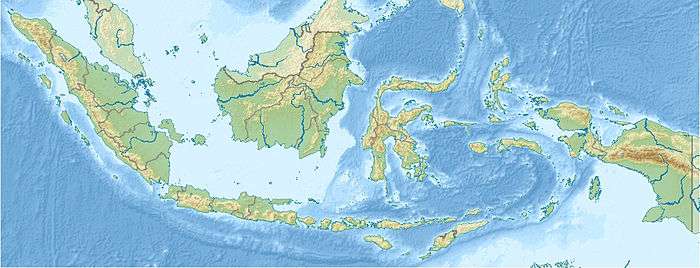
At 3,805 metres (12,484 ft) above sea level, Kerinci is the highest volcano in Indonesia. Kerinci is located in the border of the titular Kerinci Regency of Jambi province and South Solok Regency of West Sumatra province, in the west central part of the island near the west coast, and is about 130 km (81 mi) south of Padang. It is part of the Barisan Mountains, a chain of volcanoes that span from the extreme northwest of the island (in Aceh province) all the way to the extreme southeast (in Lampung province). It is the most prominent feature of the terrain of Kerinci Seblat National Park, with pine-forested slopes rising 2,400–3,300 metres (7,900–10,800 ft) above the surrounding basin, and a cone 13 km (8 mi) wide and 25 km (16 mi) long at the base, elongated in the north-south direction. At the summit there is a deep 600 m (1,969 ft) wide crater, often partially filled by a small crater lake on the northeast side of the crater floor.

Volcanic activity
Kerinci is more active than most Indonesian volcanoes, with nearly annual phreatic eruptions. In 2004, Kerinci erupted and continues to spew clouds of sulphurous smoke, with plumes reaching as high as 1,000 m (3,281 ft) above the summit. In 2009, Kerinci erupted again and followed by June 2, 2013 eruption with 600 m (1,969 ft) spewed black smoke.[1] There is farmland in the area, and a tea plantation on its southern slope, Kerinci, being located in an Indonesian national park, and perhaps out of respect for its frequent growlings as well, sits in an area that is sparsely populated by Indonesian population-density standards.
Climbing
Kerinci can be climbed from the village of Kersik Tuo, 6 or 7 hours away from Padang by car or bus. The climb and descent normally takes 2 days and 1 night, when choosing to go all the way to the summit. Climbers may also choose to go up only as far as Camp 2 or 3, skipping the summit attempt, which requires a pre-dawn climb. Kerinci's terrain consists of thick jungle, and can get muddy and slippery even if there are only mild drizzles, which may occur occasionally even during the dry season. To climb the volcano a guide is needed, as there have been rare cases of people disappearing after attempting to trek alone.
Lakes
The Kerinci Seblat National Park has at least fifteen lakes of note, with the biggest being Kerinci Lake, followed by Gunung Tujuh Lake. The 4,200-hectares of Kerinci Lake lies at a height of 650 metres (2,130 ft), and is the host of the annual Kerinci Lake Festival. Gunung Tujuh Lake (literally, Seven Mountains Lake) is a caldera lake formed in an extinct volcano, and is surrounded by seven peaks. It is also the highest lake in Southeast Asia at 1,996 metres (6,549 ft).[2]
Kecik Wok Gedang Wok
Based on research in 1973, the 'Kecik Wok Gedang Wok' people are recognized as the first tribe to settle at a plateau around Mount Kerinci 10,000 years ago. Today, the Kecik Wong Gedang Wok people are limited due to assimilation with the Proto-Malay tribes which came later. There are around 135 dialects used only along the valley. This makes ethnographic analysis difficult to conduct.[3]
References
- "Mt. Kerinci erupts". June 2, 2013.
- "Exploring Kerinci". October 30, 2011.
- "Archived copy". Archived from the original on 2011-05-25. Retrieved 2011-05-23.CS1 maint: archived copy as title (link)