Monte Troodelöh
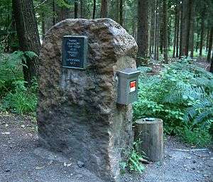
Monte Troodelöh is the highest point in the municipal area of the city of Cologne. It lies in the Rath/Heumar district, approximately 1,250 metres south of the A4 at Wolfsweg between the intersection of Pionier-Hütten-Weg and the Brück-Forsbacher Weg.
Overview
It lies on rising ground in the middle of Königsforst at a height of 118 metres above sea level. Above the Wolfsweg there is a prominence that is 130 metres higher, but it lies outside of the boundaries of Cologne and is officially a part of Bergisch Gladbach.
As recently as 1999, Monte Troodelöh was largely unknown. Today it is a destination on many suggested hiking routes and is considered a tourist attraction, in spite of the fact that the spot offers neither an attractive view nor any rest stops or amenities.[1][2]
References
- de:Monte Troodelöh
- Buttkereit, Rainer. "Monte Troodelöh". Retrieved 17 January 2013.