Matialihat
Matialihat (also known as Matelli) is a census town in the Matiali CD block in the Malbazar subdivision of the Jalpaiguri district in the state of West Bengal, India.
Matialihat | |
|---|---|
Census Town | |
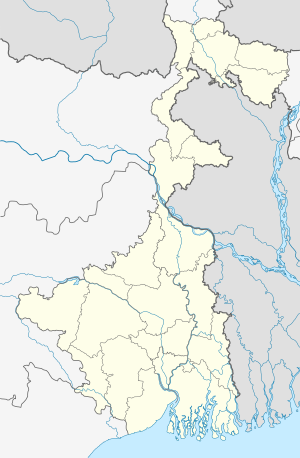 Matialihat Location in West Bengal, India  Matialihat Matialihat (India) | |
| Coordinates: 26.947159°N 88.812305°E | |
| Country | |
| State | West Bengal |
| District | Jalpaiguri |
| Area | |
| • Total | 0.3118 km2 (0.1204 sq mi) |
| Population (2011) | |
| • Total | 4,215 |
| • Density | 14,000/km2 (35,000/sq mi) |
| Time zone | UTC+5:30 (IST) |
| PIN | 735223 |
| Telephone/STD code | 03562 |
| Vehicle registration | WB |
| Lok Sabha constituency | Alipurduars |
| Vidhan Sabha constituency | Nagrakata |
| Website | jalpaiguri |
Geography
 |
| Places and tea estates in Malbabazar subdivision (including Mal, Nagrakata and Matiali CD blocks) in Jalpaiguri district CT: census town, R: rural/ urban centre, N: neighbourhood, NP: national park/ wildlife sanctuary, TE: tea estate Abbreviations used in names – TG for Tea Garden (town/village), TE for Tea Estate, JRS: junction railway station Owing to space constraints in the small map, the actual locations in a larger map may vary slightly |
Location
Matialihat is located at 26.947159°N 88.812395°E.
Area overview
Gorumara National Park has overtaken traditionally popular Jaldapara National Park in footfall and Malbazar has emerged as one of the most important towns in the Dooars. Malbazar subdivision is presented in the map alongside.[1][2]It is a predominantly rural area with 88.62% of the population living in rural areas and 11.32% living in the urban areas.[3][4]Tea gardens in the Dooars and Terai regions produce 226 million kg or over a quarter of India's total tea crop. [5][6] Some tea gardens were identified in the 2011 census as census towns or villages. [7]Such places are marked in the map as CT (census town) or R (rural/ urban centre). Specific tea estate pages are marked TE.
Note: The map alongside presents some of the notable locations in the subdivision. All places marked in the map are linked in the larger full screen map.
Demographics
As per the 2011 Census of India, Matialihat had a total population of 4,215. There were 2,200 (52%) males and 2,015 (48%) females. There were 398 persons in the age range of 0 to 6 years. The total number of literate people in Matialihat was 3,253 (85.22% of the population over 6 years).[8]
Infrastructure
According to the District Census Handbook 2011, Jalpaiguri, Matialihat covered an area of 0.3118 km2. Among the civic amenities, it had 20 km roads with open drains, the protected water supply involved overhead tank, tap water from treated sources, hand pumps. It had 766 domestic electric connections, 125 road lighting points. Among the medical facilities it had 1 dispensary/ health centre, 5 medicine shops. Among the educational facilities it had 5 primary schools, 1 middle school, 1 secondary school, the nearest senior secondary school at Chaloa 8 km away. Among the social, cultural and recreational facilities, it had 1 public library, 1 reading room. An important commodity it produced was tea. It had branches of 1 cooperative bank, 2 non-agricultral credit societies.[9]
Schools
There are two higher secondary schools and one junior girls school:
- Matelli High School (Bengali medium higher secondary school)
- Rastrabhasha High School (Hindi medium higher secondary school)
- Junior Girls School
There are two primary schools:
- Matelli Special Board Free Primary School
- Aamtala Free Primary School
There are 4 medical shops well known:
- Parul Medical Owner:Nirmalendu Pyne
- Dutta Medical Owner:Subir Dutta
- Maa Kali Pharmacy :Dinu
Surroundings
Matelli Bazar is surrounded by many TeaGardens and is the main center for the people/workers of those gardens, people from those gardens majorly come to the Bazaar on its popular Sunday market for the purchase of their daily needs. However, some people come daily as well.
Culture, festivals and celebrations
Since the major population of Matelli and its surroundings are Hindu though people from all the religion lives here with love and peace, It has never been heard about any type of clash between any communities. People from all the religion celebrates their festivals with lots of love and joy.
The place has been popular for its picnic spot, and during the new year, some Melas are set up during the Durga Puja which is a major festival of West Bengal. Nagaisuree TG Mela, Ingdong TG Mela – people of the TG celebrate these mela as their cultural part wearing the traditional dresses and dancing around. People from all the communities visit the Mela.
References
- "Malbazar". North Bengal Tourism. Retrieved 13 July 2020.
- "Dooars Tour". North Bengal Tourism. Retrieved 13 July 2020.
- "Jalpaiguri". District Profile. District administration. Retrieved 13 July 2020.
- "District Statistical Handbook 2014 Jalpaiguri". Tables 2.2, 2.4b,. Department of Planning and Statistics, Government of West Bengal. Retrieved 13 July 2020.CS1 maint: extra punctuation (link)
- "Tea Growing Regions". Dooars and Terai. Indian Tea Association. Retrieved 13 July 2020.
- "Dooars-Terai". Tea Board India. Retrieved 13 July 2020.
- "2011 Census – Primary Census Abstract Data Tables". West Bengal – District-wise. Registrar General and Census Commissioner, India. Retrieved 13 July 2020.
- "C.D. Block Wise Primary Census Abstract Data(PCA)". West Bengal – District-wise CD Blocks. Registrar General and Census Commissioner, India. Retrieved 4 July 2020.
- "District Census Handbook Darjiling, Census of India 2011, Series 20, Part XII A" (PDF). Section II Town Directory, Pages 451-453: Statement I: Status and Growth History, Pages 454-455: Statement II: Physical Aspects and Location of Towns, Pages 456-457: Statement III: Civic and other Amenities, Pages 458-459: Statement IV: Medical Facilities 2009, Pages 460—463: Statement V: Educational, Recreational and Cultural Facilities, Pages 464: Statement VI:Industry and Banking. Directorate of Census Operations V, West Bengal. Retrieved 26 June 2020.
Cities, towns and locations in Jalpaiguri district | |||||
|---|---|---|---|---|---|
| Cities, municipal and census towns |
| ||||
| Locations other than cities and towns |
| ||||
| Specific Tea Estates | |||||
| Related Topics |
| ||||