Massachusetts Route 10
Massachusetts Route 10 is a 60.69-mile-long (97.67 km) north–south state highway that runs from the state line at Southwick to the state line at Northfield.
| ||||
|---|---|---|---|---|

Route 10 highlighted in red | ||||
| Route information | ||||
| Maintained by MassDOT | ||||
| Length | 60.69 mi[1] (97.67 km) | |||
| Existed | 1922–present | |||
| Major junctions | ||||
| South end | ||||
| North end | ||||
| Location | ||||
| Counties | Hampden, Hampshire, Franklin | |||
| Highway system | ||||
| ||||

Route description
Route 10 crosses the border from Granby, Connecticut into Southwick, Massachusetts, overlapped with U.S. 202. It runs north through the Pioneer Valley towns of Southwick, Westfield, Southampton, Easthampton, Northampton, Hatfield, Whately, Deerfield, Greenfield, Bernardston, Gill, and Northfield. Route 10 has a long concurrency with U.S. 5 for about 25 miles (40 km) from Northampton to Bernardston, where it was sometimes called the "5 & 10 Highway". During this concurrency, it closely parallels Interstate 91, with five exits from Northampton to Deerfield, with close access at Route 2 in Greenfield and another exit, solely for Route 10, in Bernardston. It crosses the Connecticut River in Northfield before entering New Hampshire.
Route 10 is concurrent with seven other routes (US 5, US 20, US 202, and Massachusetts Routes 57, 9, 116, and 63) for 43 miles (69.20 km) of its nearly 61 miles (98.17 km) in the state with three points of triple concurrency, leaving less than a third of its length as the sole road designation.
History
An odd sight greeted motorists in Easthampton in July 2005: standard issue Alabama state highway signs with the number 10 in a map of that state, instead of the standard Massachusetts square. This odd "Alabama 10" signage came about when a contractor mistakenly applied the sample from a federal manual. The signs have since been replaced with the correct shields.[2][3]
Major intersections
| County | Location | mi | km | Destinations | Notes |
|---|---|---|---|---|---|
| Hampden | Southwick | 0.0 | 0.0 | Continuation into Connecticut; Southern terminus of concurrency with US 202 | |
| 1.9 | 3.1 | Western terminus of Route 168 | |||
| 4.3 | 6.9 | Southern terminus of concurrency with Route 57 | |||
| 4.9 | 7.9 | Northern terminus of concurrency with Route 57 | |||
| Westfield | 9.6 | 15.4 | Southern terminus of concurrency with US 20 | ||
| 9.9 | 15.9 | Northern terminus of concurrency with US 20 | |||
| 11.3 | 18.2 | Exit 41 on I-90 / Massachusetts Turnpike (formerly exit 3) | |||
| 14.3 | 23.0 | Northern terminus of concurrency with US 202 | |||
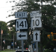
| Hampshire | Easthampton | 21.8 | 35.1 | Western terminus of Route 141 | |
| Northampton | 26.1 | 42.0 | Southern terminus of concurrency with Route 9 | ||
| 26.4 | 42.5 | Northern terminus of concurrency with Route 9; southern terminus of concurrency with US 5 | |||
| 27.8 | 44.7 | Exit 26 on I-91 (formerly exit 20); northbound exit and southbound entrance | |||
| 29.6 | 47.6 | Exit 27 on I-91 (formerly exit 21); northbound access via Elm Street | |||
| Hatfield | 32.0 | 51.5 | Exit 30 on I-91 (formerly exit 22) | ||
| 32.3 | 52.0 | Exit 30 on I-91 (formerly exit 22) | |||
| Franklin | Whately | 34.0 | 54.7 | Exit 32 on I-91 (formerly exit 23); northbound entrance | |
| 34.7 | 55.8 | Exit 32 on I-91 (formerly exit 23); entrance from I-91 south | |||
| 37.1 | 59.7 | Exit 35 on I-91 (formerly exit 24); no exit from southbound | |||
| 37.4 | 60.2 | Southern terminus of concurrency with Route 116 | |||
| Deerfield | 38.3 | 61.6 | Northern terminus of concurrency with Route 116 | ||
| Deerfield River | 44.6 | 71.8 | Deerfield River Bridge | ||
| Greenfield | 46.0 | 74.0 | Court Square, site of historic road marker | ||
| 47.7 | 76.8 | Interchange | |||
| Bernardston | 52.5 | 84.5 | Northern terminus of concurrency with US 5 | ||
| 52.9 | 85.1 | Exit 50 on I-91 (formerly exit 28) | |||
| Gill | 55.5 | 89.3 | Southern terminus of Route 142 | ||
| Connecticut River | 56.8 | 91.4 | Bennett's Meadow Bridge | ||
| Northfield | 57.5 | 92.5 | Southern terminus of concurrency with Route 63 | ||
| 59.9 | 96.4 | Northern terminus of concurrency with Route 63 | |||
| 60.7 | 97.7 | Continuation into New Hampshire | |||
| 1.000 mi = 1.609 km; 1.000 km = 0.621 mi | |||||
See also
- New England Interstate Route 10
References
- Executive Office of Transportation, Office of Transportation Planning - 2005 Road Inventory
- Daniel, Mac (July 26, 2005). "Word to road crews: Tuscaloosa is over 1,000 miles thataway". The Boston Globe. Retrieved 2009-12-31.
- "Alabama road signs in Massachusetts?". WSFA-TV. Retrieved 2009-12-31.