Mahtotopa Mountain
Mahtotopa Mountain (8,677 feet (2,645 m)) is located in the Lewis Range, Glacier National Park in the U.S. state of Montana.[3] Mahtotopa Mountain rises to the south above Saint Mary Lake midway between Red Eagle Mountain and Little Chief Mountain and can be easily seen from the Going-to-the-Sun Road to the southwest of Rising Sun. Originally named Four Bears Mountain by George Bird Grinnell in 1885, the name was changed in 1932 to Mahtotopa. Mahtotopa is an incorrect spelling of "Mato-tope", the Mandan chief known as Four Bears. Mato-tope was a grandfather of Joe Kipp, a hunting companion of Grinnell.
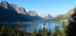
Saint Mary Lake with Mahtotpa Mountain at far left
| Mahtotopa Mountain | |
|---|---|
 Mahtotopa Mountain under the cloud with Little Chief Mountain in background | |
| Highest point | |
| Elevation | 8,677 ft (2,645 m) [1] |
| Prominence | 417 ft (127 m) [1] |
| Coordinates | 48°39′06″N 113°34′09″W [2] |
| Geography | |
 Mahtotopa Mountain Location in Montana  Mahtotopa Mountain Location in the United States | |
| Location | Glacier County, Montana, U.S. |
| Parent range | Lewis Range |
| Topo map | USGS Rising Sun, MT |
References
- "Mahtotopa Mountain, Montana". Peakbagger.com. Retrieved July 28, 2017.
- "Mahtotopa Mountain". Geographic Names Information System. United States Geological Survey. Retrieved July 28, 2017.
- Rising Sun, MT (Map). TopoQwest (United States Geological Survey Maps). Retrieved July 28, 2017.
This article is issued from Wikipedia. The text is licensed under Creative Commons - Attribution - Sharealike. Additional terms may apply for the media files.