Llanddona fish weir
Llanddona fish weir (also known as Welsh: Gorad Llanddona or Welsh: Gorad Fona) is a post medieval fish trap sited in Llanddona, on the Isle of Anglesey. The fish weir is a scheduled monument.
| Llanddona fish weir | |
|---|---|
| Gorad Llanddona | |
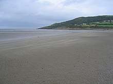 Red Wharf Bay with fish weir in the distance | |
| Type | fish weir |
| Location | Anglesey, Wales |
| Coordinates | 53.308°N 4.144°W |
| OS grid reference | SH 5725 8116 |
| Community | Llanddona |
| Principal area | Anglesey |
| Official name: Llanddona Fish Weir | |
| Designated | 31 October 2002 |
| Reference no. | AN137 |
 Location in Anglesey | |
Location
Llanddona fish weir is at the far eastern end of the beach at Red Wharf Bay where a band of rocks turns to sand, and is near the estuary of the brook that passes near St Dona's church.[1][2][3] The fish weir lies at the edge of the Penmon Historic Landscape Area.[4]
Description
Llanddona fish weir is a V-shaped trap, typically used when trapping fish in tidal waters.[5][6] The two arms of the V run down the beach, starting below the high-water line and almost meet at the tip of the V just above the low-water line, where the fish are caught in a net or a trap when the tide recedes.[7] The sides of the V-shaped trap can be made of stone, wattle fencing, or both.[7]
At Llanddona the sea is north of the beach, so the western arm, about 300m long, points north-east, and the eastern arm, about 100m long, starts at the edge of the beach and points north-west.[3][2]
History
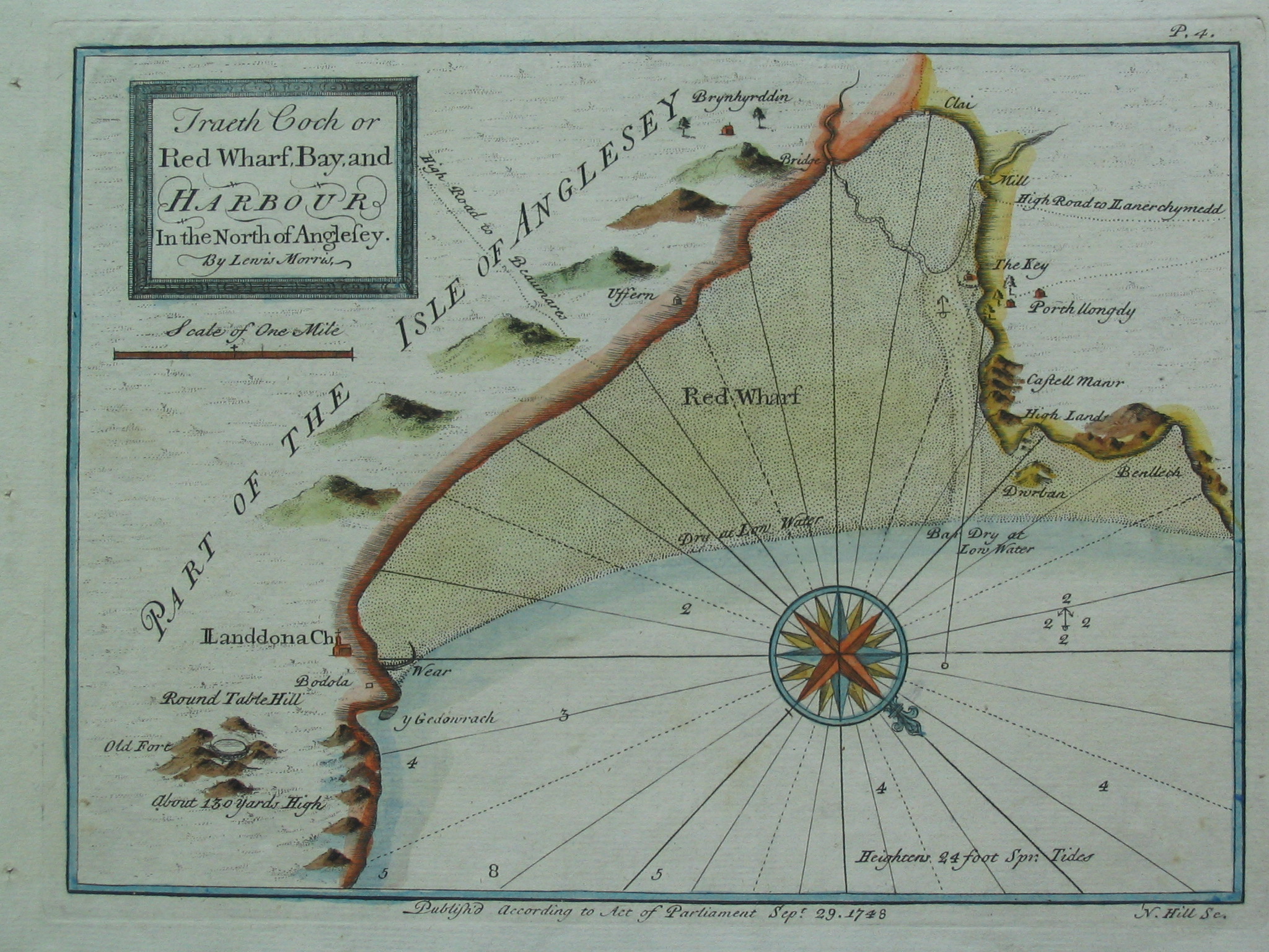
Llanddona fish weir is first mentioned in the 17th century in the records of the Baron Hill estate and is also shown on a chart of 1748 by Lewis Morris, a hydrographer, surveyor and author from Anglesey.[6][1][8]
Near the weir there are two buildings named as Godreddi Bach and Godreddi Mawr. The names seem to be a corruption of Goreddi (the plural of gored, meaning weir).[9] This possibly associates the buildings with the weir, and that there may have been more than one weir.[9] Additionally, a double line of stones has been identified on an aerial photograph which may be part of the original construction or part of later rebuilding.[1]
Recent history
Llanddona fish weir was designated as a scheduled monument in 2002 as being of national importance to improve understanding of medieval or post-medieval maritime agricultural practices and possibly containing archaeological information concerning chronology and building techniques.[6]
Access
Llanddona fish weir, like most of the beach at Red Wharf Bay, is covered by the sea at high tide, and even at low tide the apex of the weir is still underwater.[3] The Llanddona circular walk passes near the site of the weir.[10]
References
- Llanddona (Report). Gwynedd Archaeological Trust (GAT). GAT PRN 33476. Archived from the original on 24 September 2015. Retrieved 29 July 2016.
- Anglesey Sheet XIV.NE (Map) (1st ed.). 1:10560. Ordnance Survey. 1888. Retrieved 29 July 2016 – via National Library of Scotland.
- "Llanddona Fish Trap". National Monuments Record of Wales (NMRW). Royal Commission on the Ancient and Historical Monuments of Wales (RCAHMW). May 2012. NPRN 406349. Retrieved 29 July 2016 – via coflein (online database of the NMRW).
- "Penmon Historic Landscapes". Gwynedd Archaeological Trust (GAT). 2010. Archived from the original on 5 August 2016. Retrieved 29 July 2016.
- "Fish Trap, Llandona". Historic Environment Record (HER). Gwynedd Archaeological Trust (GAT). GAT PRN 7204. Retrieved 29 July 2016 – via archwilio (online database of the four Welsh Archaeological Trusts).
- Llanddona Fish Weir. National Monuments Record of Wales (NMRW) (Report). Cadw. 31 October 2002 [Scheduled 2002]. Cadw Id: AN137.
- Bannerman, N. V. Campbell (2011). Flood, Folklore and Fish Weirs (PDF) (Report). p. 3. Retrieved 30 July 2016.
- Wiliam, Dafydd Wyn. "Morris, Lewis". Oxford Dictionary of National Biography (online ed.). Oxford University Press. doi:10.1093/ref:odnb/19313. (Subscription or UK public library membership required.)
- Vousden, Nikola (2014). The Archaeological and Historical Significance of Intertidal Fish Traps at Llanon, Cardigan Bay (Report). Lampeter: University of Wales Trinity Saint David. pp. 32–33. CiteSeerX 10.1.1.655.3206.
- "Circular walk – Llanddona" (PDF). www.visitanglesey.co.uk. Isle of Anglesey County Council. Retrieved 1 August 2016.
External links
- Llanddona Fish Weir – on Ancient Monuments website
- Lewis Morris's Map of Red Wharf Bay, 1748 – from a collection at Liverpool University