Little River (Delaware)
The Little River (also called Little Creek) is a river, approximately 8 mi (13 km)[3] long, in central Delaware in the United States.
| Little River Tributary to Delaware Bay | |
|---|---|
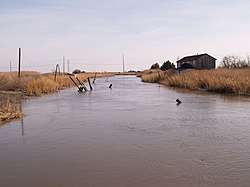 Little Creek looking downstream (east) from DE 9 bridge in 2008 | |
  | |
| Location | |
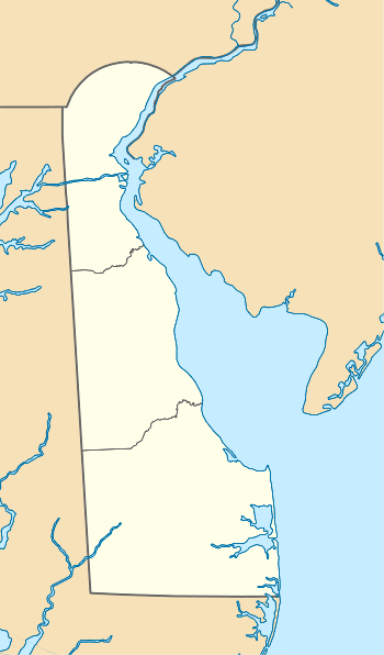
| Country | United States |
| State | Delaware |
| County | Kent |
| City | Little Creek, Delaware |
| Physical characteristics | |
| Source | On the watershed divide between Little Creek and St. Jones River |
| • location | Dover, Delaware |
| • coordinates | 39°11′37″N 075°31′36″W[1] |
| • elevation | 30 ft (9.1 m)[2] |
| Mouth | Delaware Bay |
• location | about 2 miles east of Little Creek, Delaware |
• coordinates | 39°09′36″N 075°24′28″W[1] |
• elevation | 0 ft (0 m)[2] |
| Length | 8.34 mi (13.42 km)[3] |
| Basin size | 13.93 square miles (36.1 km2)[4] |
| Discharge | |
| • location | Delaware Bay |
| • average | 16.62 cu ft/s (0.471 m3/s) at mouth with Delaware Bay[4] |
| Basin features | |
| Progression | northeast |
| River system | Delaware Bay |
| Tributaries | |
| • left | unnamed tributaries |
| • right | Morgan Branch Elm Branch |
| Bridges | white Oak Road DE 8 DE 9 |
It rises in central Kent County, approximately 1 mi (1.6 km) northwest of Dover and flows generally east, entering Delaware Bay approximately 6 mi (10 km) west Dover. The lower 2 mi (3.2 km) of the river is surrounded by extensive wetlands protected as part of the Little Creek Wildlife Area.
See also
- List of Delaware rivers
Dover (capital) | ||
| Topics |
|  |
| Society |
| |
| Cities | ||
| Towns |
| |
| Counties | ||
References
- "GNIS Detail - Little River". geonames.usgs.gov. US Geological Survey. Retrieved 31 July 2019.
- "Little Creek Wildlife Area Topo Map, Kent County DE (Little Creek Area)". TopoZone. Locality, LLC. Retrieved 31 July 2019.
- "ArcGIS Web Application". epa.maps.arcgis.com. US EPA. Retrieved 31 July 2019.
- "Little River Watershed Report". Waters Geoviewer. US EPA. Retrieved 31 July 2019.
This article is issued from Wikipedia. The text is licensed under Creative Commons - Attribution - Sharealike. Additional terms may apply for the media files.