List of listed buildings in Edinburgh/2
List
| Name | Location | Date Listed | Grid Ref. [note 1] | Geo-coordinates | Notes | LB Number [note 2] | Image |
|---|---|---|---|---|---|---|---|
| Dean Bank Terrace 2, 3, 4, Saxe-Coburg Terrace | 55°57′36″N 3°12′26″W | Category B | 30097 |  | |||
| 71 George Street And 36 And 38 Frederick Street | 55°57′12″N 3°12′03″W | Category A | 30102 | | |||
| 89 George Street | 55°57′10″N 3°12′08″W | Category B | 30103 | | |||
| 179 High Street And 73 Cockburn Street | 55°57′01″N 3°11′17″W | Category B | 30117 | 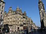 | |||
| Hope Park Crescent 6-11 | 55°56′27″N 3°10′57″W | Category B | 30118 | 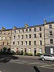 | |||
| Hope Park Terrace 1-5 | 55°56′27″N 3°10′57″W | Category B | 30119 | 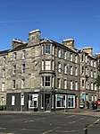 | |||
| 118 And 120 Lauriston Place, Including Boundary Wall And Railings | 55°56′41″N 3°12′04″W | Category B | 30126 | | |||
| 63-67 (Odd Nos) York Place, Including Railings | 55°57′23″N 3°11′17″W | Category A | 29973 | | |||
| 2-4A (Even Nos) York Place, And 3-9 (Odd Nos) Dublin Street | 55°57′22″N 3°11′34″W | Category A | 29975 | | |||
| 22 York Place, Including Railing And Lamp | 55°57′23″N 3°11′28″W | Category A | 29984 | | |||
| 36 York Place, Including Railings | 55°57′24″N 3°11′24″W | Category A | 29991 | | |||
| 40, 42 York Place, Including Railings And Boundary Wall | 55°57′24″N 3°11′23″W | Category A | 29993 | | |||
| 24 York Road, Gothic House, With Boundary Wall And Gatepiers | 55°58′41″N 3°12′10″W | Category A | 29998 | | |||
| 7 Young Street | 55°57′11″N 3°12′18″W | Category A | 30000 | | |||
| 10 And 12 Young Street, Sovereign House | 55°57′10″N 3°12′18″W | Category C(S) | 30006 | | |||
| 14 Young Street | 55°57′10″N 3°12′21″W | Category A | 30007 | | |||
| Princes Street, General Register House Circular Record Hall ('Back Dome') | 55°57′15″N 3°11′22″W | Category B | 30025 |  | |||
| Fettes College South Gates And Railings To Carrington Road) And On Fettes Avenue As Far As East Lodge. East Lodge And Gates Fettes Avenue. West Lodge And Gates. Glencorse House. Moredun House | 55°57′52″N 3°13′22″W | Category B | 30044 | | |||
| 6 East Suffolk Road (Lodge) And 1-13 (Inclusive Numbers) And 20-22 (Inclusive Numbers) East Suffolk Park, Gatepiers, Boundary Walls And Railings | 55°55′47″N 3°10′05″W | Category B | 30050 | | |||
| 110 And 112 West Bow (Including Edmonstone's Close) | 55°56′53″N 3°11′39″W | Category B | 29910 | | |||
| Whitehill Street 24-30 Newcraighall | 55°56′08″N 3°05′21″W | Category C(S) | 29914 | | |||
| 44 Whitehouse Road, Almond Bank House, Including Boundary Wall | 55°58′29″N 3°18′09″W | Category C(S) | 29928 | | |||
| 33-51 (Odd Numbers) William Street | 55°56′55″N 3°12′51″W | Category B | 29930 | | |||
| 6-26 (Even Numbers) William Street | 55°56′58″N 3°12′44″W | Category B | 29931 | | |||
| 28, 30, 32, 24, 36, 38 William Street | 55°56′55″N 3°12′50″W | Category B | 29932 | | |||
| 5-29 (Odd Nos) Windsor Street Including Railings | 55°57′29″N 3°10′55″W | Category A | 29942 | | |||
| 6-26 (Even Nos) Windsor Street Including Railings | 55°57′30″N 3°10′57″W | Category A | 29944 | | |||
| 4-32 (Even Nos) Montgomery Street And 28-30 (Even Nos) Windsor Street Including Railings | 55°57′32″N 3°10′57″W | Category B | 29945 | | |||
| 47 And 49 Woodhall Road With Boundary Wall | 55°54′14″N 3°15′42″W | Category C(S) | 29951 | | |||
| 51 And 53 Woodhall Road With Boundary Wall And Railings | 55°54′14″N 3°15′44″W | Category C(S) | 29952 | | |||
| 27 York Place, Including Railings | 55°57′22″N 3°11′25″W | Category A | 29964 | | |||
| 29-31 (Odd Nos) York Place, Including Railings | 55°57′22″N 3°11′24″W | Category A | 29965 | | |||
| 47-49 (Odd Nos) York Place, Including Railings | 55°57′22″N 3°11′21″W | Category A | 29969 | | |||
| 8-20 (Consecutive Nos) Wardie Square | 55°58′46″N 3°13′01″W | Category C(S) | 29884 | | |||
| 119-144 (Consecutive Nos) Lower Granton Road | 55°58′47″N 3°13′08″W | Category C(S) | 29888 | | |||
| 1-6 (Consecutive Nos) Wardie Square Including Boundary Wall | 55°58′47″N 3°13′00″W | Category C(S) | 29889 | | |||
| 24-30 (Consecutive Nos) Wardie Square | 55°58′47″N 3°13′01″W | Category C(S) | 29890 | | |||
| 5-33 (Inclusive Nos) Warriston Crescent With Railings | 55°57′50″N 3°12′00″W | Category A | 29894 | | |||
| 1-21 (Odd Nos) Waterloo Place And 1-3 Leith Street, 16 Calton Road And 7 Regent Arch Place, Including Waterloo Buffet | 55°57′13″N 3°11′17″W | Category A | 29895 | | |||
| 23-27 (Odd Nos) Waterloo Place | 55°57′14″N 3°11′12″W | Category A | 29896 | | |||
| 1-11 (Inclusive Nos) Wemyss Place, Including Railings | 55°57′14″N 3°12′21″W | Category A | 29901 | | |||
| 95-99 (Odd Nos) West Bow | 55°56′54″N 3°11′41″W | Category A | 29905 | | |||
| 4-16B (Even Numbers) Stafford Street And 2, 4 William Street | 55°56′58″N 3°12′42″W | Category B | 29830 | | |||
| Thistle Street, 1 And 2 Thistle Court With Lamp Brackets, Boundary Walls, Gates And Railings | 55°57′16″N 3°11′43″W | Category A | 29836 | 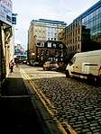 | |||
| 40-44 (Even Nos) Thistle Street | 55°57′14″N 3°11′56″W | Category B | 29842 | | |||
| 9-15A (Inclusive Nos, Except No 14) Trinity Crescent With Railings | 55°58′48″N 3°12′19″W | Category C(S) | 29853 | | |||
| 7 And 9 Union Street Including Railings And Boundary Wall | 55°57′30″N 3°11′10″W | Category B | 29863 | | |||
| 5-8 (Inclusive Nos) Upper Bow | 55°56′56″N 3°11′38″W | Category C(S) | 29865 | 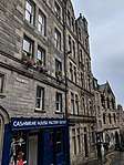 | |||
| 38-46 (Even Nos) Victoria Street | 55°56′55″N 3°11′40″W | Category B | 29873 | | |||
| 3, 5, 7, 9 Walker Street | 55°56′56″N 3°12′45″W | Category A | 29878 | | |||
| 12, 14, 16 Walker Street | 55°56′57″N 3°12′49″W | Category A | 29882 | | |||
| 10-13 (Inclusive Nos) South Bridge And 15 Niddry Street | 55°56′59″N 3°11′14″W | Category C(S) | 29790 | | |||
| 19-36 (Inclusive Nos) South Bridge, 29-57 (Inclusive Nos) Niddry Street And 212 Cowgate | 55°56′57″N 3°11′13″W | Category C(S) | 29791 | | |||
| 37-52 (Inclusive Nos) South Bridge, 1-5 (Odd Nos) Infirmary Street And 2-14 (Even Nos) Niddry Street South | 55°56′55″N 3°11′12″W | Category C(S) | 29792 | | |||
| Infirmary Street, South Bridge Resource Centre And 8 Infirmary Street, Including Boundary Walls And Gatepiers | 55°56′53″N 3°11′08″W | Category B | 29793 | | |||
| 85-99 (Inclusive Nos) South Bridge, 22-40 (Even Nos) Blair Street And 208 Cowgate | 55°56′56″N 3°11′14″W | Category B | 29797 |  | |||
| 1-8 (Inclusive Nos) South College And 1-11 (Odd Nos) Nicolson Street | 55°56′49″N 3°11′10″W | Category B | 29798 |  | |||
| 1 Spylaw Avenue, Glenlinden, And 12B Spylaw Park With Boundary Wall And Gatepiers | 55°54′28″N 3°16′00″W | Category C(S) | 29803 | | |||
| 45 Spylaw Bank Road, Glenlyon, With Boundary Wall, Gatepiers, Garage, Garden Terrace And Steps | 55°54′32″N 3°15′47″W | Category B | 29818 | | |||
| 49 Spylaw Bank Road, Almora, With Boundary Wall, Gatepiers, Motor House And Garden Terrace | 55°54′32″N 3°15′49″W | Category B | 29819 | | |||
| 65 Spylaw Bank Road, Balmadies, With Boundary Wall, Gatepiers, Garage And Greenhouse | 55°54′33″N 3°16′07″W | Category B | 29820 | | |||
| 52 Spylaw Bank Road, Sir William Fraser Homes With Pavilions, Birdbath, Garden House, Boundary Walls And Gatepiers | 55°54′33″N 3°15′48″W | Category A | 29821 | | |||
| 5, 7, 8, 10, 11, 12, 14, 16 And 17 Spylaw Street | 55°54′27″N 3°15′28″W | Category C(S) | 29822 | | |||
| St Patrick Square 26-34 | 55°56′35″N 3°11′02″W | Category B | 29737 | | |||
| St Patrick Square 35-41 | 55°56′36″N 3°11′02″W | Category B | 29738 | | |||
| St Stephen Street 17-29 And 1-11 St Stephen Place | 55°57′28″N 3°12′26″W | Category B | 29744 | | |||
| 5-11 (Odd Nos) St Vincent Street, Including Railings | 55°57′28″N 3°12′12″W | Category B | 29749 | | |||
| 35 And 37 Salisbury Road, Including Boundary Walls | 55°56′16″N 3°10′36″W | Category B | 29756 | | |||
| 2 And 2A Salisbury Road, The Salisbury Centre, Including Gatepiers | 55°56′18″N 3°10′28″W | Category C(S) | 29758 | | |||
| 5-11 (Inclusive Nos) Rutland Square, Including Railings And Lamp Standards | 55°56′55″N 3°12′31″W | Category A | 29688 |  | |||
| 12-22 (Inclusive Nos) Rutland Square And 6 And 7 Rutland Court Lane, Including Railings And Lamp Standards | 55°56′54″N 3°12′35″W | Category A | 29689 |  | |||
| 11-25 (Odd Nos) Rutland Street, Including Railings And Lamp Standards | 55°56′57″N 3°12′31″W | Category B | 29693 | 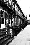 | |||
| 1 And 2 St Andrew Square And 16-22 (Even Nos) South St Andrew Street, Former Prudential Assurance Building, With Railings | 55°57′13″N 3°11′32″W | Category B | 29695 | 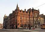 | |||
| 42 St Andrew Square, Royal Bank Of Scotland | 55°57′14″N 3°11′29″W | Category A | 29708 | | |||
| St Bernard's Crescent 3-35 And 52-58 Dean Street | 55°57′28″N 3°12′41″W | Category A | 29712 |  | |||
| St. Bernard's Crescent, 16-26 | 55°57′26″N 3°12′47″W | Category B | 29717 | | |||
| 7 And 9 North St David Street And Queen Street | 55°57′19″N 3°11′40″W | Category A | 29727 | | |||
| 23, 24, 25 & 26 St James Square | 55°57′17″N 3°11′24″W | Category A | 29728 | | |||
| 2, 3, 4, 5, 6 Rothesay Place | 55°57′03″N 3°13′00″W | Category B | 29663 | | |||
| 7, 8, 9, 10, 11 Rothesay Place | 55°57′02″N 3°13′02″W | Category B | 29664 | | |||
| 3 Rothesay Terrace, Melvin House | 55°57′05″N 3°13′00″W | Category A | 29668 | 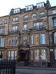 | |||
| 2 Roxburgh Street And 36, 37 Drummond Street Including Railings | 55°56′52″N 3°11′01″W | Category B | 29675 | | |||
| 1-25 Royal Circus (Odd Nos), And 1-6 (Inclusive Nos) Circus Gardens, 29-33 (Odd Nos) India Street, 1-9A (Odd Nos) South East Circus Place And 40-48A(Even Nos) Howe Street, Including Railings And Lamps With 24 Jamaica Street North Lane | 55°57′24″N 3°12′12″W | Category A | 29677 | | |||
| 2-32 Royal Circus (Even Nos), And 1-10 North West Circus Place, 2-6 (Even Nos) North East Circus Place And 1-3A (Odd Nos) St Vincent Street, Including Railings And Lamps | 55°57′27″N 3°12′13″W | Category A | 29678 | | |||
| 15-23A (Inclusive Nos) Royal Crescent, And 15 Dundonald Street, Including Railings And Lamps | 55°57′34″N 3°11′52″W | Category A | 29680 | | |||
| 1 and 2 Royal Terrace, including Railings and Boundary Walls | 55°57′24″N 3°10′40″W | Category A | 29681 | 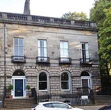 | |||
| Rankeillor Street, 5-15 | 55°56′32″N 3°10′53″W | Category B | 29604 | | |||
| Rankeillor Street, 8-52 | 55°56′33″N 3°10′58″W | Category B | 29605 | | |||
| Rankeillor Street, 54 And 45-55 St Leonard's Street | 55°56′35″N 3°10′48″W | Category B | 29606 | | |||
| Redhall Bank Road, 4, Inglis Bank | 55°55′12″N 3°15′22″W | Category B | 29616 | | |||
| Redhall Bank Road, 8-10 | 55°55′10″N 3°15′23″W | Category B | 29617 | | |||
| 1 Regent Terrace, including Railings and Boundary Walls | 55°57′18″N 3°10′35″W | Category A | 29618 | 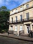 | |||
| 28-48 (Even Nos) West Register Street, Formerly Royal Bank Stationary Warehouse | 55°57′13″N 3°11′27″W | Category B | 29620 | | |||
| 16-20 (Even Nos) Robertson's Close | 55°56′54″N 3°11′10″W | Category B | 29631 |  | |||
| 37-49 (Odd Nos) Rose Street | 55°57′10″N 3°11′52″W | Category B | 29632 |  | |||
| 95-99 (Odd Nos) Rose Street | 55°57′08″N 3°12′04″W | Category B | 29640 | | |||
| 101-105 (Odd Nos) Rose Street | 55°57′08″N 3°12′05″W | Category B | 29641 | | |||
| 196-200 (Even Nos) Rose Street And Wall To Rear | 55°57′05″N 3°12′18″W | Category B | 29654 | | |||
| 1-36 (Inclusive Nos) Rosebank Cottages, Including Boundary Walls | 55°56′43″N 3°12′39″W | Category B | 29656 |  | |||
| 6, 7 And 8 Rosebery Crescent, Including Railings | 55°56′48″N 3°13′09″W | Category C(S) | 29660 | | |||
| Rosebery Crescent 10-14 | 55°56′47″N 3°13′11″W | Category B | 29661 | | |||
| 23-25 (Inclusive Nos) Queen Street With Railings | 55°57′17″N 3°11′57″W | Category A | 29545 | | |||
| 26, 26A And 27 Queen Street (Including Stewart House) With Railings And Lamp Standards | 55°57′16″N 3°11′58″W | Category A | 29546 | | |||
| 28 And 29 Queen Street With Railings And Lamp Standards | 55°57′16″N 3°11′59″W | Category A | 29548 | | |||
| 48 Queen Street With Railings And Lamp Standards | 55°57′14″N 3°12′09″W | Category A | 29558 | | |||
| 66 And 67 Queen Street, With 33 And 35 Young Street Lane North, Railings And Lamp Standards | 55°57′13″N 3°12′19″W | Category A | 29570 | | |||
| 79, 79A And 80 Queen Street And 5 And 6 North Charlotte Street | 55°57′11″N 3°12′25″W | Category A | 29574 | | |||
| 23-39 (Inclusive Nos) Queensferry Street And 14 Randolph Place | 55°57′03″N 3°12′34″W | Category B | 29576 | | |||
| 18, 19, 20 Queensferry Street | 55°57′03″N 3°12′37″W | Category B | 29578 | | |||
| Raeburn Place 1-17 | 55°57′32″N 3°12′37″W | Category B | 29579 | | |||
| Raeburn Place 2-14 And 2, 4, 6 St Bernard's Row | 55°57′32″N 3°12′36″W | Category B | 29584 | | |||
| Raeburn Place, 16-26 | 55°57′33″N 3°12′39″W | Category B | 29585 | | |||
| 28, 28A, 30 And 30A-D Raeburn Place, Including Boundary Walls | 55°57′33″N 3°12′39″W | Category C(S) | 29586 | | |||
| Raeburn Street, 2-10 | 55°57′31″N 3°12′44″W | Category B | 29591 | | |||
| 1-8 (Inclusive Nos) Randolph Crescent, Including Railings, With 2 And 3-9 (Odd Nos) Randolph Lane | 55°57′06″N 3°12′39″W | Category A | 29600 | 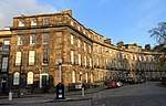 | |||
| 9-17 (inclusive Nos) Randolph Crescent, including Railings | 55°57′08″N 3°12′46″W | Category A | 29601 | 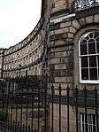 | |||
| 16-28 (Even Nos) Palmerston Place, Including Railings | 55°56′52″N 3°13′00″W | Category B | 29475 | | |||
| 54-62 (Even Nos) Palmerston Place, Including Railings | 55°56′59″N 3°13′10″W | Category B | 29478 | | |||
| Picardy Place 2-22 (Even Nos) And 16,17 Union Place And 19, 19A Broughton Street With Mews To Broughton Street Lane | 55°57′26″N 3°11′11″W | Category B | 29488 | 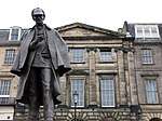 | |||
| 3 Wester Close | 55°58′51″N 3°11′43″W | Category C(S) | 29489 | | |||
| 2A-18 West Preston Street | 55°56′21″N 3°10′50″W | Category B | 29500 | | |||
| 16-18 (Inclusive Nos) Princes Street | 55°57′12″N 3°11′26″W | Category B | 29501 | | |||
| 97, 97A And 98 Princes Street And 1 And 3 Frederick Street | 55°57′07″N 3°11′58″W | Category B | 29508 | | |||
| 129 Princes Street | 55°57′03″N 3°12′18″W | Category B | 29516 | | |||
| 4 Lothian Road, the Caledonian Hotel, including Piers, Railings and Former Screen Entrance to Station | 55°56′58″N 3°12′26″W | Category A | 29524 | .jpg) | |||
| 8 Queen Street, Royal College of Physicians, with Railings | 55°57′18″N 3°11′47″W | Category A | 29535 |  | |||
| 114 And 118 Hanover Street And 17 And 17A Queen Street With Railings | 55°57′17″N 3°11′54″W | Category B | 29541 | | |||
| Nicolson Street West, 35-53 | 55°56′41″N 3°11′08″W | Category B | 29436 | | |||
| 1 And 2 Northfield Gardens | 55°56′57″N 3°08′17″W | Category B | 29442 | 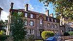 | |||
| 125 High Street/2 North Gray's Close | 55°57′02″N 3°11′12″W | Category B | 29443 | | |||
| 1 Northumberland Street, And 20 And 22 Nelson Street, Including Railings | 55°57′27″N 3°11′47″W | Category A | 29445 | | |||
| 3-17A (Odd Nos) Northumberland Street, Including Railings And Lamps | 55°57′27″N 3°11′48″W | Category A | 29446 | | |||
| 43-47 (Odd Nos) Northumberland Street, Including Railings And Lamps And 2 Northumberland Street North West Lane | 55°57′25″N 3°12′00″W | Category A | 29449 | | |||
| 51-61 (Odd Nos) Northumberland Street, Including Railings And Lamps With 8-14 (Even Nos) Northumberland Street North West Lane | 55°57′24″N 3°12′04″W | Category A | 29451 | | |||
| 14-26 (Even Nos) Northumberland Street, Including Railings And Lamps | 55°57′25″N 3°11′52″W | Category A | 29455 | | |||
| 42-68 (Even Nos) Northumberland Street, Including Railings And Lamps | 55°57′23″N 3°12′04″W | Category A | 29458 | | |||
| 2-6 (Inclusive Numbers) East Norton Place And 53-61 (Odd Numbers) Montrose Terrace | 55°57′26″N 3°10′14″W | Category B | 29460 | | |||
| 7-19 (Inclusive Numbers) East Norton Place | 55°57′27″N 3°10′14″W | Category C(S) | 29461 | | |||
| 3-21 (Odd Numbers) Palmerston Place Including Railings | 55°56′52″N 3°12′57″W | Category B | 29472 | | |||
| 1-20 Murray Cottages Including Boundary Walls | 55°56′22″N 3°17′32″W | Category C(S) | 29381 | | |||
| 10-14 (Even Nos) Nelson Street, Including Railings And Lamps | 55°57′25″N 3°11′48″W | Category A | 29390 | | |||
| 202 And 204 Newhaven Road Including Boundary Wall And Coach House To No 204 | 55°58′41″N 3°11′34″W | Category C(S) | 29400 | | |||
| 1-3 (Inclusive Nos) East Newington Place, Including Boundary Walls | 55°56′20″N 3°10′40″W | Category B | 29403 | | |||
| 1-27 (Odd Nos), 35, 37 Newington Road And 1, 3 East Preston Street Including Boundary Walls | 55°56′19″N 3°10′44″W | Category B | 29405 |  | |||
| 75-115 (Odd Nos) Newington Road And 55 Salisbury Road | 55°56′16″N 3°10′40″W | Category B | 29407 |  | |||
| 56-66 (Even Nos) Newington Road And 1 And 2 West Newington Place | 55°56′16″N 3°10′43″W | Category B | 29410 | | |||
| 4, 5 And 6 Nicolson Square | 55°56′46″N 3°11′09″W | Category B | 29412 | | |||
| Nicolson Street, 86-90 | 55°56′42″N 3°11′01″W | Category B | 29422 | | |||
| 19 And 20 Minto Street, Including Boundary Walls And Pedestrian Gates | 55°56′06″N 3°10′30″W | Category B | 29350 | | |||
| 21 Minto Street, Including Boundary Walls And Pier | 55°56′06″N 3°10′30″W | Category B | 29351 | |
Key
The scheme for classifying buildings in Scotland is:
- Category A: "buildings of national or international importance, either architectural or historic; or fine, little-altered examples of some particular period, style or building type."[1]
- Category B: "buildings of regional or more than local importance; or major examples of some particular period, style or building type, which may have been altered."[1]
- Category C: "buildings of local importance; lesser examples of any period, style, or building type, as originally constructed or moderately altered; and simple traditional buildings which group well with other listed buildings."[1]
In March 2016 there were 47,288 listed buildings in Scotland. Of these, 8% were Category A, and 50% were Category B, with the remaining 42% being Category C.[2]
Notes
- Sometimes known as OSGB36, the grid reference (where provided) is based on the British national grid reference system used by the Ordnance Survey.
• "Guide to National Grid". Ordnance Survey. Retrieved 12 December 2007.
• "Get-a-map". Ordnance Survey. Retrieved 17 December 2007. - Historic Environment Scotland assign a unique alphanumeric identifier to each designated site in Scotland, for listed buildings this always begins with "LB", for example "LB12345".
References
- All entries, addresses and coordinates are based on data from Historic Scotland. This data falls under the Open Government Licence
- "What is Listing?". Historic Environment Scotland. Retrieved 29 May 2018.
- Scotland's Historic Environment Audit 2016 (PDF). Historic Environment Scotland and the Built Environment Forum Scotland. pp. 15–16. Retrieved 29 May 2018.
This article is issued from Wikipedia. The text is licensed under Creative Commons - Attribution - Sharealike. Additional terms may apply for the media files.