List of listed buildings in Dunoon And Kilmun
List
| Name | Location | Date Listed | Grid Ref. [note 1] | Geo-coordinates | Notes | LB Number [note 2] | Image |
|---|---|---|---|---|---|---|---|
| Kilmun Pier And Associated Buildings | 55°59′33″N 4°56′02″W | Category B | 85 |  | |||
| Blairmore Farm Including Outbuildings And Farm Cottages | 56°00′30″N 4°54′14″W | Category C(S) | 50415 | | |||
| Blairmore, Shore Road, Blair Athol, Including Coach House, Boundary Walls And Gatepiers | 56°00′08″N 4°53′53″W | Category C(S) | 50425 | | |||
| Blairmore, Shore Road, Creggandarroch | 55°59′55″N 4°53′49″W | Category B | 50428 | | |||
| Loch Eck, Inverchapel Lodge Including Boundary Walls And Garden Walls | 56°02′39″N 4°59′00″W | Category C(S) | 50438 | | |||
| Strone, 1, 2, 3, 4, 5, 6 High Cottages | 55°59′12″N 4°54′22″W | Category C(S) | 50439 | | |||
| Strone, Choille Bheag Including Outbuildings, Boundary Walls, Gatepiers And Gates | 55°59′19″N 4°55′04″W | Category B | 50440 | | |||
| Strone, Dunselma Stables Including Boundary Walls | 55°59′09″N 4°53′58″W | Category C(S) | 50441 | | |||
| Strone House Including Boundary Walls, Gatepiers And Gates | 55°59′06″N 4°53′51″W | Category C(S) | 50442 | | |||
| Kilmun, Shore Road, Anchorage, Ardmun, Fountain Villa, Heathbank, Lochview And Woodburn (The Tea Caddies) Including Outbuildings, Boundary Walls, Gatepiers And Gates | 55°59′41″N 4°56′13″W | Category C(S) | 5065 | | |||
| Benmore View, Shore Road, Sandbank | 55°58′58″N 4°57′01″W | Category B | 43020 | | |||
| Blairmore Pier, Former Ticket Office | 55°59′41″N 4°53′43″W | Category C(S) | 6611 | | |||
| Benmore Botanic Garden, Benmore House, Fernery | 56°01′23″N 4°59′37″W | Category B | 6436 |  | |||
| Whistlefield Inn Including Ancillary Buildings And Boundary Walls | 56°05′46″N 4°59′05″W | Category C(S) | 5060 |  | |||
| Castle Toward | 55°52′11″N 5°00′51″W | Category B | 5068 | | |||
| Strone, Dunselma Including Outbuilding, Boundary Walls, Gates And Gatepiers | 55°59′07″N 4°53′59″W | Category A | 5075 | | |||
| Benmore Botanic Garden, Footbridge Over The Eachaig River | 56°01′08″N 4°59′05″W | Category C(S) | 50413 | | |||
| Blairmore Hall (Former Ferry Waiting Room) | 55°59′40″N 4°53′44″W | Category C(S) | 50417 | | |||
| Blairmore, Shore Road, Bannachra, Including Coach House, Boundary Walls And Gatepiers | 56°00′13″N 4°53′54″W | Category C(S) | 50424 | | |||
| Blairmore, Shore Road, Duart Tower Including Outbuilding, Boundary Walls And Gatepiers | 55°59′59″N 4°53′51″W | Category C(S) | 50429 | | |||
| Glenfinart House Walled Garden Including Well And Ancillary Buildings | 56°03′18″N 4°54′42″W | Category B | 50431 | | |||
| Kilmun, Shore Road, Younger Hall Including Boundary Wall, Railings, Gatepiers And Gates | 55°59′36″N 4°56′03″W | Category C(S) | 43021 | | |||
| Ardentinny, Blinkbonny, Raglan, Fern Cottage And Glencairn, Including Boundary Walls | 56°02′47″N 4°54′38″W | Category B | 5057 | | |||
| Ardentinny, Ferry Cottages Including Boundary Walls | 56°02′42″N 4°54′31″W | Category C(S) | 5059 | | |||
| Kilmun, K6 Telephone Kiosk At Kilmun Pier | 55°59′34″N 4°56′02″W | Category B | 5067 | | |||
| Toward Lighthouse, Toward Point | 55°51′43″N 4°58′47″W | Category B | 5070 | | |||
| Blairmore Pier | 55°59′40″N 4°53′40″W | Category C(S) | 50419 | | |||
| Blairmore, Shore Road, Blairmore House, Lodge | 55°59′43″N 4°53′44″W | Category C(S) | 50427 | | |||
| Strone, Midge Lake, Rhubeg Grotto | 55°59′13″N 4°54′59″W | Category C(S) | 50443 | | |||
| Kilmun, Old Kilmun House, Including Boundary Walls | 55°59′51″N 4°56′37″W | Category A | 6582 | | |||
| Benmore Botanic Garden, Benmore House, Steading | 56°01′42″N 4°59′11″W | Category B | 5076 | | |||
| Benmore Botanic Garden, Benmore House, Cottages To East Of Walled Garden (Riverside And Adjoining Cottage) | 56°01′42″N 4°58′57″W | Category C(S) | 50412 | | |||
| Blairmore, Fairy Knowe Including Coach House, Sundial, Gates And Gatepiers | 55°59′30″N 4°53′47″W | Category C(S) | 50414 | | |||
| Blairmore Place (Mixed Use Building At Blairmore Pier) | 55°59′39″N 4°53′44″W | Category C(S) | 50422 | | |||
| Kilmun, Shore Road, Finnart Including Boundary Walls, Ancillary Buildings And Sundial | 55°59′44″N 4°56′22″W | Category C(S) | 50437 | | |||
| Strone, Midge Lane, Rockbank Including Coach House And Boundary Walls | 55°59′13″N 4°54′47″W | Category C(S) | 50444 | | |||
| Strone, Shore Road, The Boathouse (Former Dunselma Boathouse) Including Boundary Walls, Gates And Gatepiers And Jetty | 55°59′02″N 4°53′53″W | Category C(S) | 50445 | | |||
| Strone, Shore Road, Tyneshandon | 55°59′02″N 4°54′13″W | Category C(S) | 50448 | | |||
| Benmore Botanic Garden, Benmore House, Walled Garden With Garden House, Gates And Fountain | 56°01′41″N 4°59′05″W | Category B | 6439 |  | |||
| Toward Quay | 55°52′00″N 5°01′18″W | Category B | 6234 | | |||
| Invereck (Church Of Scotland Eventide Home) Including Outbuildings, Boundary Walls And Gatepiers | 56°00′13″N 4°58′40″W | Category B | 50432 | | |||
| Benmore Botanic Garden, Bayley Balfour Memorial Hut, Puck's Hut | 56°01′40″N 4°59′11″W | Category C(S) | 6437 | | |||
| Benmore Botanic Garden, Benmore House, Golden Gates | 56°01′19″N 4°59′23″W | Category A | 6438 | .jpg) | |||
| Kilmun, St Munn's Parish Church (Church Of Scotland) Including Argyll And Douglas Mausolea, Associated Buildings And Graveyard | 55°59′47″N 4°56′33″W | Category A | 5073 |  | |||
| Benmore Botanic Garden, Benmore House (Benmore Outdoor Centre) Including Ancillary Buildings | 56°01′32″N 4°59′18″W | Category B | 95 | .jpg) | |||
| Ardentinny, Ferry House | 56°02′45″N 4°54′34″W | Category C(S) | 50404 | | |||
| Blairmore, Shore Road, Otterburn Including Outbuildings, Boundary Walls, Gatepiers And Gates | 55°59′53″N 4°53′46″W | Category C(S) | 50430 | | |||
| Strone, Shore Road, Dunselma Lodge, Including Boundary Walls, Gates And Gatepiers | 55°59′03″N 4°53′52″W | Category B | 50447 | | |||
| Sandbank Parish Church | 55°58′50″N 4°56′49″W | Category C(S) | 50828 |  | |||
| Ardentinny Hotel | 56°02′41″N 4°54′30″W | Category B | 5058 |  | |||
| Hafton House | 55°58′38″N 4°55′29″W | Category B | 5071 | | |||
| Hafton House Drybridge Over Rear Railway | 55°58′35″N 4°55′29″W | Category B | 5074 | | |||
| Strone, St Columba's Church Of Scotland Including Halls, Boundary Walls And Gatepiers | 55°59′02″N 4°53′55″W | Category C(S) | 5080 | 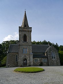 | |||
| Blairmore, Shore Road, Blairmore House Including Garage, Boundary Walls, Garden Walls And Gatepiers | 55°59′44″N 4°53′47″W | Category B | 50426 | | |||
| Kilmun, Eachaig Bridge Including Stone Parapets | 56°00′19″N 4°57′40″W | Category B | 50433 | | |||
| Kilmun, Graham's Point, Cast Iron Bus Shelter | 55°59′24″N 4°55′41″W | Category C(S) | 50434 | | |||
| Kilmun, Graham's Point, Memorial To James Duncan | 55°59′21″N 4°55′40″W | Category C(S) | 50435 | | |||
| Strone, Shore Road, Craigielee Including Fountain, Boundary Walls And Gatepiers | 55°59′08″N 4°53′51″W | Category B | 50446 | | |||
| Toward Castle | 55°52′01″N 5°00′30″W | Category B | 5069 | .jpg) | |||
| Benmore Botanic Garden, Benmore House North Lodge, Including Gates And Railings (Black Gate) | 56°01′37″N 4°58′51″W | Category B | 5077 |  | |||
| Ardentinny Church Of Scotland | 56°02′47″N 4°54′39″W | Category C(S) | 86 |  | |||
| Kilmun, Shore Road, Cashlie, Including Boundary Walls | 56°00′13″N 4°57′26″W | Category C(S) | 50436 | |
Key
The scheme for classifying buildings in Scotland is:
- Category A: "buildings of national or international importance, either architectural or historic; or fine, little-altered examples of some particular period, style or building type."[1]
- Category B: "buildings of regional or more than local importance; or major examples of some particular period, style or building type, which may have been altered."[1]
- Category C: "buildings of local importance; lesser examples of any period, style, or building type, as originally constructed or moderately altered; and simple traditional buildings which group well with other listed buildings."[1]
In March 2016 there were 47,288 listed buildings in Scotland. Of these, 8% were Category A, and 50% were Category B, with the remaining 42% being Category C.[2]
Notes
- Sometimes known as OSGB36, the grid reference (where provided) is based on the British national grid reference system used by the Ordnance Survey.
• "Guide to National Grid". Ordnance Survey. Retrieved 12 December 2007.
• "Get-a-map". Ordnance Survey. Retrieved 17 December 2007. - Historic Environment Scotland assign a unique alphanumeric identifier to each designated site in Scotland, for listed buildings this always begins with "LB", for example "LB12345".
References
- All entries, addresses and coordinates are based on data from Historic Scotland. This data falls under the Open Government Licence
- "What is Listing?". Historic Environment Scotland. Retrieved 29 May 2018.
- Scotland's Historic Environment Audit 2016 (PDF). Historic Environment Scotland and the Built Environment Forum Scotland. pp. 15–16. Retrieved 29 May 2018.
This article is issued from Wikipedia. The text is licensed under Creative Commons - Attribution - Sharealike. Additional terms may apply for the media files.