List of listed buildings in Dundee/6
List
| Name | Location | Date Listed | Grid Ref. [note 1] | Geo-coordinates | Notes | LB Number [note 2] | Image |
|---|---|---|---|---|---|---|---|
| 94, 96 High Street/52, 54 Commercial Street, Clydesdale Bank | 56°27′41″N 2°58′07″W | Category B | 25251 |  | |||
| 9 Dudhope Terrace | 56°27′58″N 2°59′04″W | Category B | 25254 | | |||
| Park Place, Carnelley Building, University Of Dundee, Including Boundary Walls | 56°27′28″N 2°58′43″W | Category B | 25266 | | |||
| Finlathen Aqueduct | 56°29′10″N 2°56′33″W | Category B | 25284 | | |||
| 9, 11 Forfar Road Craigiemount And Noblestown Cottage | 56°28′33″N 2°57′14″W | Category B | 25299 | | |||
| 56 Small's Wynd, Old Medical School, Including Boundary Wall And Railings, University Of Dundee | 56°27′28″N 2°58′46″W | Category B | 25304 | | |||
| 146 Princes Street And Victoria Street | 56°28′04″N 2°57′30″W | Category B | 25306 | | |||
| 25A Forfar Road And Return To Walrond Street Maryfield Transport Depot | 56°28′36″N 2°57′09″W | Category B | 25307 | | |||
| Claverhouse Road Or Mansion Drive, Mansion House | 56°29′37″N 2°57′43″W | Category B | 25116 | | |||
| Claverhouse Road, Claverhouse Cottage, North | 56°29′32″N 2°57′50″W | Category B | 25123 | | |||
| 88 Victoria Road And Return Elevation To Forebank Road And Bonnybank Road, Bonnybank Apartments, Former Forebank Dyeworks (Front Block Only) | 56°27′57″N 2°58′05″W | Category C(S) | 25126 | | |||
| 11, 12, 13 Dock Street | 56°27′33″N 2°58′09″W | Category C(S) | 25142 | | |||
| 42, 44 West Henderson's Wynd And Elevation To Anchor Lane, Former South Anchor Mill | 56°27′41″N 2°59′04″W | Category B | 25148 | | |||
| 16 Constitution Terrace And Return To Constitution Street, Rose House With Boundary Walls | 56°28′01″N 2°58′39″W | Category B | 25172 | | |||
| 11-17 (Odd Nos) Exchange Street | 56°27′38″N 2°58′01″W | Category C(S) | 25196 | | |||
| 72 And 74 Constable Street | 56°27′58″N 2°57′33″W | Category B | 25197 | | |||
| 21-29 Cowgate, County Bingo, Former King's Theatre | 56°27′49″N 2°58′03″W | Category B | 25201 | | |||
| 51 Magdalen Yard Road, Former Tay Rope Works (Facade Only) | 56°27′11″N 2°59′19″W | Category C(S) | 25031 | | |||
| 230 Broughty Ferry Road With Railings | 56°28′08″N 2°56′01″W | Category C(S) | 25049 | | |||
| 9 Commercial Street | 56°27′40″N 2°57′59″W | Category C(S) | 25050 | | |||
| 17 Commercial Street | 56°27′40″N 2°57′59″W | Category C(S) | 25052 | | |||
| Byron Street Ss Peter And Paul Rc Church And Presbytery | 56°28′24″N 2°58′54″W | Category B | 25054 | | |||
| 14 Milne's East Wynd And Milne's West Wynd Burnside Works | 56°27′42″N 2°59′11″W | Category B | 25081 | | |||
| 2 Princes Street, Upper Dens Mill | 56°27′58″N 2°57′46″W | Category A | 25101 | | |||
| St Salvador Street And Return Elevations To Glamis Street And Main Street, Caldrum Works (Excluding East Mill And Warehouses) | 56°28′17″N 2°58′16″W | Category B | 25105 | | |||
| 10, 12 Constitution Road, Including Gatepiers And Railings | 56°27′44″N 2°58′30″W | Category B | 25110 | | |||
| East Dock Street, Gates And Gatepiers At Entrances To Victoria Dock | 56°27′43″N 2°57′46″W | Category C(S) | 24942 | | |||
| 205 Brook Street, Lower Pleasance And Brewery Lane, The Coffin Mill, Logie Works | 56°27′43″N 2°59′19″W | Category A | 24956 | | |||
| 17 Bell Street/5 Royal Exchange Lane, Bonar House, High School of Dundee | 56°27′49″N 2°58′17″W | Category B | 24978 | | |||
| 44-56 (Even Nos) Bell Street, (Mercantile Buildings,) Including Building To Rear | 56°27′48″N 2°58′23″W | Category C(S) | 24988 | | |||
| 28, 30 Bingham Terrace | 56°28′25″N 2°56′33″W | Category C(S) | 25016 | | |||
| Alexander Street And 46, 48 Dens Road, Hillbank, Or Blakey's Mill | 56°28′13″N 2°57′53″W | Category B | 24922 | | |||
| 117 Strathmartine Road, Frews Bar | 56°28′30″N 2°58′48″W | Category C(S) | 51106 | | |||
| 1 Hyndford Street, And 39, 41 Shaftesbury Road 'Hyndford Cottage', Now Shaftesbury Hotel, With Gate And Gatepiers | 56°27′26″N 3°00′05″W | Category C(S) | 44963 | | |||
| 69 Victoria Street, Former Victoria Street Church | 56°28′04″N 2°57′39″W | Category B | 44964 | | |||
| West Ferry, 2A Ellieslea Road, Inveravon Including Conservatory, Wall And Gatepiers | 56°28′14″N 2°53′32″W | Category C(S) | 25935 | | |||
| West Ferry, 61 Albany Road And 102 Strathern Road, Claremont, Including Boundary Wall, Gatepiers, Terrace Wall And Lamp Standards | 56°28′22″N 2°53′31″W | Category B | 25944 | | |||
| West Ferry, 118 Strathern Road, Northwood Including Conservatory, Gatepiers, Enclosing Wall, Lamp Standard And Terrace Wall | 56°28′21″N 2°53′22″W | Category B | 25948 | | |||
| West Ferry, 30 Victoria Road, Aystree Lodge, Coach House And Stables, Including Gatepiers | 56°28′18″N 2°53′11″W | Category B | 25951 | | |||
| West Ferry, 42 Victoria Road, Deanscourt, Including Gatepiers And Boundary Wall, And Coach House | 56°28′21″N 2°53′10″W | Category B | 25952 | | |||
| Magdalen Yard Road, Magdalen Green, K6 Telephone Kiosk | 56°27′11″N 2°59′28″W | Category B | 25959 | | |||
| Broughty Ferry, 415 King Street, Gall's Cottage | 56°27′54″N 2°52′08″W | Category C(S) | 25848 | | |||
| Broughty Ferry, 206 King Street And 29 Ambrose Street | 56°27′57″N 2°52′31″W | Category C(S) | 25850 | | |||
| Broughty Ferry, 101 Monifieth Road, Reres Hill Park Lodge | 56°28′12″N 2°51′25″W | Category C(S) | 25857 | | |||
| Broughty Ferry, 89 Queen Street, Brae Cottage | 56°28′08″N 2°52′40″W | Category C(S) | 25867 | | |||
| Broughty Ferry, 164 Queen Street, St Mary's Episcopal Church, Including Boundary Wall And Gatepiers | 56°28′06″N 2°52′37″W | Category B | 25870 | | |||
| Pitkerro, Kellas Road, Pitkerro Mill | 56°29′25″N 2°53′35″W | Category C(S) | 25898 | | |||
| Stannergate, Lower Broughty Ferry Road, Orphanage Bridge | 56°28′05″N 2°56′01″W | Category B | 25901 | | |||
| West Ferry, 36 Albany Road And 13 Fairfield Road, Craigmore, Including Gatepiers And Boundary Wall | 56°28′15″N 2°54′05″W | Category C(S) | 25905 | | |||
| West Ferry, Craigie Avenue, Craigiebank Church Including Church Hall | 56°28′17″N 2°55′43″W | Category B | 25914 | | |||
| West Ferry, Douglas Terrace, Railway Road Bridge | 56°28′08″N 2°53′15″W | Category B | 25919 | | |||
| Broughty Ferry, Brook Street Congregational Church And Hall, Including Wall And Gatepiers | 56°28′05″N 2°52′43″W | Category C(S) | 25765 | | |||
| Broughty Ferry, 391, 393 Brook Street | 56°28′00″N 2°52′10″W | Category C(S) | 25769 | | |||
| Broughty Ferry, 408 Brook Street, St Aidans Church, Including Churchyard, Walls And Gatepiers | 56°27′58″N 2°52′09″W | Category B | 25773 | | |||
| Broughty Ferry, 76 Camphill Road, And Enclosing Walls, The Bughties | 56°28′15″N 2°51′41″W | Category B | 25786 | | |||
| Broughty Ferry, 6, 8 Forthill Road, Rosemount Including Boundary Wall | 56°28′13″N 2°52′28″W | Category C(S) | 25819 | | |||
| Broughty Ferry, Gray Street, Railway Station, Including Covered Bridge, Subway, Signal Box And Level Crossing | 56°28′03″N 2°52′24″W | Category A | 25823 | | |||
| Broughty Ferry, Gray Street, Cabmens' Shelter Adjoining Railway Station | 56°28′03″N 2°52′23″W | Category C(S) | 25824 | | |||
| Broughty Ferry, 15 King Street | 56°28′01″N 2°52′52″W | Category C(S) | 25842 | | |||
| 4 St Peter's Street, St Peter's Church, Including Halls And Church Officer's House | 56°27′23″N 2°59′28″W | Category B | 25675 | | |||
| 6 West Grove Avenue, The Boreen, With Boundary Wall | 56°27′29″N 3°00′55″W | Category B | 25684 | | |||
| Balmossie, Balmossie Mill | 56°28′56″N 2°51′04″W | Category B | 25737 | | |||
| Broughty Ferry, 31 Beach Crescent, Including Wall And Gatepiers At King Street | 56°27′54″N 2°52′23″W | Category B | 25761 | | |||
| 24, 26, 28 Union Street | 56°27′33″N 2°58′15″W | Category B | 25590 | | |||
| 130 Perth Road, Dundee West Church (Latterly Roseangle Ryehill, And Formerly St John's Including Railings, Excluding Hall To West (Church Of Scotland) | 56°27′22″N 2°58′56″W | Category B | 25591 | | |||
| 156 Perth Road And 2 Greenfield Place, Greenfield House Including Railings | 56°27′22″N 2°59′06″W | Category C(S) | 25599 | | |||
| 29 Ward Road, Former Sheriff Court And Sheriff Clerk's Office | 56°27′42″N 2°58′36″W | Category B | 25606 | | |||
| 2 Ward Road, Barrack Street Museum | 56°27′41″N 2°58′27″W | Category B | 25610 | | |||
| 424-6 Perth Road, Including Railings | 56°27′23″N 3°00′06″W | Category B | 25611 | | |||
| 454A Perth Road, Former Binrock Lodge, Gatepiers And Boundary Wall | 56°27′23″N 3°00′19″W | Category B | 25619 | | |||
| 456 Perth Road, Binrock | 56°27′20″N 3°00′23″W | Category B | 25621 | | |||
| 510 Perth Road, Balgowan Including Boundary Walls And Gatepiers | 56°27′23″N 3°01′13″W | Category C(S) | 25636 | | |||
| 27 Roseangle With Boundary Walls | 56°27′18″N 2°59′05″W | Category C(S) | 25656 | | |||
| 22 Roseangle And Railings And Garden (Formerly Sea) Walls | 56°27′18″N 2°59′01″W | Category B | 25666 | | |||
| 26 Roseangle Including Iron Railings And Garden Walls | 56°27′18″N 2°59′02″W | Category C(S) | 25668 | | |||
| 16 Victoria Road, Ladywell Tavern, Former Victoria Brewery | 56°27′53″N 2°58′17″W | Category B | 25521 | | |||
| 267, 269 Perth Road And 38 Shaftesbury Road, With Boundary Walls | 56°27′25″N 3°00′04″W | Category B | 25547 | | |||
| 303 Perth Road The Cedars | 56°27′25″N 3°00′20″W | Category B | 25555 | | |||
| 365 Perth Road, Seathwood House, Lodge And Gatepiers | 56°27′26″N 3°01′19″W | Category B | 25571 | | |||
| 1-7 (Odd Nos) Union Street, 52-58 (Even Nos) Nethergate | 56°27′33″N 2°58′18″W | Category B | 25576 | | |||
| 162 Nethergate, Formerly Tayside House, Including Boundary Walls, Railings And Steps | 56°27′25″N 2°58′35″W | Category B | 25464 | | |||
| 507 Strathmartine Road, Strathmartine Parish Church (Church Of Scotland) With Railings | 56°29′47″N 3°00′05″W | Category B | 25491 | | |||
| 13, 14 Trottick Mains | 56°29′31″N 2°58′15″W | Category C(S) | 25500 | | |||
| 10 Panmure Street | 56°27′48″N 2°58′10″W | Category B | 25504 | | |||
| 4 Union Terrace, And Return To Constitution Terrace With Boundary Walls And Gatepiers | 56°27′59″N 2°58′40″W | Category B | 25509 | | |||
| 2, 4 Victoria Road, And 86 Bell Street, India Buildings | 56°27′50″N 2°58′19″W | Category A | 25515 | | |||
| 45 Murraygate | 56°27′46″N 2°58′06″W | Category B | 25362 | | |||
| Blackness Avenue, Shaftesbury Avenue And Shaftesbury Terrace, Logie And St John's (Cross) Parish Church And Halls (Church Of Scotland) | 56°27′27″N 2°59′49″W | Category B | 25368 | | |||
| Nethergate, City Churches, St Clement's, Or Steeple Church | 56°27′34″N 2°58′23″W | Category A | 25374 | 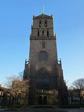 | |||
| Nethergate, City Churches, Old St Paul's And St David's, Or South Church | 56°27′34″N 2°58′21″W | Category A | 25378 | | |||
| 1 Laurel Bank And 2 Dudhope Street With Boundary Walls And Gatepiers | 56°27′53″N 2°58′36″W | Category B | 25385 | | |||
| 93, 95, 97 Nethergate | 56°27′29″N 2°58′29″W | Category B | 25390 | | |||
| 133-139 (Odd Nos) Nethergate, Morgan Tower | 56°27′26″N 2°58′34″W | Category A | 25402 | .jpg) | |||
| 28 Cleghorn Street "The American Land" | 56°27′52″N 2°59′45″W | Category C(S) | 25404 | | |||
| 1 Glamis Road Duncraig Lodge And Gatepiers | 56°27′28″N 3°01′20″W | Category B | 25423 | | |||
| 68 And 69 High Street And 1 And 5 New Inn Entry, Including The Arctic Bar | 56°27′39″N 2°58′11″W | Category B | 25234 | | |||
| 4 Dudhope Terrace | 56°28′00″N 2°58′57″W | Category B | 25238 | | |||
| 74, 75 And 76 High Street | 56°27′40″N 2°58′11″W | Category A | 25243 | | |||
| 8 Dudhope Terrace | 56°27′59″N 2°59′03″W | Category B | 25250 | | |||
| Off Perth Road, Geddes Quadrangle, Carnegie Building, University Of Dundee | 56°27′26″N 2°58′50″W | Category B | 25273 | | |||
| 15 Dudhope Terrace, Dudhope House | 56°27′58″N 2°59′23″W | Category B | 25276 | | |||
| 18 Park Avenue And Return To Morgan Street, Park Church (Of Scotland) | 56°28′17″N 2°57′20″W | Category B | 25294 | | |||
| Constitution Road, St Mary Magdalene's Episcopal Church, Including Hall, Boundary Wall And Railings | 56°27′51″N 2°58′37″W | Category B | 25113 | | |||
| 60 Victoria Road, The Victoria Road Calender (A And S Henry's) | 56°27′56″N 2°58′09″W | Category B | 25122 | | |||
| Claverhouse Road, Claverhouse Cottages, South (Bowfronted Cottage) | 56°29′31″N 2°57′50″W | Category B | 25127 | | |||
| 371 Clepington Road Clepington Sluice Chamber | 56°28′44″N 2°59′24″W | Category B | 25137 | | |||
| Euclid Crescent, High School of Dundee, Including Lodge, Gatepiers, Boundary Wall And Railings | 56°27′47″N 2°58′23″W | Category A | 25177 |  | |||
| 2 Euclid Crescent, Meadowside Gospel Hall | 56°27′48″N 2°58′20″W | Category C(S) | 25181 | | |||
| 3 Douglas Terrace With Boundary Walls And Gatepiers | 56°28′00″N 2°59′08″W | Category B | 25188 | | |||
| 29-33 (Odd Nos) Exchange Street | 56°27′39″N 2°58′00″W | Category C(S) | 25199 | | |||
| 14-18 (Even Nos) Exchange Street | 56°27′38″N 2°58′03″W | Category B | 25203 | | |||
| Camperdown Country Park (To Liff Road) South Lodge | 56°28′41″N 3°02′24″W | Category B | 25094 | | |||
| Camperdown Street, Railings, Gates And Gatepiers Between Harbour Warehouse And Transit Shed 25 | 56°27′48″N 2°57′25″W | Category B | 24937 | | |||
| 23 Albany Terrace With Boundary Walls And Gatepiers | 56°28′01″N 2°59′16″W | Category C(S) | 24943 | | |||
| 5 Bank Street | 56°27′41″N 2°58′19″W | Category B | 24949 | | |||
| Marine Parade, Former Panmure Shipyard, (Wm R Stewart And Sons) | 56°27′36″N 2°57′37″W | Category B | 24952 | | |||
| Railway Bridge, Burnside Street, Wellbank Lane, Camperdown Works | 56°28′18″N 3°00′18″W | Category B | 24980 | | |||
| 80-100 Cowgate, East Port Calender Works | 56°27′54″N 2°57′52″W | Category B | 24990 | | |||
| Baxter Park Pavilion, Steps, Boundary Walls And Gatepiers | 56°28′20″N 2°57′03″W | Category A | 24992 |  | |||
| 1 Dura Street And Return Elevations To Dens Road, Cowan Street And Brown Constable Street, Dura Works (Excluding Single-Storey Rear) | 56°28′10″N 2°57′47″W | Category B | 24999 | | |||
| 1-3 (Inclusive) Baxter Park Terrace And Return Elevation To Pitkerro Road | 56°28′25″N 2°57′15″W | Category B | 25000 | | |||
| 6 Bingham Terrace Tillydrine, With Boundary Walls And Garage | 56°28′23″N 2°56′47″W | Category B | 25008 | | |||
| Camperdown Dock | 56°27′48″N 2°57′14″W | Category A | 24923 |  | |||
| 123-129 (Odd Nos) Perth Road, Tay Bridge Bar | 56°27′22″N 2°59′29″W | Category C(S) | 51279 | | |||
| Loon's Road, North Tay Centre | 56°28′20″N 2°59′51″W | Category B | 51587 | |
Key
The scheme for classifying buildings in Scotland is:
- Category A: "buildings of national or international importance, either architectural or historic; or fine, little-altered examples of some particular period, style or building type."[1]
- Category B: "buildings of regional or more than local importance; or major examples of some particular period, style or building type, which may have been altered."[1]
- Category C: "buildings of local importance; lesser examples of any period, style, or building type, as originally constructed or moderately altered; and simple traditional buildings which group well with other listed buildings."[1]
In March 2016 there were 47,288 listed buildings in Scotland. Of these, 8% were Category A, and 50% were Category B, with the remaining 42% being Category C.[2]
See also
Notes
- Sometimes known as OSGB36, the grid reference (where provided) is based on the British national grid reference system used by the Ordnance Survey.
• "Guide to National Grid". Ordnance Survey. Retrieved 12 December 2007.
• "Get-a-map". Ordnance Survey. Retrieved 17 December 2007. - Historic Environment Scotland assign a unique alphanumeric identifier to each designated site in Scotland, for listed buildings this always begins with "LB", for example "LB12345".
References
- All entries, addresses and coordinates are based on data from Historic Scotland. This data falls under the Open Government Licence
- "What is Listing?". Historic Environment Scotland. Retrieved 29 May 2018.
- Scotland's Historic Environment Audit 2016 (PDF). Historic Environment Scotland and the Built Environment Forum Scotland. pp. 15–16. Retrieved 29 May 2018.
This article is issued from Wikipedia. The text is licensed under Creative Commons - Attribution - Sharealike. Additional terms may apply for the media files.