List of listed buildings in Dundee/5
List
| Name | Location | Date Listed | Grid Ref. [note 1] | Geo-coordinates | Notes | LB Number [note 2] | Image |
|---|---|---|---|---|---|---|---|
| Broughty Ferry, 218 Queen Street, Post Office | 56°28′05″N 2°52′33″W | Category C(S) | 25871 |  | |||
| Broughty Ferry, Queen Street, East Church | 56°28′03″N 2°52′14″W | Category B | 25872 | | |||
| Broughty Ferry, 158 St Vincent Street | 56°28′00″N 2°52′11″W | Category C(S) | 25877 | | |||
| Broughty Ferry, St Vincent Street, Baptist Church | 56°27′56″N 2°52′12″W | Category C(S) | 25879 | | |||
| West Ferry, Craigiebarn Road, Stirling House, Including Wall In Garden | 56°28′16″N 2°54′58″W | Category B | 25918 | | |||
| Broughty Ferry, 151 Brook Street, Ymca Gymnasium | 56°28′04″N 2°52′38″W | Category C(S) | 25767 | | |||
| Broughty Ferry, 134 Brook Street, Former Municipal Buildings, Including Wrought-Iron Arch And Clock | 56°28′03″N 2°52′39″W | Category C(S) | 25771 | | |||
| Broughty Ferry, 79-85 (Odd Nos) Fisher Street | 56°27′55″N 2°52′41″W | Category C(S) | 25796 | | |||
| Broughty Ferry, 87 Fisher Street | 56°27′55″N 2°52′40″W | Category C(S) | 25797 | | |||
| Broughty Ferry, 89 Fisher Street | 56°27′55″N 2°52′40″W | Category C(S) | 25798 | | |||
| Broughty Ferry, 161 Fisher Street | 56°27′54″N 2°52′32″W | Category C(S) | 25801 | | |||
| Broughty Ferry, 16 Fort Street | 56°27′56″N 2°52′37″W | Category C(S) | 25813 | | |||
| Broughty Ferry, 48 Fort Street | 56°27′58″N 2°52′35″W | Category C(S) | 25815 | | |||
| Broughty Ferry, 21 Hill Street, Dunalistair Gardens, Dunalistair, Including Detached Former Service Wing,_Retaining Wall And Balustrade | 56°28′14″N 2°52′16″W | Category B | 25836 | | |||
| 49 Seafield Road And 6 Magdalen Place, Elm Lodge With Boundary Walls | 56°27′16″N 2°59′14″W | Category B | 25677 | | |||
| Tullideph Road, St Francis Friary (Rc) | 56°27′57″N 2°59′55″W | Category B | 25682 | | |||
| 53-61 (Odd Nos) West Port And 3, 5, Johnston's Lane | 56°27′34″N 2°58′47″W | Category B | 25685 | | |||
| Baldovie, Baldovie House, Including Boundary Wall | 56°29′16″N 2°53′42″W | Category C(S) | 25734 | | |||
| Barnhill 5 Montagu Street (Formerly The Shieling) | 56°28′32″N 2°50′54″W | Category C(S) | 25745 | | |||
| By 40 Perth Road, Seabraes Gentlemen's Lavatories | 56°27′24″N 2°58′47″W | Category B | 25589 | | |||
| 158 Perth Road, St Mark's Church (Gate Fellowship) | 56°27′22″N 2°59′08″W | Category A | 25601 |  | |||
| 412 Perth Road, The Binns | 56°27′22″N 3°00′04″W | Category B | 25605 | | |||
| 4 Ward Road, Auction Rooms | 56°27′41″N 2°58′28″W | Category C(S) | 25612 | | |||
| 452 Perth Road, Greywalls | 56°27′20″N 3°00′19″W | Category A | 25617 | | |||
| 506 Perth Road West Dene, With Boundary Walls And Gatepiers | 56°27′23″N 3°01′11″W | Category B | 25634 | | |||
| 24 Whitehall Crescent, 9, 10 Dock Street, Gilfillan Memorial Church | 56°27′33″N 2°58′11″W | Category B | 25651 | | |||
| 17, 17A Roseangle And 10 Greenfield Place With Boundary Walls | 56°27′20″N 2°59′01″W | Category B | 25654 | | |||
| 9-13 Whitehall Street, Whitehall Chambers | 56°27′33″N 2°58′13″W | Category B | 25661 | | |||
| 225 Perth Road And Blackness Avenue, Blackness Branch Library, With Railings | 56°27′25″N 2°59′46″W | Category B | 25532 | | |||
| 231-233 Perth Road, Blackness Crescent With Boundary Walls | 56°27′25″N 2°59′50″W | Category C(S) | 25536 | | |||
| Riverside Drive, Discovery Quay, Alexandra Fountain | 56°27′22″N 2°58′09″W | Category B | 25541 | | |||
| 315 Perth Road, Western Cemetery Entrance Screen, Boundary Walls, Monuments And Lodges, 2 And 4 Grosvenor Road | 56°27′24″N 3°00′28″W | Category B | 25559 | | |||
| 325 Perth Road University, Formerly Elmslea, House And Lodge, Boundary Walls And Gatepiers | 56°27′24″N 3°00′40″W | Category B | 25563 | | |||
| 333 Perth Road Including Boundary Walls And E Gatepiers, Formerly To Farington Hall | 56°27′25″N 3°00′54″W | Category C(S) | 25569 | | |||
| 86 Nethergate, St David's Halls, (In Close To Rear Of 84, 88 And 90 Nethergate) | 56°27′31″N 2°58′19″W | Category B | 25429 | | |||
| Hazel Avenue Or 385 Perth Road, Wayside | 56°27′32″N 3°01′45″W | Category C(S) | 25439 | | |||
| 1 Panmure Terrace, With Boundary Walls And Gatepiers | 56°28′01″N 2°58′54″W | Category B | 25443 | | |||
| 6 Paradise Road, Marrbank, And 7, 9 Dudhope Street, With Boundary Walls And Gatepiers | 56°27′53″N 2°58′31″W | Category B | 25457 | | |||
| 172 Nethergate, Spring Grove, (Formerly Caird Rest), Including Balustraded Steps And Boundary Walls | 56°27′24″N 2°58′40″W | Category B | 25477 | | |||
| 59 Magdalen Yard Road, Royal Dundee Institution For The Blind, (Building Fronting Magdalen Yard Road Only) With Boundary Walls And Gatepiers | 56°27′12″N 2°59′27″W | Category C(S) | 25478 | | |||
| 43, 45 North Lindsay Street | 56°27′40″N 2°58′33″W | Category B | 25483 | | |||
| 26-36 (Even Nos) North Lindsay Street | 56°27′36″N 2°58′29″W | Category B | 25486 | | |||
| Magdalen Yard Road, 91, 93, Seafield Lodge | 56°27′14″N 2°59′39″W | Category B | 25493 | | |||
| 10 Milnbank Road With Railings | 56°27′43″N 2°59′26″W | Category B | 25505 | | |||
| 48, 50 St Andrews Street Or Lane, And Cowgate, Former Dundee Calender And Villa: "The Sea Captain's House" | 56°27′50″N 2°57′59″W | Category B | 25310 | | |||
| 81 Seagate And Return Elevation To Candle Lane Former No 2 Customs Warehouse | 56°27′44″N 2°58′00″W | Category B | 25318 | | |||
| 9 Wellington Street, Walker House | 56°28′03″N 2°57′57″W | Category C(S) | 25337 | | |||
| 22 Meadowside, 2 Courier Place, Euclid Crescent, Courier Building | 56°27′44″N 2°58′22″W | Category B | 25339 |  | |||
| 191 High Street, Lochee, Lochee West Church (Church Of Scotland) | 56°28′28″N 3°00′45″W | Category B | 25357 | | |||
| Balgay Park Pavilion | 56°27′50″N 3°00′49″W | Category B | 25360 | | |||
| 191 High Street, And Nicholl's Lane, Lochee, Lochee West Church Hall | 56°28′27″N 3°00′43″W | Category C(S) | 25361 | | |||
| High Street, Lochee And Old Muirton Road Former Lochee Station, Now Lochee Burns Club | 56°28′11″N 3°00′22″W | Category B | 25365 |  | |||
| Nethergate, City Churches, St Mary's Tower, Or The Steeple | 56°27′34″N 2°58′23″W | Category A | 25370 | | |||
| Nethergate, Mercat Cross | 56°27′32″N 2°58′23″W | Category B | 25386 | | |||
| 432 Blackness Road, Redcroft With Boundary Walls And Gatepiers (Excluding Lodges) | 56°27′32″N 3°01′10″W | Category B | 25392 | | |||
| Law Hill War Memorial | 56°28′11″N 2°59′22″W | Category B | 25409 |  | |||
| 24 Exchange Street | 56°27′39″N 2°58′01″W | Category B | 25211 | | |||
| Dens Road Primary School Including Air Intake For Plenum Heating, System, Janitors House And Railings | 56°28′23″N 2°58′13″W | Category B | 25225 | | |||
| 26, 28 High Street | 56°27′36″N 2°58′14″W | Category B | 25227 | | |||
| 2 Dudhope Terrace | 56°28′00″N 2°58′54″W | Category B | 25229 | | |||
| 10 Dudhope Terrace | 56°27′58″N 2°59′06″W | Category B | 25257 | | |||
| 240 Hilltown And 1A Stirling Street. Former Dundee Savings Bank | 56°28′10″N 2°58′31″W | Category B | 25264 | | |||
| Off Perth Road, Geddes Quadrangle, East Wing, (Also Known As East Wing Of Harris Building), University Of Dundee | 56°27′27″N 2°58′48″W | Category B | 25277 | | |||
| 22 Powrie Place And Forebank Road, St Mary's Rc Presbytery | 56°28′01″N 2°58′15″W | Category B | 25298 | | |||
| Thistle Street, Bowbridge Works, Gates And Gatepiers | 56°28′19″N 2°58′28″W | Category C(S) | 25118 | | |||
| Victoria Street, Former Eagle Jute Mills (Victoria Street Front Only) | 56°28′04″N 2°57′44″W | Category B | 25129 | | |||
| 21 Crichton Street | 56°27′35″N 2°58′12″W | Category C(S) | 25134 | | |||
| 27 West Henderson's Wynd And Return Elevation To Milne Street, Verdant Works | 56°27′42″N 2°58′58″W | Category A | 25140 | .jpg) | |||
| 2 West Henderson's Wynd, Former South Anchor Mill Weaving Factory | 56°27′40″N 2°59′04″W | Category C(S) | 25144 | | |||
| 45 Constitution Street And 1 Upper Constitution Street, Dungarth Gatepiers, Gates And Overthrow Arch | 56°28′01″N 2°58′45″W | Category B | 25153 | | |||
| 62, 63 Dock Street, 15 And 17 Candle Lane, Unicorn House, Former Sailors' Home And Chapel | 56°27′42″N 2°57′53″W | Category B | 25173 | | |||
| 4 Euclid Crescent, Trinity Hall, High School of Dundee, Formerly Original Secession Church | 56°27′48″N 2°58′20″W | Category C(S) | 25185 | | |||
| Dudhope Castle | 56°27′51″N 2°59′03″W | Category A | 25195 | .jpg) | |||
| 37, 39, 41 Cowgate | 56°27′51″N 2°58′01″W | Category B | 25205 | | |||
| Broughty Ferry Road, Roodyards Burial Ground With Guthrie Mausoleum | 56°28′01″N 2°56′45″W | Category B | 25038 | | |||
| Methven Street, Camperdown Works, Cox's Stack | 56°28′22″N 3°00′12″W | Category A | 25044 | 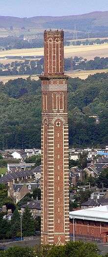 | |||
| 2, 4 Commercial Street/37-40 (Inclusive Nos) Dock Street, Brough's Buildings | 56°27′39″N 2°57′59″W | Category B | 25079 | | |||
| Camperdown Country Park, Stables And Former Tacksman's House | 56°29′07″N 3°02′50″W | Category B | 25086 | | |||
| 36-42 Commercial Street, St Roque's Hall, Including Boundary Wall, Archway And Steps To High Street | 56°27′41″N 2°58′05″W | Category B | 25095 | | |||
| 8 Constitution Road, Ward Congregational Church | 56°27′43″N 2°58′30″W | Category B | 25107 | | |||
| Albert Square, Mcmanus Galleries, Formerly Albert Institute, Including Lampstandards | 56°27′45″N 2°58′15″W | Category A | 24939 |  | |||
| Eastern Wharf, Princess Alexandra Wharf And Caledon West Wharf | 56°27′50″N 2°56′37″W | Category B | 24947 | | |||
| 7-25 (Odd Nos) Bank Street | 56°27′41″N 2°58′19″W | Category B | 24954 | | |||
| Balmuir Bridge | 56°29′43″N 2°58′34″W | Category B | 24977 | | |||
| 31, 33 Castle Street | 56°27′37″N 2°58′06″W | Category B | 25013 | | |||
| 10 Castle Street | 56°27′39″N 2°58′07″W | Category C(S) | 25017 | | |||
| 32, 34 Bingham Terrace | 56°28′25″N 2°56′32″W | Category C(S) | 25019 | | |||
| 63-73 (Odd Nos) King Street | 56°27′55″N 2°57′52″W | Category B | 25022 | | |||
| Albert Square, Statue Of James Carmichael | 56°27′47″N 2°58′15″W | Category B | 24930 | .jpg) | |||
| West Ferry, 32 Dundee Road, Magdala, Including Wall And Gatepiers | 56°28′10″N 2°53′32″W | Category B | 25928 | | |||
| West Ferry, 34 Dundee Road, Including Walls And Gatepiers, Fort William, Royal Tay Yacht Club | 56°28′09″N 2°53′27″W | Category B | 25929 | | |||
| West Ferry, 17 Fairfield Road, Red Court Coach House And Stable | 56°28′19″N 2°54′10″W | Category B | 25940 | | |||
| West Ferry, 6 Ralston Road, 1-6 (Inclusive Nos) Beachtower, Including Gatepiers And Boundary Walls | 56°28′10″N 2°54′23″W | Category A | 25947 | | |||
| West Ferry, 118 Strathern Road, Northwood Lodge | 56°28′22″N 2°53′18″W | Category C(S) | 25949 | | |||
| West Ferry, West Ferry Bay, Royal Tay Yacht Club, Beachclubhouse | 56°28′07″N 2°53′38″W | Category B | 25954 | | |||
| Hawkhill, Blackness (Formerly Hawkhill) Primary School | 56°27′24″N 2°59′30″W | Category B | 25956 | | |||
| Broughty Ferry, West Queen Street, St Luke's And Queen Street Church | 56°28′10″N 2°53′00″W | Category A | 25885 |  | |||
| Broughty Ferry, Yewbank Avenue, Roycroft, Including Glasshouse And Sundial | 56°28′08″N 2°51′28″W | Category B | 25888 | | |||
| Pitkerro, Pitkerro House, Former Generator/Battery House | 56°29′34″N 2°53′20″W | Category C(S) | 25897 | | |||
| Broughty Ferry, 397 Brook Street | 56°28′00″N 2°52′10″W | Category C(S) | 25770 | | |||
| Broughty Ferry, 7 Camphill Road, Carbet Lodge, Including Gatepiers And Walls | 56°28′08″N 2°52′21″W | Category B | 25779 | | |||
| Broughty Ferry 40 Camphill Road Woodknowe, Including Gatepiers And Boundary Walls | 56°28′09″N 2°52′07″W | Category C(S) | 25781 | | |||
| Broughty Ferry, 74 Camphill Road, Former Bughties Lodge And Coach House | 56°28′15″N 2°51′45″W | Category B | 25785 | | |||
| Broughty Ferry, Esplanade, Beach Shelter | 56°28′03″N 2°51′30″W | Category C(S) | 25793 | | |||
| Broughty Ferry, 167 Fisher Street | 56°27′54″N 2°52′32″W | Category C(S) | 25802 | | |||
| Broughty Ferry, 63 Fort Street, Wellwood | 56°28′00″N 2°52′36″W | Category C(S) | 25809 | | |||
| Broughty Ferry, 14 Fort Street | 56°27′55″N 2°52′37″W | Category C(S) | 25812 | | |||
| Broughty Ferry, The Harbour, Former Submarine Miners' Depot, Including Enclosing Wall | 56°27′48″N 2°52′10″W | Category B | 25830 | | |||
| Broughty Ferry, 17 And 19 Hill Street, Forthill Cottage, Including Boundary Wall | 56°28′12″N 2°52′19″W | Category B | 25835 | | |||
| Balmossie, Balmossie Railway Viaduct Over Dichty Water | 56°28′54″N 2°50′35″W | Category A | 25739 | | |||
| Balmossie, Panmure Bleachfield, Road Bridge Over Dichty Water | 56°28′53″N 2°50′44″W | Category C(S) | 25742 | | |||
| Barnhill, Invermark Terrace, St Margaret's Manse | 56°28′24″N 2°50′56″W | Category C(S) | 25744 | | |||
| 9-19 (Odd Nos) Union Street | 56°27′33″N 2°58′17″W | Category B | 25578 | | |||
| 12, 14, 16 Union Street | 56°27′33″N 2°58′16″W | Category B | 25586 | | |||
| 18, 20, 22 Union Street | 56°27′33″N 2°58′15″W | Category B | 25588 | | |||
| 150 Perth Road | 56°27′22″N 2°59′01″W | Category B | 25595 | | |||
| 71-87 (Odd Nos) Meadowside, Kandahar House | 56°27′52″N 2°58′15″W | Category B | 25598 | | |||
| 1-7 (Odd Nos) Ward Road, 1 And 2 Constitution Road | 56°27′43″N 2°58′29″W | Category B | 25600 | | |||
| 10, 12 Ward Road | 56°27′41″N 2°58′31″W | Category B | 25616 | | |||
| 458 Perth Road, The Ridges | 56°27′23″N 3°00′23″W | Category B | 25623 | | |||
| 11 Whitehall Crescent | 56°27′34″N 2°58′11″W | Category B | 25639 | | |||
| 13 And 15 Whitehall Crescent, 15 Whitehall Street | 56°27′33″N 2°58′13″W | Category B | 25641 | | |||
| Dock Street, Former Custom House And Harbour Chambers | 56°27′41″N 2°57′51″W | Category A | 25673 | | |||
| 22 Paton's Lane With Boundary Walls | 56°27′15″N 2°59′25″W | Category B | 25520 | | |||
| 65-71 (Odd Nos) Reform Street Meadowside | 56°27′43″N 2°58′18″W | Category B | 25522 | | |||
| 165-7 Perth Road And 2 Ford's Lane, Including The Speedwell Bar | 56°27′23″N 2°59′35″W | Category B | 25529 | | |||
| 274 Clepington Road, King's Cross Hospital, Railings Gatepiers And Gate Only | 56°28′41″N 2°59′11″W | Category B | 25537 | | |||
| 49, 51, 53 South Tay Street | 56°27′32″N 2°58′36″W | Category C(S) | 25558 | | |||
| Old Glamis Road And Claverhouse Road, Mains Parish Church (Of Scotland) And Churchyard | 56°29′29″N 2°58′18″W | Category B | 25440 | | |||
| 3 Magdalen Place | 56°27′14″N 2°59′12″W | Category C(S) | 25456 | | |||
| 158 Nethergate, Nethergate House, Including Boundary Walls And Railings | 56°27′26″N 2°58′31″W | Category A | 25458 | | |||
| 4 Magdalen Place | 56°27′14″N 2°59′14″W | Category C(S) | 25465 | | |||
| 127 South Road Lochee, Lochee Cabinet Factory, Formerly Balgay Linen Works | 56°28′19″N 3°00′59″W | Category B | 25482 | | |||
| Strathmartine Road And Mains Road Hilltown Or Barrie's Clock | 56°28′17″N 2°58′33″W | Category C(S) | 25488 | | |||
| 150 Strathmartine Road, Coldside Branch Public Library, Including Railings | 56°28′29″N 2°58′51″W | Category A | 25494 |  | |||
| 24 Milnbank Road With Railings | 56°27′43″N 2°59′31″W | Category B | 25508 | | |||
| Panmure Street, Trinity Hall, High School of Dundee, Formerly Panmure Street Congregational Church, Including Railings | 56°27′47″N 2°58′19″W | Category B | 25513 | .jpg) | |||
| 3 Norwood Crescent, Ballochmyle, With Boundary Wall | 56°27′33″N 3°00′52″W | Category B | 25514 | | |||
| 41 High Street, Lochee St Mary's Rc Church Hall, Gray's Lane | 56°28′16″N 3°00′28″W | Category C(S) | 25342 | | |||
| Meadowside, Meadow Place, Bell Street, Victoria Road, Meadow Place Buildings | 56°27′51″N 2°58′17″W | Category B | 25346 | | |||
| 5 Arnhall Drive Dounans, Including Gates And Boundary Walls | 56°27′26″N 3°01′12″W | Category B | 25352 | | |||
| 2 Kinghorne Road, 288, 290 Hilltown | 56°28′13″N 2°58′34″W | Category B | 25377 | | |||
| Nethergate, City Churches, St Mary's East, Or Dundee Parish Church | 56°27′34″N 2°58′20″W | Category A | 25382 | -geograph-2679665.jpg) | |||
| 3 Glamis Road, Duncraig, With Boundary Walls | 56°27′30″N 3°01′18″W | Category B | 25419 | | |||
| Lawton Road, Rockwell Primary And High Schools, Janitors Houses, Railings And Gates | 56°28′27″N 2°59′14″W | Category B | 25420 | | |||
| 22 Exchange Street | 56°27′39″N 2°58′02″W | Category B | 25207 | | |||
| 10 Dudhope Street, Craigbank, With Boundary Walls And Gatepiers | 56°27′54″N 2°58′31″W | Category B | 25218 | | |||
| Crescent Street, And Return To Brown Constable Street Wallacetown Nursery School, Gatepiers And Railings Only | 56°28′02″N 2°57′39″W | Category C(S) | 25221 | | |||
| 12 Dudhope Street With Boundary Walls And Gatepiers | 56°27′54″N 2°58′30″W | Category C(S) | 25222 | | |||
| 77-80 (Inclusive Nos) High Street And Returns To Murraygate/Commercial Street | 56°27′42″N 2°58′10″W | Category A | 25247 | |
Key
The scheme for classifying buildings in Scotland is:
- Category A: "buildings of national or international importance, either architectural or historic; or fine, little-altered examples of some particular period, style or building type."[1]
- Category B: "buildings of regional or more than local importance; or major examples of some particular period, style or building type, which may have been altered."[1]
- Category C: "buildings of local importance; lesser examples of any period, style, or building type, as originally constructed or moderately altered; and simple traditional buildings which group well with other listed buildings."[1]
In March 2016 there were 47,288 listed buildings in Scotland. Of these, 8% were Category A, and 50% were Category B, with the remaining 42% being Category C.[2]
See also
Notes
- Sometimes known as OSGB36, the grid reference (where provided) is based on the British national grid reference system used by the Ordnance Survey.
• "Guide to National Grid". Ordnance Survey. Retrieved 12 December 2007.
• "Get-a-map". Ordnance Survey. Retrieved 17 December 2007. - Historic Environment Scotland assign a unique alphanumeric identifier to each designated site in Scotland, for listed buildings this always begins with "LB", for example "LB12345".
References
- All entries, addresses and coordinates are based on data from Historic Scotland. This data falls under the Open Government Licence
- "What is Listing?". Historic Environment Scotland. Retrieved 29 May 2018.
- Scotland's Historic Environment Audit 2016 (PDF). Historic Environment Scotland and the Built Environment Forum Scotland. pp. 15–16. Retrieved 29 May 2018.
This article is issued from Wikipedia. The text is licensed under Creative Commons - Attribution - Sharealike. Additional terms may apply for the media files.