List of hillside letters in California

This is a list of hillside letters (also known as mountain monograms) in the U.S. state of California.[1][2][3] There are at least 80 hillside letters, acronyms, and messages in the state, possibly as many as 91. Among these are the oldest letter (the C in Berkeley, 1905) and the largest letter (the L in Susanville, almost 600 feet long).

MonogramTownDescriptionLocation
AAgoura Hills34.1538°N 118.7499°W / 34.1538; -118.7499 (Agoura Hills)
SMorgan HillAnn Sobrato High School37.1457°N 121.6814°W / 37.1457; -121.6814 (Ann Sobrato High School)
AAzusa34.1551°N 117.8919°W / 34.1551; -117.8919 (Azusa)
BBanner33.0694°N 116.5441°W / 33.0694; -116.5441 (Banner)
BBard32.8373°N 114.5287°W / 32.8373; -114.5287 (Bard)
BBarstow34.9008°N 117.0333°W / 34.9008; -117.0333 (Barstow)
BBoron35.0145°N 117.6605°W / 35.0145; -117.6605 (Boron)
BBurbank34.2016°N 118.2959°W / 34.2016; -118.2959 (Burbank)
BYucca ValleyBurnt Mountain34.1054°N 116.4131°W / 34.1054; -116.4131 (Burnt Mountain)
BRidgecrestBurroughs High School35.6554°N 117.6127°W / 35.6554; -117.6127 (Burroughs High School)
CLUThousand OaksCalifornia Lutheran University34.2333°N 118.8797°W / 34.2333; -118.8797 (Cal Lutheran University)
CPPPomonaCal Poly Pomona34.0595°N 117.8269°W / 34.0595; -117.8269 (CPP Hill)
CALICOCalico34.955°N 116.8635°W / 34.955; -116.8635 (Calico)
CDaggettCalico High School34.8736°N 116.8949°W / 34.8736; -116.8949 (Calico High School)
PSan Luis ObispoCalifornia Polytechnic State University35.3028°N 120.6518°W / 35.3028; -120.6518 (California Polytechnic State University)
[Eagle]San Luis ObispoCamp San Luis Obispo (Nat. Guard Base)35.3309°N 120.7208°W / 35.3309; -120.7208 (Camp San Luis Obispo (Nat. Guard Base))
CSan Juan CapistranoCapistrano High School33.5093°N 117.6762°W / 33.5093; -117.6762 (Capistrano High School)
CCoalinga36.1366°N 120.4073°W / 36.1366; -120.4073 (Coalinga)
CColeville38.5726°N 119.515°W / 38.5726; -119.515 (Coleville)
DVShoshoneDeath Valley35.9809°N 116.276°W / 35.9809; -116.276 (Death Valley)
DDinubaDinuba High School36.5819°N 119.3465°W / 36.5819; -119.3465 (Dinuba)
dDuarte34.1546°N 117.95°W / 34.1546; -117.95 (Duarte)
ECLakesideEl Capitan High School32.8678°N 116.9265°W / 32.8678; -116.9265 (El Capitan High School)
EEscondido33.165°N 117.102°W / 33.165; -117.102 (Escondido)
FFillmore34.4091°N 118.893°W / 34.4091; -118.893 (Fillmore)
GOLDSTONEFort IrwinGoldstone Observatory35.3028°N 116.8062°W / 35.3028; -116.8062 (Goldstone Observatory)
GEl CajonGrossmont High School32.78°N 116.9864°W / 32.78; -116.9864 (Grossmont)
HGlendaleHoover High School34.1789°N 118.2562°W / 34.1789; -118.2562 (Hoover High School)
HHornbrook41.9111°N 122.5462°W / 41.9111; -122.5462 (Hornbrook)
KKelseyville38.9835°N 122.7958°W / 38.9835; -122.7958 (Kelseyville)
LLaguna BeachLaguna Beach High School33.5450°N 117.7744°W / 33.5450; -117.7744 (Laguna Beach High School)
LSusanvilleLassen High School40.4465°N 120.6528°W / 40.4465; -120.6528 (Lassen High School)
LLaytonville39.6965°N 123.4656°W / 39.6965; -123.4656 (Laytonville)
LVLee Vining37.9553°N 119.1259°W / 37.9553; -119.1259 (Lee Vining)
LLemon Cove36.3878°N 119.0094°W / 36.3878; -119.0094 (Lemon Cove)
LLindsay36.2173°N 119.0516°W / 36.2173; -119.0516 (Lindsay)
L¹⁶PLone Pine36.6027°N 118.0875°W / 36.6027; -118.0875 (Lone Pine)
LAHacienda HeightsLos Altos High School34.0184°N 117.9962°W / 34.0184; -117.9962 (Los Altos High School)
LLoyalton39.6936°N 120.2056°W / 39.6936; -120.2056 (Loyalton)
LMULos AngelesLoyola Marymount University33.9725°N 118.4182°W / 33.9725; -118.4182 (Loyola Marymount University)
LLudlow34.7186°N 116.1747°W / 34.7186; -116.1747 (Ludlow)
MMaricopa35.0361°N 119.412°W / 35.0361; -119.412 (Maricopa)
MSan Luis ObispoMission Preparatory Academy35.2824°N 120.6747°W / 35.2824; -120.6747 (Mission Prep Academy)
MMonrovia34.1582°N 118.0145°W / 34.1582; -118.0145 (Monrovia)
MMoreno Valley33.9597°N 117.2789°W / 33.9597; -117.2789 (Moreno Valley)
MBMorro Bay35.3772°N 120.8502°W / 35.3772; -120.8502 (Morro Bay)
MSACWalnutMount San Antonio College34.0413°N 117.8423°W / 34.0413; -117.8423 (Mt. San Antonio College)
NILESFremontneighborhood37.5828°N 121.9732°W / 37.5828; -121.9732 (neighborhood)
OOroville39.5472°N 121.5509°W / 39.5472; -121.5509 (Oroville)
PSan BernardinoPacific High School34.1334°N 117.2652°W / 34.1334; -117.2652 (Pacific High School)
PSan MarcosPalomar College33.1557°N 117.173°W / 33.1557; -117.173 (Palomar College)
PPorterville36.0285°N 118.9649°W / 36.0285; -118.9649 (Porterville)
PPortola39.805°N 120.4453°W / 39.805; -120.4453 (Portola)
QQuincy39.9386°N 120.9335°W / 39.9386; -120.9335 (Quincy)
RRandsburg35.3689°N 117.6476°W / 35.3689; -117.6476 (Randsburg)
RRedlands34.183417°N 117.105053°W / 34.183417; -117.105053
RReedley36.6913°N 119.4249°W / 36.6913; -119.4249 (Reedley)
SSan Jacinto33.8204°N 116.9397°W / 33.8204; -116.9397 (San Jacinto)
SLSan Luis ObispoSan Luis Obispo High School35.2834°N 120.6463°W / 35.2834; -120.6463 (San Luis Obispo High School)
SSanger36.6945°N 119.426°W / 36.6945; -119.426 (Sanger)
SPSanta Paula34.326°N 119.0423°W / 34.326; -119.0423 (Santa Paula)
SSanta ClaritaSaugus High School34.4416°N 118.5209°W / 34.4416; -118.5209 (Saugus High School)
SSeville36.5137°N 119.2121°W / 36.5137; -119.2121 (Seville)
SShandon35.6661°N 120.3826°W / 35.6661; -120.3826 (Shandon)
SOUTH SAN FRANCISCO THE INDUSTRIAL CITYSouth San Francisco37.6634°N 122.4181°W / 37.6634; -122.4181 (South San Francisco)
SMCMoragaSt. Mary's College37.8375°N 122.1102°W / 37.8375; -122.1102 (St. Mary's College)
SVYermoSilver Valley High School34.8959°N 116.8945°W / 34.8959; -116.8945 (Silver Valley High School)
TTehachapi35.1348°N 118.4179°W / 35.1348; -118.4179 (Tehachapi)
TTempleton35.5462°N 120.7132°W / 35.5462; -120.7132 (Templeton)
TTrona35.7847°N 117.3953°W / 35.7847; -117.3953 (Trona)
CBerkeleyUniversity of California, Berkeley37.8746°N 122.2496°W / 37.8746; -122.2496 (University of California Berkeley)
CRiversideUniversity of California, Riverside33.9713°N 117.3022°W / 33.9713; -117.3022 (University of California Riverside)
RRedlandsUniversity of Redlands34.1834°N 117.105°W / 34.1834; -117.105 (University of Redlands)
UUkiah39.1519°N 123.2390°W / 39.1519; -123.2390 (Ukiah)
VVentura34.2864°N 119.2672°W / 34.2864; -119.2672 (Ventura)
VCVenturaVentura College34.2861°N 119.2357°W / 34.2861; -119.2357 (Ventura College)
VVictorville34.5316°N 117.2935°W / 34.5316; -117.2935 (Victorville)
WWeed41.4433°N 122.3864°W / 41.4433; -122.3864 (Weed)
WWhittier33.978°N 118.0238°W / 33.978; -118.0238 (Whittier)
WWillits39.4453°N 123.3028°W / 39.4453; -123.3028 (Willits)
WWoodlake36.4321°N 119.0758°W / 36.4321; -119.0758 (Woodlake)
YYucaipa34.0412°N 117.0882°W / 34.0412; -117.0882 (Yucaipa)
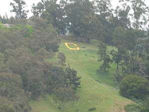
The Big C at the University of California at Berkeley

Sources

  1. Corning, Evelyn (2007). Hillside Letters A to Z : A Guide to Hometown Landmarks. Missoula, Mont.: Mountain Press Publishing Company.
  2. Parsons, James J. (1988). "Hillside Letters in the Western United States". Landscape. Sante Fe, N.M. 30 (1): 15–23. Retrieved 2011-08-09.
  3. Rocha, Guy (June 2004), "Hillside Letters: In Plain Sight But Not Intended for Planes", Sierra Sage, archived from the original on 2011-07-22, retrieved 2011-08-09
This article is issued from Wikipedia. The text is licensed under Creative Commons - Attribution - Sharealike. Additional terms may apply for the media files.