Lingeigh, North Uist
Lingeigh is an uninhabited island off North Uist, south east of Boreray. It is separated from North Uist by Traigh Lingeigh.[5]

Aerial view of Lingeigh (centre), Boreray (left), and North Uist
| Gaelic name | Lingeigh[1] |
|---|---|
| Meaning of name | heather island |
| Location | |
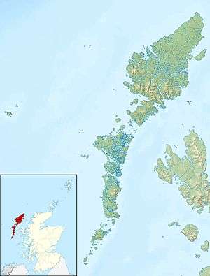 Lingeigh Lingeigh shown within the Outer Hebrides | |
| OS grid reference | NF869783 |
| Coordinates | 57.68°N 7.254°W |
| Physical geography | |
| Island group | Uists and Barra |
| Area | 42 hectares (0.16 sq mi)[2] |
| Highest elevation | 33 m (108 ft) |
| Administration | |
| Sovereign state | United Kingdom |
| Country | Scotland |
| Council area | Na h-Eileanan Siar |
| Demographics | |
| Population | 0[3] |
| Population rank | 216 [4] |
| References | [5] |
Footnotes
- Mac an Tàilleir, Iain (2003) Ainmean-àite/Placenames. (pdf) Pàrlamaid na h-Alba. Retrieved 26 August 2012.
- "Rick Livingstone’s Tables of the Islands of Scotland" (pdf) Argyll Yacht Charters. Retrieved 23 September 2013.
- National Records of Scotland (15 August 2013). "Appendix 2: Population and households on Scotland's Inhabited Islands" (PDF). Statistical Bulletin: 2011 Census: First Results on Population and Household Estimates for Scotland Release 1C (Part Two) (PDF) (Report). SG/2013/126. Retrieved 14 August 2020.
- Area and population ranks: there are c. 300 islands over 20 ha in extent and 93 permanently inhabited islands were listed in the 2011 census.
- Ordnance Survey. OS Maps Online (Map). 1:25,000. Leisure.
| Wikimedia Commons has media related to Lingeigh. |
Inhabited islands of the Hebrides | ||
|---|---|---|
| Inner Hebrides | 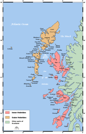 | |
| Outer Hebrides | ||
This article is issued from Wikipedia. The text is licensed under Creative Commons - Attribution - Sharealike. Additional terms may apply for the media files.