Larsøya
Larsøya,[1][2][3][4] sometimes anglicized as Lars Island, is a rocky island, less than 0.2 nautical miles (0.4 km) long, which lies just off the southwestern extremity of the island of Bouvetøya in the South Atlantic Ocean. It was first roughly charted in 1898 by a German expedition under Carl Chun. The Norwegian expedition under Captain Harald Horntvedt made a landing on the island from the ship Norvegia in December 1927, and named it after Lars Christensen, sponsor of the expedition.[5]
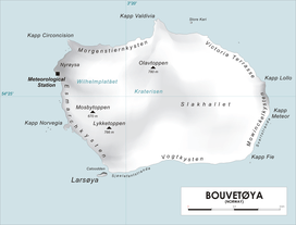
Map of Bouvetøya
See also
- List of Antarctic and subantarctic islands
References
- "Larsøya". Norwegian Polar Institute. Archived from the original on 10 May 2012. Retrieved 8 May 2012.
- Barr, Susan (1987). Norway's Polar Territories. Oslo: Aschehoug. p. 59. ISBN 82-03-15689-4.
- P. E. Baker (1967). "Historical and Geological Notes on Bouvetøya" (PDF). British Antarctic Survey Bulletin (13): 71–84. Archived from the original (PDF) on 8 May 2012. Retrieved 8 May 2012.
- Rubin, Jeff (2005). Antarctica. Lonely Planet. p. 155. ISBN 1-74059-094-5.
- "Lars Island". Geographic Names Information System. United States Geological Survey. Retrieved 2013-06-03.
![]()
This article is issued from Wikipedia. The text is licensed under Creative Commons - Attribution - Sharealike. Additional terms may apply for the media files.