La Boissière-sur-Èvre
La Boissière-sur-Èvre is a former commune in the Maine-et-Loire department in western France.
La Boissière-sur-Èvre | |
|---|---|
Part of Montrevault-sur-Èvre | |
Location of La Boissière-sur-Èvre 
| |
 La Boissière-sur-Èvre 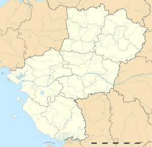 La Boissière-sur-Èvre | |
| Coordinates: 47°18′09″N 1°04′44″W | |
| Country | France |
| Region | Pays de la Loire |
| Department | Maine-et-Loire |
| Arrondissement | Cholet |
| Canton | Beaupréau |
| Commune | Montrevault-sur-Èvre |
| Area 1 | 6.02 km2 (2.32 sq mi) |
| Population (2017)[1] | 423 |
| • Density | 70/km2 (180/sq mi) |
| Time zone | UTC+01:00 (CET) |
| • Summer (DST) | UTC+02:00 (CEST) |
| Postal code | 49110 |
| Elevation | 17–102 m (56–335 ft) (avg. 33 m or 108 ft) |
| 1 French Land Register data, which excludes lakes, ponds, glaciers > 1 km2 (0.386 sq mi or 247 acres) and river estuaries. | |
Geography
The commune is traversed by the Èvre river.
History
On 15 December 2015, La Boissière-sur-Èvre, Chaudron-en-Mauges, La Chaussaire, Le Fief-Sauvin, Le Fuilet, Montrevault, Le Puiset-Doré, Saint-Pierre-Montlimart, Saint-Quentin-en-Mauges, Saint-Rémy-en-Mauges and La Salle-et-Chapelle-Aubry merged becoming one commune called Montrevault-sur-Èvre.
Population
| Year | Pop. | ±% |
|---|---|---|
| 1831 | 519 | — |
| 1836 | 467 | −10.0% |
| 1841 | 493 | +5.6% |
| 1846 | 480 | −2.6% |
| 1851 | 531 | +10.6% |
| 1856 | 591 | +11.3% |
| 1861 | 598 | +1.2% |
| 1866 | 588 | −1.7% |
| 1872 | 595 | +1.2% |
| 1876 | 581 | −2.4% |
| 1881 | 582 | +0.2% |
| 1886 | 586 | +0.7% |
| 1891 | 572 | −2.4% |
| 1896 | 555 | −3.0% |
| 1901 | 504 | −9.2% |
| 1906 | 479 | −5.0% |
| 1911 | 463 | −3.3% |
| 1921 | 396 | −14.5% |
| 1926 | 392 | −1.0% |
| 1931 | 380 | −3.1% |
| 1936 | 353 | −7.1% |
| 1946 | 344 | −2.5% |
| 1954 | 402 | +16.9% |
| 1962 | 410 | +2.0% |
| 1968 | 420 | +2.4% |
| 1975 | 347 | −17.4% |
| 1982 | 321 | −7.5% |
| 1990 | 365 | +13.7% |
| 1999 | 367 | +0.5% |
| 2006 | 381 | +3.8% |
| 2009 | 413 | +8.4% |
| 2012 | 428 | +3.6% |
References
| Wikimedia Commons has media related to La Boissière-sur-Èvre. |
| Authority control |
|
|---|
This article is issued from Wikipedia. The text is licensed under Creative Commons - Attribution - Sharealike. Additional terms may apply for the media files.