Kothanalloor
Kothanalloor is a village located in Vaikom Taluk of Kottayam District of Kerala, India. It is situated on the Kottayam-Ernakulam (Cochin) highway, 17.5 kilometers from Kottayam and 49.1 kilometers from Ernakulam.[1] The nearest railway station is at Kuruppanthara, which is 3.9 kilometers away.
Kothanalloor Mudappa | |
|---|---|
town | |
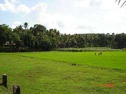 A paddy field in Kothanalloor village | |
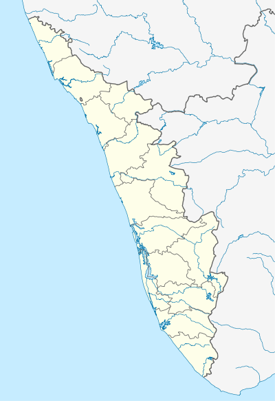 Kothanalloor Location in Kerala, India  Kothanalloor Kothanalloor (India) | |
| Coordinates: 9.720092°N 76.523691°E | |
| Country | |
| State | Kerala |
| District | Kottayam |
| Languages | |
| • Official | Malayalam, English |
| Time zone | UTC+5:30 (IST) |
| PIN | 686632 |
| Telephone code | 914829/04829 |
| Vehicle registration | KL-5/KL-36 |
| Nearest city | Mudappa |
| Lok Sabha constituency | Kottayam |
| Climate | Tropical (Köppen) |
History
Kothanalloor is mentioned in Unnineeli sandhesham (14th century AD) and annals of Udhayamperur synd (AD 1599). The Kothanalloor Sasanam by Iravi Keralavarma is to deal with Kothanalloor.[2]
Population
The latest census is ongoing as of May 2010.
Religion
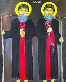
Hinduism and Christianity are both practiced in Kothanalloor. The main places of worship are the Devi Temple (Vana Durga Devi),[3] Mar Sapor and Mar Proth Forane Church[4] and St.Mary's Knanaya Catholic Church.
Churches
Mar Sabor and Mar Proth Forane Church is one of the most ancient churches in India, established in 826AD.
Education
Emmanuel's High School Kothanalloor began as the 'Mudappa Vernacular (Secondary) School' in 1919. It has over 2500 students and employs more than 80 people.
References
- "Website for Kothanalloor". Archived from the original on 9 May 2006. Retrieved 29 June 2006.
- K. Sivasankaran Nair, Venadinte parinamam, Current books, p.59.
- Vana Durga Devi Temple website
- "Sts. Gervasis & Prothasis Church website". Archived from the original on 28 September 2007. Retrieved 29 June 2006.