Khirbet Tibnah
Khirbet Tibnah (alternate spelling: Tibneh[2]), is located on the West Bank, between the villages Deir Nidham and Nabi Salih.
 Tibneh in 1882[1] | |
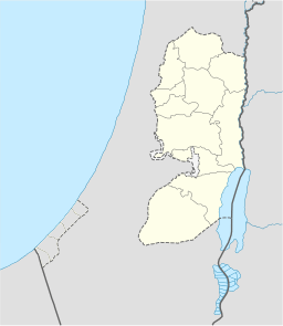 Shown within the West Bank | |
| Coordinates | 32°00′30″N 35°06′40″E |
|---|---|
| Grid position | 16035/15725 PAL |
History
According to Schürer, Thamna (Greek: Θαμνά) – a city within the district of Diospolis (=Lydda) and which served once as a toparchy (administrative city) during the Roman period, is to be identified with the biblical city of Timnath-serah, but which is now the ruin Tibnah (Tibneh) in Samaria.[3]
In 1596, the Tibnah (Tibya) site was listed as village in the nahiya Quds, in the administrative district Liwā` of Jerusalem, in a tax ledger of the "countries of Syria" (wilāyat aš-Šām) and which lands were then under Ottoman rule. During that year, Tibna was inhabited by 20 family heads, all Muslim, although the same village ceased to be inhabited in the late mandatory period. The Ottoman authority levied a 33.3% taxation on agricultural products produced by the villagers (primarily on wheat, barley, and olives), besides a marriage tax and supplement tax on goats and beehives. Total revenues accruing from the village of Tibna for that year amounted to 3700 akçe.[4]
Khirbet Tibnah is described in 19th century sources as a Tell overlooking a deep valley (Wady Reiya) on the north and the ancient Roman road to the south.[5] A cemetery was situated on a flat hill nearby, and to the northwest, the spring of Ein Tibnah emerged from a rocky channel. On the southwest was an oak tree some 30 or 40 feet high, and two wells, one of them dry. West of the tree were traces of ruins believed to be those of an Arab village.
Charles William Wilson, who traveled through Palestine in 1866, reported a cemetery containing nine tombs south of the town, which was once capital of the surrounding district: One of these tombs was large, with a portico supported on piers of rock with very simple capitals. One of the piers was apparently destroyed between 1866 and 1873. There were niches for over 200 lamps at the tomb entrance. Inside was a chamber with fourteen graves, or kok'im, with a passage leading into an inner chamber containing one grave. He also wrote about a 40 foot high oak tree near the tomb, known as Sheikh et Teim, and a village about 3 miles to the east, called Kefr Ishu'a, or Joshua's Village.
See also
References
Bibliography
- Conder, C.R.; Kitchener, H. H. (1882). The Survey of Western Palestine: Memoirs of the Topography, Orography, Hydrography, and Archaeology. 2. London: Committee of the Palestine Exploration Fund.
- Finkelstein, I.; Lederman, Zvi, eds. (1997). Highlands of many cultures. Tel Aviv: Institute of Archaeology of Tel Aviv University Publications Section. ISBN 965-440-007-3. (p. 367)
- Guérin, V. (1875). Description Géographique Historique et Archéologique de la Palestine (in French). 2: Samarie, pt. 2. Paris: L'Imprimerie Nationale. (pp. 90-93)
- Palmer, E.H. (1881). The Survey of Western Palestine: Arabic and English Name Lists Collected During the Survey by Lieutenants Conder and Kitchener, R. E. Transliterated and Explained by E.H. Palmer. Committee of the Palestine Exploration Fund.
- Schürer, E. (1891). Geschichte des jüdischen Volkes im Zeitalter Jesu Christi [A History of the Jewish People in the Time of Jesus Christ]. 1. Translated by Miss Taylor. New York: Charles Scribner's Sons. p. 158 (note 438).