Kentucky Route 126
Kentucky Route 126 (KY 126) is a 13.333-mile-long (21.457 km) state highway in Kentucky. It runs from KY 128 southeast of Cerulean to KY 139 south of Princeton via Cerulean.
| ||||
|---|---|---|---|---|
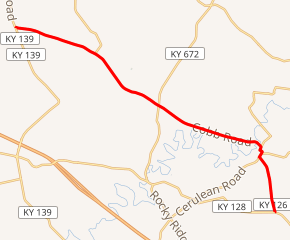
KY 126 highlighted in red | ||||
| Route information | ||||
| Maintained by KYTC | ||||
| Length | 13.333 mi[1] (21.457 km) | |||
| Major junctions | ||||
| South end | ||||
| North end | ||||
| Location | ||||
| Counties | Trigg, Caldwell | |||
| Highway system | ||||
| ||||

Major intersections
| County | Location | mi[1] | km | Destinations | Notes |
|---|---|---|---|---|---|
| Trigg | | 0.000 | 0.000 | Southern terminus | |
| Cerulean | 2.231 | 3.590 | Southern end of KY 124 concurrency | ||
| 2.388 | 3.843 | Western terminus of KY 624 | |||
| 2.678 | 4.310 | Northern end of KY 124 concurrency | |||
| Caldwell | | 6.883 | 11.077 | Southern end of KY 128 concurrency; southern terminus of KY 672 | |
| | 8.118 | 13.065 | Eastern terminus of KY 514 | ||
| | 10.095 | 16.246 | Northern end of KY 128 concurrency | ||
| | 13.333 | 21.457 | Northern terminus | ||
1.000 mi = 1.609 km; 1.000 km = 0.621 mi
| |||||
References
- "Official DMI Route Log". Kentucky Transportation Cabinet. Retrieved January 10, 2015.
This article is issued from Wikipedia. The text is licensed under Creative Commons - Attribution - Sharealike. Additional terms may apply for the media files.