Kaleden
Kaleden (/kəˈliːdən/)[4] is a designated place extending from Skaha Lake in the east almost to Nickel Plate Provincial Park in the west.[5] The City of Penticton is located just north of the lake. Kaleden was established by James Ritchie in the early 1900s as an agricultural settlement. Ritchie purchased 3,000 acres (12 km2) and planned construction of an irrigation system to bring water to the arid hillside, and in 1908 held a competition to name the new development.[6] The name Kaleden combines Eden, the biblical garden, with the Greek word for beautiful, "kalos".[6] As of the 2016 Canadian Census the population was 1,203, a -1.7% change from 2011.[1]
Kaleden | |
|---|---|
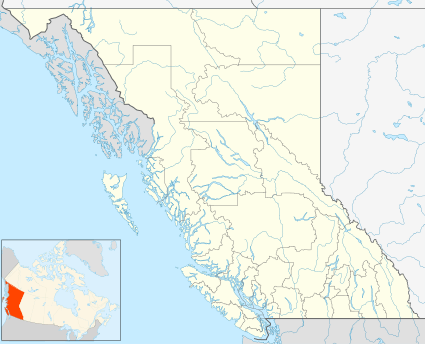
 Kaleden Location of Kaleden  Kaleden Kaleden (Canada) | |
| Coordinates: 49°24′00″N 119°36′00″W | |
| Country | Canada |
| Province | British Columbia |
| Region | Okanagan |
| Regional district | Okanagan-Similkameen |
| Area (2016)[1] | |
| • Land | 4.32 km2 (1.67 sq mi) |
| Population (2016)[1] | |
| • Total | 1,203 |
| • Density | 278.7/km2 (722/sq mi) |
| Area code(s) | 250, 778 |
| Year | Pop. | ±% |
|---|---|---|
| 1996 | 1,229 | — |
| 2001 | 1,269 | +3.3% |
| 2006 | 1,289 | +1.6% |
| 2011 | 1,224 | −5.0% |
| 2016 | 1,203 | −1.7% |
| Sources: Statistics Canada[2][3][1] | ||
The "Kaleden Cots", a form of apricot tree producing golden yellow apricots with red cheeks, were first propagated in Kaleden from trees purchased by Frank Harrison in 1910.[6] From the community beginnings as a small orcharding community, the town has evolved from fruit to vineyards and has become a bedroom community of Penticton. The Dominion Radio Astrophysical Observatory was founded there in 1960.
Kaleden has an elementary school which provides K to Grade 5 education for approximately 100 students,[7] and many summer cabins on the water as well as a resort, Ponderosa Point.[8] There are two parks in Kaleden: Kaleden Hotel Park,[9] which contains the shell of an old hotel with "heritage significance"[10] that was built in 1912 and was in use for two and a half years before World War I broke out and the hotel closed;[6] and Pioneer Park,[11] a park with a public beach, boat launch and BBQ area.
References
- "Census Profile, 2016 Census Kaleden, Unincorporated place [Designated place], British Columbia and British Columbia [Province]". Statistics Canada. Retrieved January 18, 2020.
- "Census Profile – Kaleden, UNP British Columbia (Designated place)". Statistics Canada. July 10, 2011. Retrieved May 11, 2013.
- "Population and Dwelling Counts, for Canada, Provinces and Territories, Census Divisions, Census Subdivisions (Municipalities) and Designated Places, 2001 and 1996 Censuses". Statistics Canada. Retrieved May 11, 2013.
- The Canadian Press (2017), The Canadian Press Stylebook (18th ed.), Toronto: The Canadian Press
- RDOA Parcel Viewer
- Society, Okanagan Historical. "Forty-fourth annual report of the Okanagan Historical Society". open.library.ubc.ca. Retrieved 2020-01-17.
- "About Kaleden Elementary - Kaleden Elementary". www.sd67.bc.ca. Retrieved 2020-01-17.
- Admin, Ponderosa Point. "Home". Ponderosa Point Resort. Retrieved 2020-01-17.
- "Kaleden Hotel Park | RDOS". www.rdos.bc.ca. Retrieved 2020-01-17.
- "Kaleden waterfront celebrates 100 years". Keremeos Review. 2012-04-12. Retrieved 2020-01-17.
- "Pioneer Park | Kaleden Parks & Recreation". www.kal-rec.ca. Retrieved 2020-01-17.
