Johan Petersen Fjord
Johan Petersen Fjord, also known as Petersen Bay (Danish: Petersen Bugt),[2] is a fjord in King Christian IX Land, Eastern Greenland. The fjord is named after Danish Arctic explorer Johan Petersen (1813–1880).
| Johan Petersen Fjord | |
|---|---|
| Petersen Bugt | |
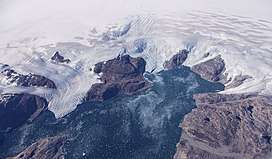 View of Johan Petersen Fjord from the air. NASA HU-25 Falcon picture. | |
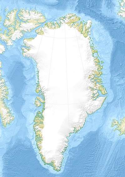 Johan Petersen Fjord Location in Greenland | |
| Location | East Greenland |
| Coordinates | 65°53′N 38°17′W |
| Ocean/sea sources | Denmark Strait North Atlantic Ocean |
| Basin countries | Greenland |
| Max. length | 20 km (12 mi) |
| Max. width | 4 km (2.5 mi) |
| References | [1] |
Geography
This fjord is located on the western shore of Sermilik (Sermiligaaq), near Tasiilaq (Ammassalik), about 20 km (12 mi) north of the mouth of the great fjord.[2] Johan Petersen Fjord runs roughly from northwest to southeast for about 20 km (12 mi). The Bruckner[3] and Heim[4] glaciers discharge at the head of the fjord.[1]
Qeertartivatsiaq Island is located on the northern side of the entrance of the fjord. There are Inuit ruins on the southern shore of the island facing the fjord.[2]
Bibliography
- Spencer Apollonio, Lands That Hold One Spellbound: A Story of East Greenland, 2008
See also
References
- GoogleEarth
- "Johan Petersen Fjord". Mapcarta. Retrieved 11 October 2019.
- "Brückner Gletscher". Mapcarta. Retrieved 12 October 2019.
- "Heim Gletscher". Mapcarta. Retrieved 11 October 2019.
External links
This article is issued from Wikipedia. The text is licensed under Creative Commons - Attribution - Sharealike. Additional terms may apply for the media files.