Hugla
Hugla is an island in the municipality of Nesna in Nordland county, Norway. The 17.9-square-kilometre (6.9 sq mi) island lies south of the islands of Tomma and Handnesøya, west of the mainland of Nesna, east of the island of Løkta, and north of the Ranfjorden. The residents of the island live mostly on the eastern coast, across the fjord from the village of Nesna.[1]

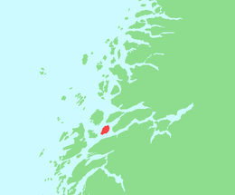
Map of Nesna
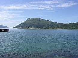 View of the southern part of Hugla | |
 | |
 Hugla Location of the island  Hugla Hugla (Norway) | |
| Geography | |
|---|---|
| Location | Nordland, Norway |
| Coordinates | 66.1873°N 12.9177°E |
| Area | 17.9 km2 (6.9 sq mi) |
| Length | 7 km (4.3 mi) |
| Width | 4.5 km (2.8 mi) |
| Highest elevation | 629 m (2,064 ft) |
| Highest point | Huggeltind |
| Administration | |
Norway | |
| County | Nordland |
| Municipality | Nesna Municipality |
See also
This article is issued from Wikipedia. The text is licensed under Creative Commons - Attribution - Sharealike. Additional terms may apply for the media files.